APRIL 24
We could have slept in this morning, but we knew that the German bakery opened at 6 and since we were awake we decided to go and have breakfast. Over some delicious baked goods, we decided that most likely we would have all the "need to do" list crossed off by early afternoon. So, we plan to be on the trail by mid afternoon. Spending a couple of days in town sounds good when on the trail, but then when we reach town, we are always ready to return as soon as possible. We hitch a ride to the grocery store with an older man in a Sprinter who has just returned from a 6 month stay in Baja. We then get a ride back to the campground

where we pack up our packs and head to Wit's End. Yoga Bae and Super Vegan are both there. Yoga Bae has a sore shin and needs to take another rest day. Super Vegan has just arrived and will be spending the night at a trail angels house. Both Dalton and Rachel have gone out of their way to be helpful.

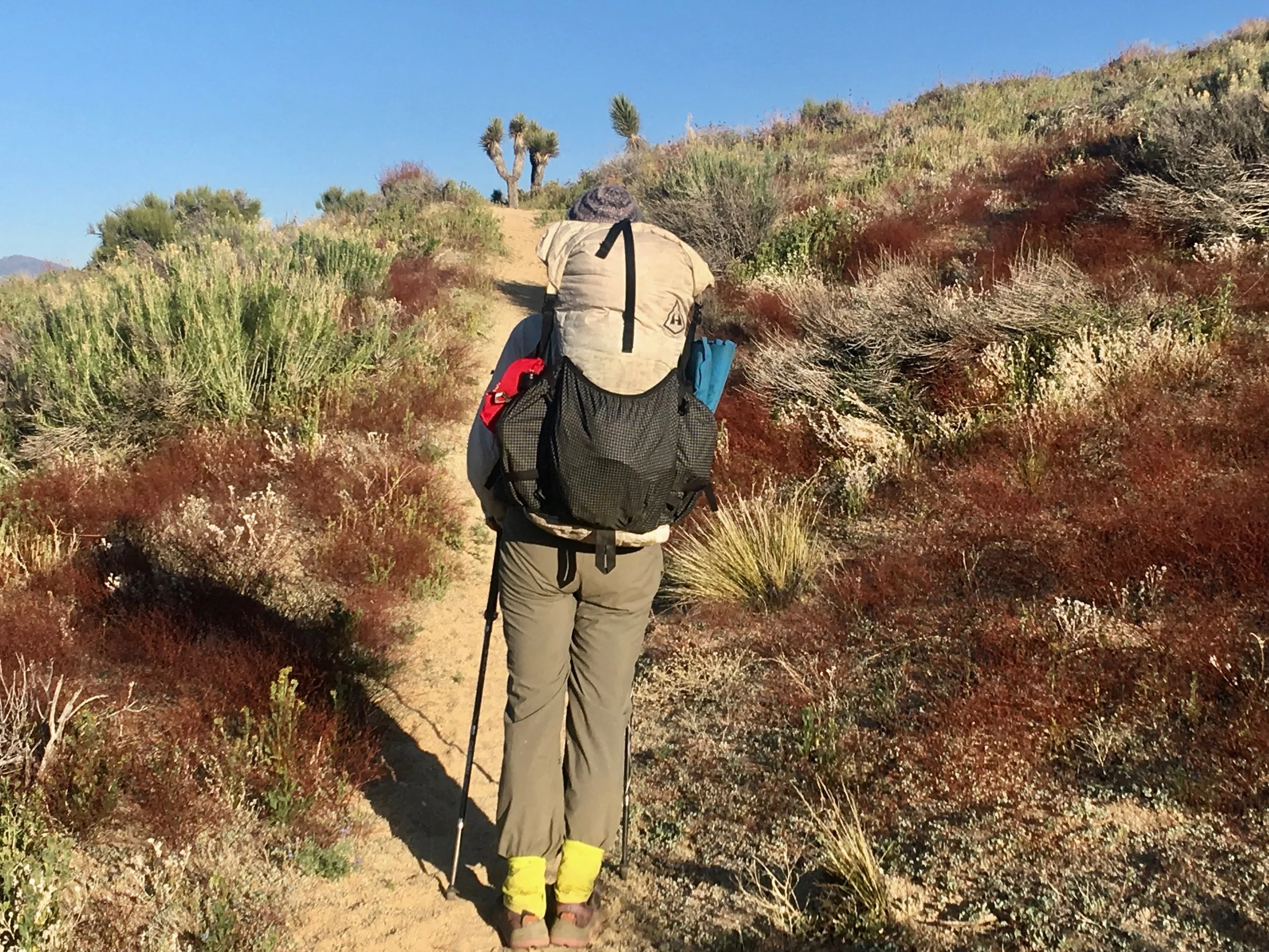
Dalton tells us two hikers that we know are at the bakery eating lunch and that he plans on taking them to the trail head when they are finished. That would work for us as well, so we head to the bakery for the second time today and have a delicious lunch. Dalton picks us up after we have eaten and drops us off where we ended our hike yesterday. We hike along the highway for a while and then look up to see where this climb is going to take us. We have been warned that this section is the driest section of the entire PCT. Often there are water caches, but as the warning says. "Do not depend on them". So with full rations and full water, we slowly make our way up the mountain. We are determined to make it to the top before camping and do!

Finally we are at the top
In the valley below are the ever turning wind turbines.

The campsite is perfect, it has some protection from the wind.
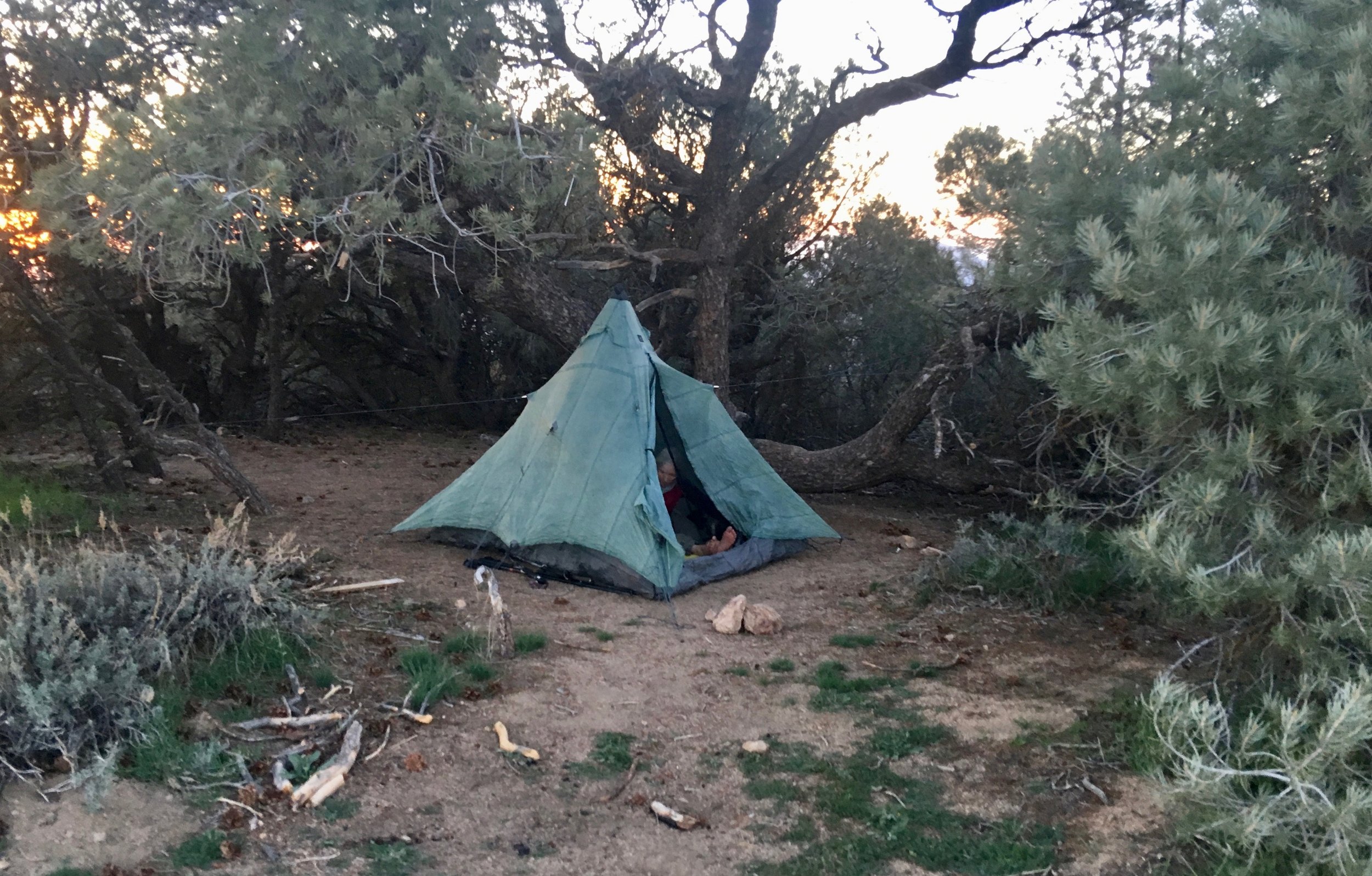
And the sunset is picture perfect.

Miles Hiked 7
APRIL 25
We liked our camping spot last night. If we had water and time, it would have been a great place to linger longer. Alas we had neither so we were on the trail by 5:30. The trail today seemed to spend way too much time on a rocky dirt road. This road was hard to walk on, because it was quite uneven and had numerous rocks that would roll under your feet. It was also quite steep so when the trail finally departed from it, we were glad. We met a couple of short section hikers today. They were out for the week and were heading southbound. They told us that there were two water caches ahead with plenty of water. That sure was good news! We still planned on carrying plenty of water, but could always top off at the caches. They were on the multi year plan to hike the PCT. Their trail names were Captain Crunch and Mr. Clean.

They were both 67 so we toasted to the 67 year old folks on the trail today.( That woulds be us also)
We also met an older gentleman called John Deer. He has been doing various section hikes for the last several years and was pretty sure that he had met us in OR or WA when we were hiking the PCT in those states. Our water source today came from Golden Oak Spring. It was flowing well and even had a resident rattlesnake which made us careful of where to sit.

Once we were off the road and back on the trail it was quite enjoyable. A good grade with lots of wild flowers.


The wind was lacking today, so we put our umbrellas to good use.

Without wind and a hot sun, we decided an afternoon siesta was a necessity. We finally found a mostly shaded area and quickly closed our eyes. It was somewhat challenging to start moving again, but moving was the only way that we would get down the trail. We passed John Deer who had found a small shade tree to put up his tent. He was done for the day and would start hiking tomorrow morning. We stopped to have dinner and then continued on afterwards. Walking in the evening was so much better than in the heat of the day. We also got quite a bit of elevation gain completed. Our choice for camping was not ideal. Most of the trees were dead or dying and quite a few limbs had fallen down. The wind had not blown all day so we were hoping that it would stay calm all night, too. Great moon tonight!
APRIL 26
It was a good morning to have breakfast in bed and be on the trail by 5:30. No limbs fell during the night which is always a good thing. One advantage of being up on the trail this early is that one often gets to enjoy the sunrises.

This was a 5 star!
First stop of the day was Robin Bird Spring. Several groups of hikers had camped here last night and were just leaving when we arrived. The spring was a good source of water and we treated what we needed. Another milestone occurred today when this mileage marker appeared.

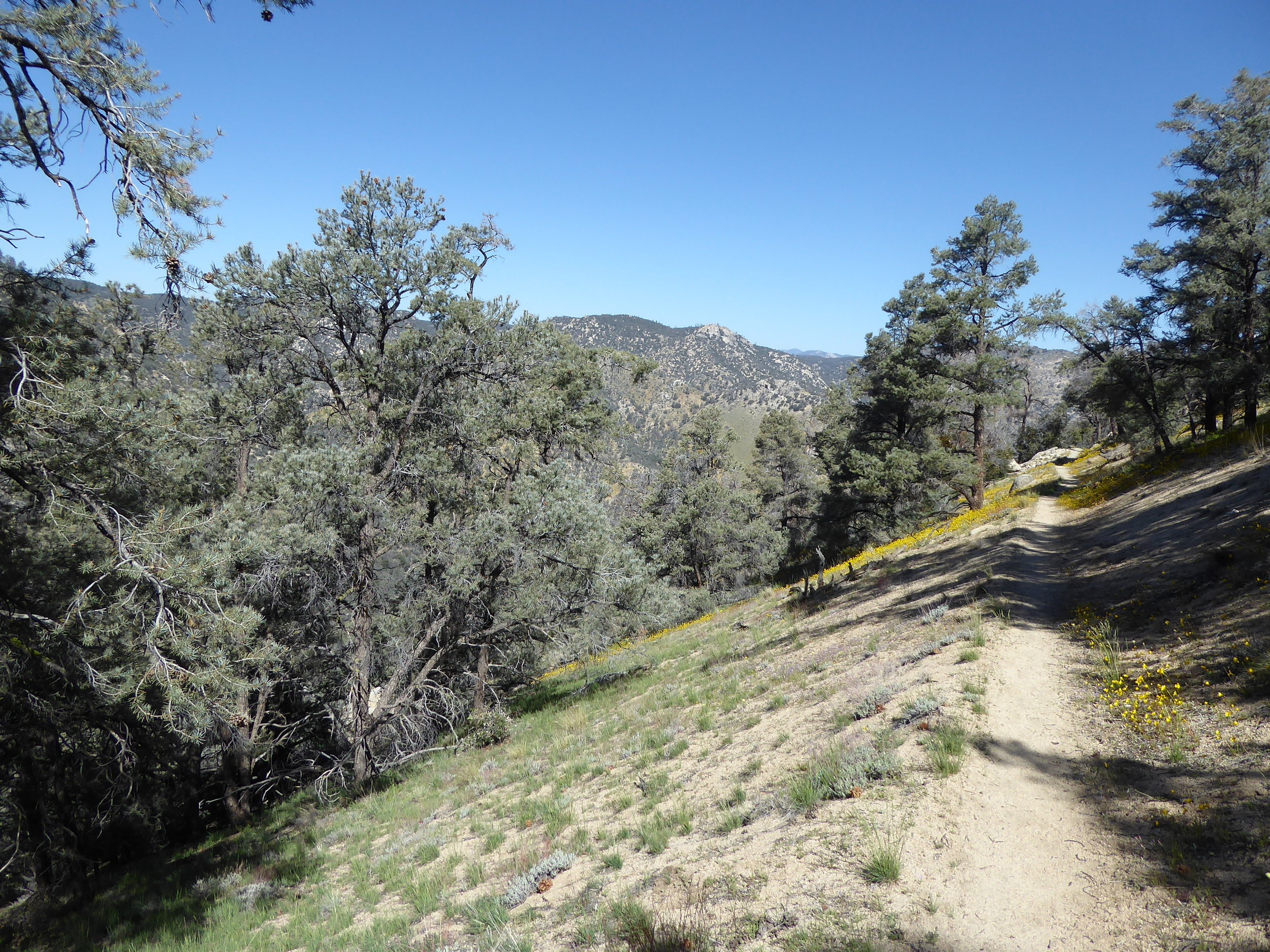
For the first part of the day we found ourselves hiking on pine needle covered trails with lots of tall coniferous trees along the sides of the trail. We hiked for several miles along Lander creek which we even had to step across several times.

We talked to another hiker going southbound and he confirmed that there should be water at the two caches coming up. Eventually we hiked out of the forest and into a more bouldery area.

The flowers again add color to the trail

Late afternoon we found the first water cache next to a dirt road. It definitely is a good feeling to see all that fresh water sitting there.

We decide to make dinner here and then travel afterwards. We are now out of the trees again and are in the Mojave desert which is known for its Joshua trees. Just as we are finishing up dinner, we hear a loud buzzing sound and then see a large number of bees flying by. For at least a minute the multitude of bees pass right above our heads. We lay still hoping they will just pass by. One can tell that some are checking us out, but apparently and thankfully we didn't seem to be a threat. I try not to think of the consequences if theses bees had been aggressive. Once they all passed we packed up and continued on the trail. We were hoping that it would be somewhat cooler, but the heat from the sun was quite hot. Even when the sun went down, it really did not cool down. The landscape has changed quite a bit with groups of Joshua trees spread throughout. It makes for a great and varied landscape.

Good setting for our tent as the moon rises.

Miles hiked 22
APRIL 27
The temperatures had cooled during the night so leaving early seemed like a good plan. It is a magical landscape of Joshua trees and boulders.


The wildflowers also added color to the pathway.


We hike up and then we hike down, we hike up and then we hike down, etc.


Finally at the bottom of a mountain is water cache number# 2. It has recently been replenished by volunteers.

It is quite the welcoming oasis! We are at the front of many hikers to come. Since these caches are the only water for 30 miles they are quite appreciated. There may be as much as 1000 gallons of water brought in over the summer. At the cache we meet 3 hikers in there 60's. Two of them are finishing up a four year journey of hiking the entire PCT in sections. They will be done at Walker Pass which is about 20 miles away. We camel up which means we drink a good amount of water and get psyched to climb back out of the valley. It is quite the up for the end of the day, but we take it step by step and enjoy the beauty of the wildflowers that hug the path.

We get to the top, take a break and then begin the descent to Walker Pass which we should reach tomorrow. We pass the three hikers setting up their tents which we had met at the cache. They invite us to share their site, but we decide to go a little bit further. We stop to make dinner and then continue on. We had planned on getting another hour of hiking in, until we meet a hiker out for the weekend. He tells us of a wind storm forecast for tonight and recommends that we find a place to camp soon in the trees. Those directions are easy to follow when we spot a flat spot in a drainage below the trail. We set up our tent and hear the wind whipping overhead. We are glad that we took the hiker's advice.
Miles hiked 21
APRIL 28
The temperature dropped during the night and was below freezing when we woke up. It seemed quite appropriate to have breakfast in bed. When Don looked out of the tent he saw 3 headlamps walking down the trail. It was the threesome that we had met yesterday. They were meeting a ride at the trailhead and wanted to be sure they were on time. We, on the other hand, were running thru different scenarios. Our original plan was to hike another 50 miles and end this portion of our hike at Kennedy Meadows. The more that we talked to various hikers, getting a ride out of Kennedy Meadows this time of year could be difficult. Hiking back the 50 miles to Walker Pass did not see like a great option either. Walker Pass, where, we were hiking to today, had a bus stop and starting here later would be most efficient. There was also a storm coming that could start dumping snow at the higher elevations. We could handle that, but not sure if we really wanted to when later we could hike the trail in better conditions. So, we could try to rent a car in a nearby town and drive to San Diego tonight. The more we talked this idea over, the more it seemed that this plan had the most merit. Regardless, we needed to hike the 10 miles to Walker Pass and make the final decision there. First we decided to check out an old cabin. Had we been two days earlier the owners of the cabin would have been there, cooking for hikers and telling stories of the past. We had been told that four generations of one family were there.

It would have been fun to hear the stories, but it was still fun to see the cabin and see where they got their water. Such a necessary thing in this part of the country.

After we left the cabin, it was mostly down hill.

A neat rock cairn made sure we were on track.

And the flowers added to our enjoyment.
Right before we got to the bottom Donna spotted her favorite toad and of course the toad posed while she got some great photos.


Then we saw the parking lot and heard Rabid Rabbit, one of the threesome, calling, "Hey, Peter Pan, come over this way I got some trail magic." We found out that a ride was picking up two of the hikers and Rabid Rabbit was hiking to Kennedy Meadows in a couple of days to meet his wife. That schedule did not work for us so we went back to thinking of going to a nearby town to rent a car. We saw another hiker and thinking he was a PCT hiker, called him over for some goodies.
Turned out he was just a day hiker and had a car here. He was out testing his gear for a hike planned for later in the Sierras. Turned out he was heading in the direction we needed to go to get a car. We asked if he could drop us off and he agreed. We got a car, bought him dinner and then headed back to San Diego. The drive took less than 4 hours. Now it is time to think about how we are going to hike the remaining 1000 miles. The plan we have come up with is to hike South Bound from Siead Valley to Sonoran Pass. Then take a bus to Walker Pass where we will hike north bound thru the Sierras. This should give the Sierras plenty of time to lose some snow cover. We are psyched to get back on the trail!!!!!