June 29-July 1
Transitions between locations- We left Etna and headed toward Carson city in Nevada, stopping to camp at a forest service campground near Hat Rim. It was fun to see signs for the PCT crossing the highway. When we got up in the morning to start the car it was sluggish. We attributed it to the fact that the car had been sitting for awhile and hoped that driving it would charge the battery. Alas when we stopped to get a fuel canister at a nearby town it would not start. A friendly local saw our predicament and gave us a jump. Guess we need to have it evaluated so looked up a Toyota dealer and found one in Reno. When we pulled into service we noted that there was a Costco and REI all in walking distance. Leaving the car there we headed to Costco for some food and then to REI to check out shoes for Don. Both places had what we needed. Back to the Toyota dealer where we were told that a new battery had solved the problem of the car not starting. Our destination for the evening was back to our cousins Bob and Marsha. We enjoyed an evening meal with them and got a tour of Carson City. The next day was spent organizing for the Sierras and more visiting. We left the morning of the first and headed to Lake Isabella where we had made arrangements to leave our car there for a month. We were somewhat dismayed when the outside temperature in the car read 105 degrees. On the way we saw a hiker hitching. When we stopped to pick him up, we realized that it was Peer Pressure, a man we had previously met. Recently we had read about this man on Facebook and realized that he was a PCT imposter. He did very little hiking and would hitch to towns instead of hiking to them. His stories had changed since we saw him. Leaving him off at the next town we wished him well. It has almost been two months since we left this area. The hills that were a verdant green in late April have turned quite dry and brown. One can feel the heat the instant one steps out of the car. Glad we have our shade umbrellas. We check out the trailhead at Walker Pass that will lead us into the Sierras. Then it is off to Happy Haven RV park where our car will get parked for the month. In the morning we will catch a bus that will take us to the trailhead. Meanwhile at the RV park we meet Little Feet who just arrived from the trail. We exchange stories and head off to a local eatery. The night is quite warm and we are glad when it is time to walk to the bus station at 4:30am. The bus arrives and heads up to Walker Pass. This is a great service for hikers.
July 2
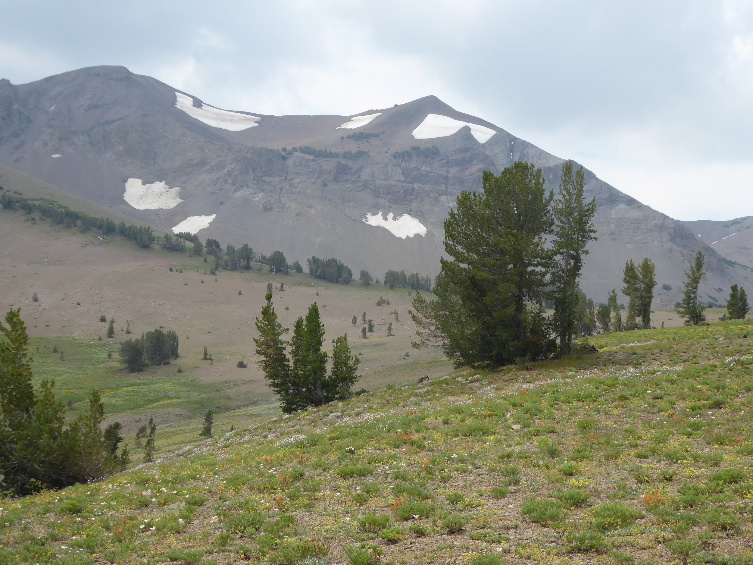
We were glad to feel some coolness in the air and hoped that we would get some hiking done before the sun rose in the sky. At the trail head we read the sign of how Walker Pass became named.

There is also a sign warning of the need to take water. From the water report we will need to hike 17 miles before we come to a reliable water source.

We are only carrying 3 days of food, but the weight of all the water makes our packs feel heavy. The trail leads us upward thru the very dry surroundings.

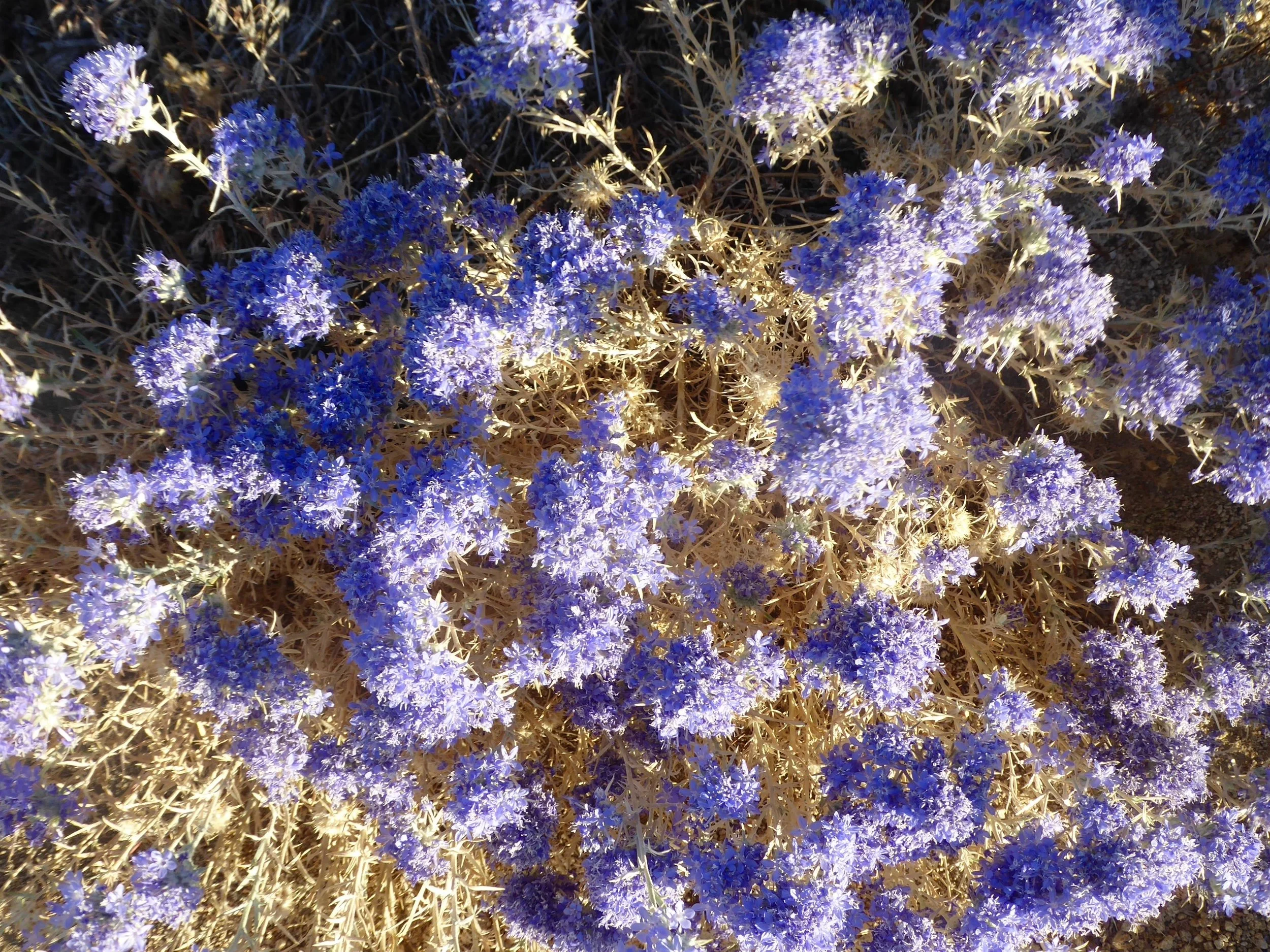
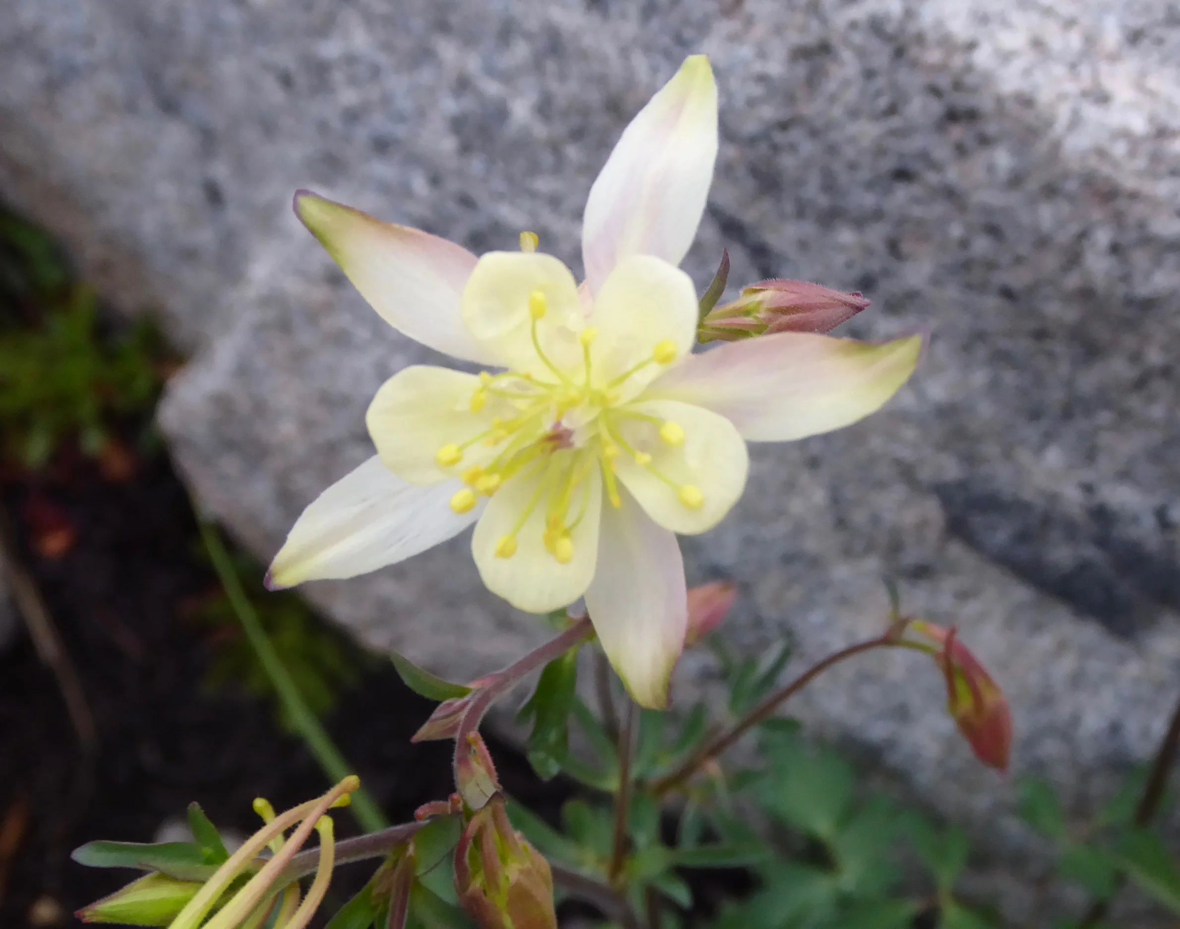
A purple flower adds color to the trail.
The trail is well worn and mostly up. It is a marked contrast in vegetation from the hiking we have done in previous weeks.


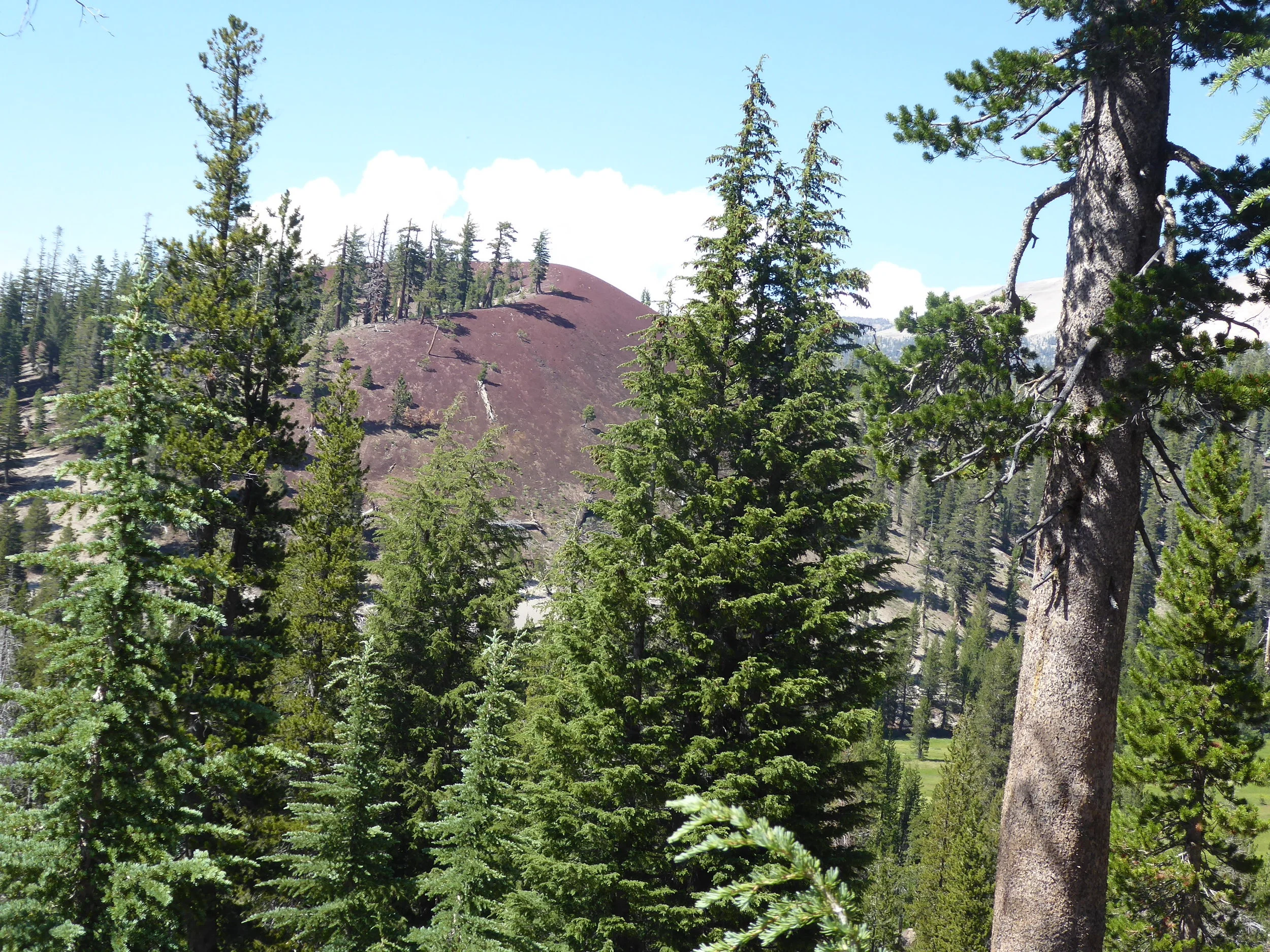
In the distance we can see the foothills of the Sierras.
Our lunch break finds us sharing the shade with a lonely tree, It is not much coverage but we appreciate it. When we arrive at the 17 mile water source, we hear voices and meet a father/daughter team that had left yesterday. They have spent most of the day here waiting to hike when it is cooler. They are amazed that we have hiked thru the mid part of the day. We give our umbrellas credit for that. We decide to eat dinner here and to hike up a steep climb afterwards. They plan on doing the same.

We are glad to top out at the summit just as the sun is going down. We are also glad to have this section of the hike completed. We find a protected spot nestled into some trees and pitch the tent.
Miles hiked 20
July 3
Knowing that it is going to be another hot day of hiking we begin our trek early loosing most of the elevation that we gained yesterday. Our umbrellas come out as soon the the sun hits the trail.

We have another 8000 foot pass to do today and assume that we will be in trees once we reach the top. That was a wrong assumption! Once we head over the pass we are back in treeless terrain. An old forest fire has killed any of the scattered trees. There are some flowers to add color to the landscape.


We meet a man drying his socks in the sun. He is only doing a short section to Kennedy Meadows. We exchange stories and hear about his website and books that he has written. Once again we enjoy the stories of the hikers we meet. We have lunch under a lone pine trees and head down the mountain side once again.

We appreciate the added color to the trail.

The trail winds down and the wind picks up. We alternate putting up the umbrella and then taking it down as the trail changes direction. It is a very dry section and we are hoping that the water report is accurate for the next water source.

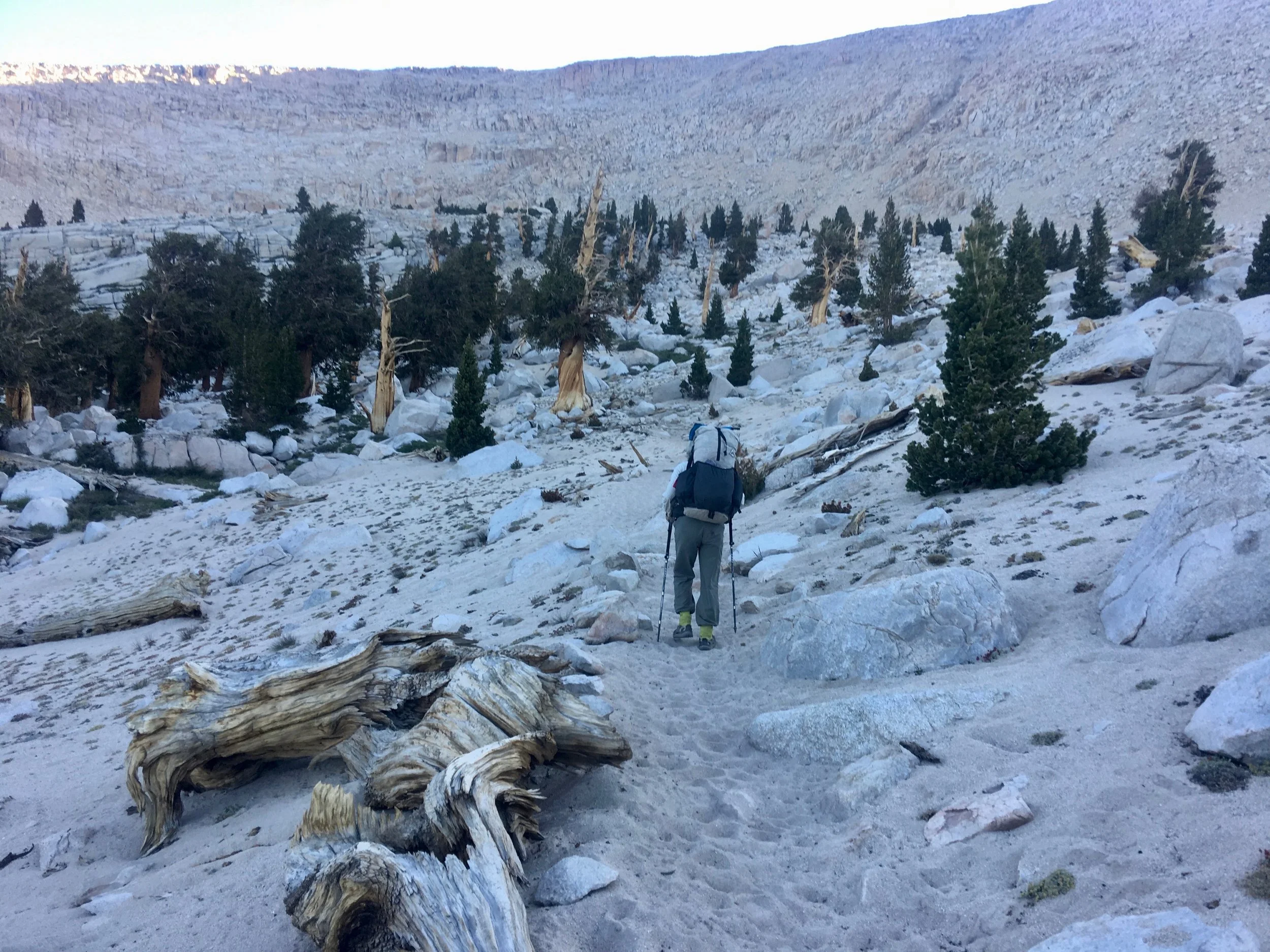
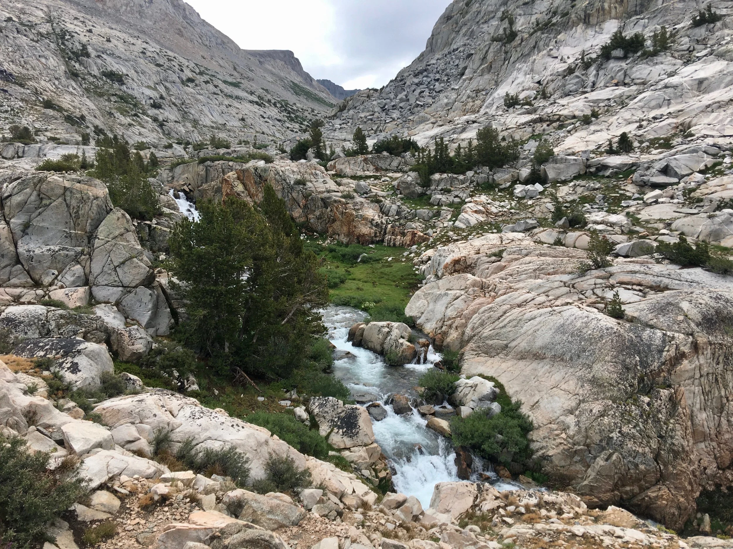
Tomorrow we should be closing in on the Sierras and water should be much more plentiful. Now, however, we are are on the hunt for water. A greener area suggests that water is nearby and after a search we see a spring with flowing water. We decide to have dinner here and perhaps camp. The decision to not camp here is made easy when we are attacked by numerous ants. They are everywhere. We move once while eating dinner and after completing our meal we quickly pack up and move on. We hike for several more miles and come upon a forested area. Once a flat spot is found minus ants we are ready to call it good for the day. Tomorrow we will be at Kennedy Meadows and picking up our resupply box for the Sierras.
Miles hiked 20
July 4
We have about 8 miles to hike this morning before reaching Kennedy Meadows. The trail is mostly flat following the Kern River Valley, It feels good to be walking along water except for the cows that are also enjoying the water. We decide to wait before filling our water bottles. We make our way out to the road which will lead us to the town of Kennedy Meadows

We have been told that in the winter the population drops to 60.

The country store is hopping with activity. We are able to take showers , do laundry and eat plenty of ice cream. Our resupply box, however is about 3 miles away at a restaurant called Grumpys. Grumpys offers a free shuttle so after a call to them they show up and shuttle us to their restaurant. Before organizing our gear we have what is becoming our usual meal of a hamburger and milkshake. We have a 7 day ration period so our packs are full. The big difference is that water is more plentiful so we won’t have to carry as much. After a visit to Yogi’s store, a resupply store, we head back to the country store. It is still plenty warm so sitting in the shade at a picnic table and eating one more ice-cream bar seems appropriate. Around 5 we head back down the trail and find a camping spot near some water. Don realizes that his hat is missing and decides to see if he can find it where it might have dropped off of his pack. I set up camp and enjoy the sound of running water. Shortly afterwards he returns with hat in hand. we are looking forward to the Sierras! Great way to celebrate the Fourth.
Miles hiked 9
July 5
After a restful night by the stream, we are excited to begin our hike into the mountains. Looks like we will be seeing new flowers as this one blooms by the trail.

The coolness of the air feels good compared to the last several days of having temps in the 90’s. Todays hike finds us mostly going up in elevation with lot of views.


This area has herds of cattle grazing in the green meadows. We imagine that they are quite content here and ignore our presence. In the distance we see a bridge crossing the Kern River. Information about this water source warns of cow patties and swallows polluting the water source. When we get close to the bridge we see plenty of swallows helping to reduce the insect population.

A couple of swallows use the sides of the bridge to take a rest from flying.


We are glad that we still have water and don’t need to share it with the swallows and cows. Today we headed over a 10,000 foot pass. The snow that had covered this area in May is gone and the hiking goes quickly. We notice a variation of the PCT trail sign.

Miles hiked 22
July 7
We camped in a magical spot last night surrounded by Sequoia trees. The moon was almost full and cast unique shadows around the tent. With the moon being so bright we awoke early and headed down the trail with our headlamps on. When the sun rose we appreciated the views and also the light on the bark of the sequoia trees.


We are enjoying the views and marveling at the trees. The sky is a perfect blue color. We stop for a break at a view point.

Still snow on the summits, but none where we are hiking.
The trail continues to climb in elevation. Tonight we we will be camped at over 11,000 feet.

The trail alternates between going up and then there are some flat sections.

This was a different section of trail

Then it was back to the trees.
We passed a trail junction and immediately noticed that the trail had become heavily used by horses. The dirt on the trail was about 3 inches deep, which made difficult walking. We were not enjoying hiking thru here. Decided to take a break on a fallen tree for lunch.

While sitting here we heard the footsteps of a large pack train. Soon we could see them kicking up the dust of the trail. We quickly understood why the trail was in a very dusty condition.

Fortunately they turned off at a close trail junction and there was immediate improvement in the trail surface.
We left the sequoia forests behind and headed up to a large meadow.

Our destination tonight is Chicken Little Lake at 11,000 feet. As we get closer to the lake we begin to see more hikers. We are near one of the trailheads for the John Muir Trail. This is the most people we have seen on trail. We hope that there will be room for us at the lake. When we arrive we find a site and watch more folks arrive. Balloonz who we met yesterday has dinner with us as well as Walnut. She had hiked the PCT last year, but had not climbed MT. Whitney so she had gotten a JMT permit which enabled her to climb the mountain. Several JMT hikers stop by and are quite tired after their first day hike. We have hiked over a 1000 miles now and our bodies are feeling strong. We give them words of encouragement, but tell them to HYOH.
Miles hiked 22
July 7
We wake up early and after having breakfast we are among the first ones out of camp. The sun is just beginning to rise over the mountain.
We catch a glimpse of Chicken Little Lake as we climb to higher elevations.

Several hikers that we talked to yesterday that had just started their hike were experiencing some altitude problems. We are glad that our bodies have acclimatized. We pass Walnut who we met yesterday, she is taking a break by some water and not feeling 100 percent. The trail leads us thru some rocky areas.

Needless to say we are enjoying the beauty of today’s hike. At an overlook we see the meadows far below us.

A sign confirms that we are in National parks and the elevation is high.

Scenes from the trail


Today our destination is Crab Tree Meadows. If all goes as planned we will be attempting to Climb Mt. Whitney tomorrow, which is over 14,000 feet. Before we get to the meadow we our greeted by a large Marmot. This must be a good habitat for them as they are quite numerous.

Movement among some rocks catches our eyes and we see a young marmot checking us out.

Just a bit further is Mom and her nursing baby.

We could have stayed here awhile watching the antics of the marmots, but eventually we had to move on and set up camp. We want to leave about 3:30 in the morning to begin the climb. Camp is made near Balloonz and Walnut. We have all dried meals for this trip so we decide to have a potluck meal which is quite delicious. Walnut has made the decision to climb Whitney tomorrow, but not to hike further. She will exit the trail at the Whitney Portal.

Knowing that time for sleeping tonight will be short, heading to the tent early is a good idea.
Miles hiked 20
July 8
The alarm went of at 3 am and by 3;30 we were hiking towards Whitney. The first obstacle was a stream crossing, that fortunately we had success doing. It was a 7 mile hike to the top so knew that we were not going to make it for sunrise. We did see headlamps making their way up the trail, they must have left at midnight. As the sun shed some light we were excited to see blue sky and quite scenic views.


It was difficult to tell exactly where the trail was going to go as it worked its way up the mountain side.

Flowers took opportunities to grow in protected places.

As we continued up we could look down and see the lakes that we had hiked by before it was light.

We appreciate the trail builders as the trail is cut out in some steep terrain.

At a trail junction with a trail going down in the opposite direction, hikers have left their packs so they don’t have to carry them to the top. The local marmots are aware of this and have taken advantage of food left in the packs..

At this point we still have about 3 miles to go to the top. Hikers that made it to the top for sunrise are now making their way back down. At our pace we should be at the top in about an hour. More colorful flowers poke their heads out among the rocks.

We take a short break where the path widens slightly.

In the distance we can see the flat area that will lead us to the summit.

Finally 5 hours later we are at the top!

Time for the selfie!

Time to look around in all directions.

Our friend Baloonz arrives an hour later. He was surprised to find our tent empty when he left.

A survey marker is placed at the summit.

There is also a hut here, but snow and ice still fill one of the rooms, a warning outside states that if the weather is turning stormy one should quickly head down. The clouds are building so we take that advice and begin our descent.

Going downhill is always easier and our pace quickens. Many hikers are going up and some need encouragement. Once we pass the junction the number of of the hikers on the trail is quite minimal.

This lake has the obvious name of Guitar Lake.
Just as we are getting to our campsite, we meet Wendy of the Lost Boys. We saw her almost a month ago. It is fun to catch up with her and make tentative plans to hopefully meet again.

She is from Australia
Once getting back to our tent, we decide to have dinner and hike afterwards. There is some thunder and lightning in the area, but the storm is short lived. we are glad to be down off of the mountain. The forecast for tomorrow is calling for unsettled weather.
We are hiking mostly in woods after dinner, but begin to smell smoke and when we get a view of the mountains we see a large billowing cloud of smoke

. Lightning has make a hit and the forest is on fire. We are safe where we are located, but hear later that hikers were rerouted around Mt. Whitney. We are hoping that we can get thru the rest of the hike without trail closures due to fire. It has been a great day and are thankful that we had good weather for the climb today.
Miles hiked 17 which included the 14 mile trip to the summit of Mt. Whitney
July 9
We camped near a beautiful stream last night. Hiking thru the dessert really makes us so appreciative of water. Upon awaking we smell smoke and there is a covering of ash on our bear canisters. We can see smoke clouds and are glad that they look like they are on the other side of the mountain. We have several stream crossings to do today, but we are past the high water time and are able to find logs or rocks to cross the water. When the sun hits the mountains we are in awe!

Welcome to the Sierras!

Today we are making our way to Forester Pass. which is the highest pass in the Sierras.
The trail weaves thru the rocks and past numerous small lakes.

In the distance we see the pass that we will be hiking over. The description of it being a notch is accurate.

The trail is carved out of the sides of the mountain. We marvel at the amount of time that was taken to build this trail.

A lot of rock work was done at switch backs.
We can only imagine what it was like for the hikers to hike over this pass in early May. We are enjoying not seeing a trail covered with snow.

Near the top is the crux move of the pass. Earlier in the year this is a 30 foot snow chute. Careful steps cut in the snow are used to cross the chute. Today, however, we are able to walk on the rock.

The snow is above the trail.

Looking back down the trail from the chute.

Almost to the top.
The top

Now it is down the other side.
First though we take a break to admire the flowers.

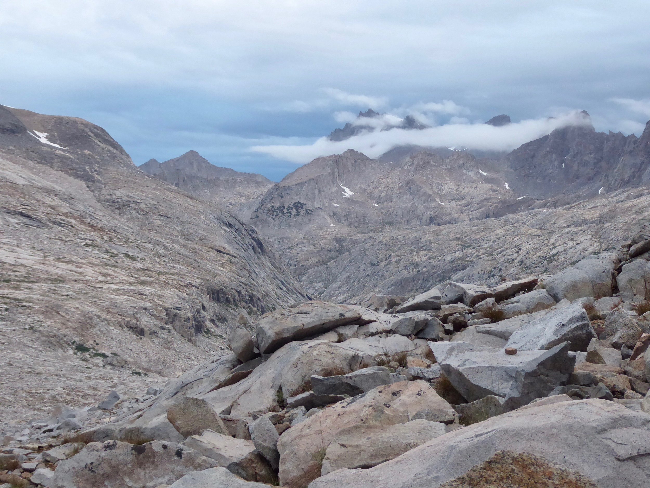
Looks like we have a big descent ahead of us and the weather is coming in.

We meet several hikers heading up the pass on this side, glad we are heading down.
We have gotten an early start and are thinking that if the weather holds we may try to go over Kersage Pass today as well. If we can make it, we will be able to perhaps get our resupply box tomorrow at Independence. On the way towards the pass we encounter a park ranger who is warning hikers of the fire near Mt. Whitney. It is not contained and if the wind shifts we may not be able to proceed. We are hoping that is not the case and head towards the pass. It is over 7 miles to hike to the road head. We go by way of the Bull Frog Lakes. No camping is permitted by them and they are undisturbed.

We stop for dinner and have this as our view.

After dinner we head up and over the pass. At the top of the pass we meet a women who asks us if we are Peter Pan and Big Foot. When we say yes, she tells us that Walnut had given her a lift and asked her to give us some tuna fish if she met us. We were glad to know that Walnut had made it down and was not affected by the fire. Heading down we notice the smoke clouds, but it does not seem that we will be stopped. Making it to a lake by dark we quickly pitch the tent and are glad to be here. Tomorrow it will only be a short hike to the roadhead.
Mies hiked 17
July 10
We are up early and on the trail at first light. We only have a couple of miles to put in before we reach the trailhead. The parking lot is full of vehicles due to the fire closure of the trail to Mt. Whitney. With all these cars here we are hoping that at least one is leaving and will be our ride to town. We find a sign that was abandoned by a previous hiker.

Alas the first two cars and the only two cars we see this morning are full. We are wondering what will be our next step when a shuttle arrives dropping off hikers, we flag it down and soon are on our way to Independence with two other JMT hikers. The shuttle drops us off at the Courthouse Motel where we have sent out next resupply. Not wanting to spend a night here we arrange to just spend a day here doing our errands. The hotel has a room for hikers and for a small fee we are able to use it. Taking showers, doing laundry in the sink and reorganizing our food is all that we need. The room has AC which feels great considering the outside temp is close to 100. After several pints of ice cream we are ready to return to the trail by late afternoon. We get a ride with the same shuttle company and by 6 we are hiking back to the lake where we camped the previous night.

Tomorrow we will be heading back up to Kersage Pass.
Miles hiked 4
July 11
We awake to a cooler morning, glad to be away from the heat of yesterday. The climb up to the top of the pass goes quickly.

We are thankful for the mostly smoke free vistas. On the way down from the Pass we meet Windy of the Lost Boys once again. She has been effected by the smoke and is planning to take several days off in town. Our plan of hiking together may not happen this time. We are hoping to go over Glenn Pass today. We pass by a dome which has good climbing routes.

On several of the trail signs a ranger has posted warnings of fires in the area and of unsettled weather. Going over passes in lightning storms is a bad idea. We are hoping that the weather holds till we get over the pass. Once again the trail work is amazing.

We keep a steady pace and see hikers at the top pf the pass. Weather is still a go as we make our way upwards.

Then we are at the top and soon heading down.

The trail winds its way down the mountain. We are as usual impressed with the rock steps that are cut into the rock.

So glad that we have a trail to follow. Having hiked so many years off trail, it seems to be easier to just appreciate the scenery and not always figuring out your next move.

Rae Lakes are far below us.
Mountains surround us.

There is definitely potential for rain today. Just hoping that there won’t be much thunder with it.

We managed to take a wrong turn, but thankfully it was only a mile out or our way and we got to see the lakes from a different angle. The rain was on and off so the umbrellas got some use today.

The trail continues going down hill to a river with a suspension bridge.


Looks like a great place to have dinner. With still some daylight, we pack up after eating and decide to hike several miles further.

Bridges make crossings so easy.
The storm that has been threatning all day decides to actually produce rain, lightning and thunder, We quicken our pace till we find a place to pitch the tent. Three other hikers that have been behind us stop in the same area. We head to bed while they build a fire. Several hours later I am wakened by a light which turns out to the fire. They have gone to bed and left a rather large fire burning. It is somewhat contained, but does not seem to be the safest. Don gets up and does some preventative fire work. We keep an eye on it till it slowly burns down. Glad that the wind did not pick up. We are now in fire season and are hoping that we can complete the trail before any fire closures.
Miles Hiked 17 which included two passes!
July 12
We were glad to get on the trail early today and leave the campfire of last night behind. The hikers of the campfire are still sleeping as we head out. Today the pass that we will hike over is called Pinchot Pass. The trail up to the pass is quite gradual.

And quite scenic

The last stretch goes up a rocky pathway.

And at the top we get to see where the trail leads down the other side.

We also look back to see where we have just hiked.

Each pass is quite unique. It is such a beautiful area to hike. We understand why it is so popular.
We will be heading down past these lakes and we are hoping to make it over Mather Pass today as well. It will all depend on the weather. We did this pass early in the day which is the best timing. Will be at Mather Pass early afternoon, so hiking onward. We pass a small area with snow that gives off a bluish color. Perhaps the remnants of an old glacier.

We head towards Mather as the clouds move in. There is some thunder and our attempt to go over this pass may not happen. There is some on and off rain. The terrain is quite rocky and the camping looks slim. Our choice may be just to hunker down and hope that the storm will pass and we can get to the other side of the pass. Then we see the perfect site, It was obvious that it had been used before so we decided to pitch the tent, have a afternoon rest and see if the weather changes. If not we are in a good spot with a small lake near by. It seems that as soon as we got the tent pitched the rain and wind came on strong. We feel good about stopping. Soon both of us were taking an afternoon nap with the sound of rain hitting the tent. We awoke several hours later and looked out of the tent. Fog had surrounded the area and covered up the mountains and the pass. The rain and wind had stopped so took the break in the weather to have dinner. We thought if the weather cleared we could get up and over the pass, but that was not to be. As soon as we finished dinner the rain and wind returned. Back into the tent we went with an easy decision made that we are spending the night here.
Miles hiked 14
July 13
We were up by 4, quite rested from all the sleep of yesterday. The wind and rain had stopped so we were ready to pack up and head to the top of the pass. Using our headlights we made our way thru the rocky trail to the top.

By 6:45 we were at the top of the pass and it was light enough to see the other side. Mather Pass going north is steep with rocky steps cut into the side of the mountain. We could hardly imagine how the folks that went over this pass in May dealt with the snow and steepness.
A yellow columbine decorated the rocky trail.
As we descended the trail, numerous streams flowed down the mountain side.

Soon we were passing the Paradise Lakes. Numerous hikers were trying to dry out their very wet camping gear. We were quite happy with our decision to stop when we did yesterday or we would have been drying out wet gear as well.


Not a bad place to be surrounded by beauty,
As we continued down, more steps were carved into the rock.

A white crown sparrow serenaded us with song.

More water falls and rushing streams were a major part of the trail today.
A pika finally poses for a photo!

One of our favorite small mammals!

Today the trail took us down a steep section known as the golden staircase. We were glad to be going down and also that there was no snow on the trail. Navigating a snow covered trail thru here would have been difficult.

Don heads down the steps. I can’t imagine doing this section very quickly without a trail.

But with a trail, we keep up a good pace. In fact we are even contemplating whether we might be able to go over Muir Pass today.

However, as the afternoon progresses the clouds lower and rain begins to fall. We decide that finding a place to camp might be the better decision. When we have to do a water crossing, the decision to camp is made easier .

The rain takes a long enough break for us to have dinner. We are glad for our meals that take a short time to prepare. Soon we are falling asleep with rain hitting the tent.
Miles hiked 20
July 14
We had gotten lots of sleep last night so when the watch said 4 we were ready to get up. With our headlamps on we started the trail up towards the pass. We had about 4 miles to hike which due to the rocky trail with lots of water crossings took us several hours. The decision to stop where we did last night was a good one.

The trail took us up between streams.

It was a chilly morning with some of the puddles having an ice covering.

There was even patches of snow that we hiked thru.
Finally we made it to the top of the pass where a sign and hut were located.


The hut is a shelter for inclement weather.

Several hikers had stayed here last night during a hard rain storm.
Views in all directions were admired.


Close to the top we came upon a mother ptarmigan and her chicks. They were darting in and out of rocks while she stood quite still and gave quiet clucking sounds.

The scenery was non stop spectacular as we headed down the valley.


We passed several lakes, but decided not to go swimming. The water temp. was quite cold.


The trail was eventually going to take us to Evolution Ck. A hiker had drowned there last year during high water. We were glad to hear about the water crossing from hikers going south. It seemed that the water would only be above my knees. On the way to the stream we met Caroline who we had met before going to Independence to get our resupply. It was fun to catch up with her.

Lots of water was heading towards the creek.
We were relieved when the crossing was indeed knee deep.

We met Aziz again today. Last time we saw him was early April at the Easter feast. He was heading south bound to Mt. Whitney and then flipping north to Oregon to finish his hike. We stopped to have dinner with Caroline and then hiked for several more hours.
Miles hiked 26
July 15
We slept in till first light this morning. The scenery continued to be spectacular.


One can almost imagine how euphoric John Muir must have felt when he walked thru these mountains.
There were quite a few stream crossings today. We always try to keep our feet dry so scouting out for rocks or logs is a must.

If non are present, the option is to put on wet shoes and go wading. We have been fortunate that none are real deep or have a strong current. A month ago when the snow was melting some streams were almost impossible to ford.

Don checks out a log
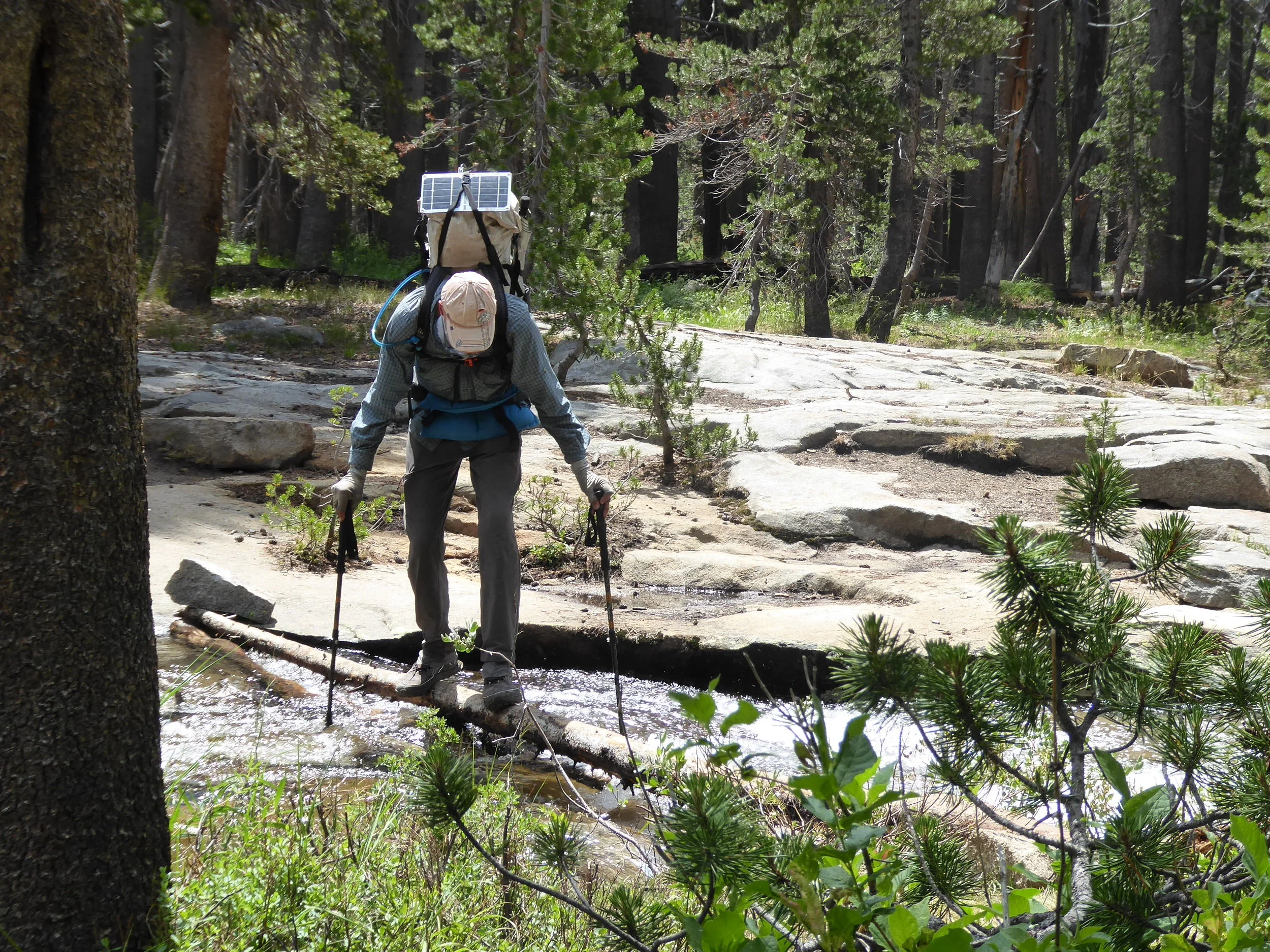
and inches his way across.
We meet a couple of girls from the Czech Republic. They are enjoying taking photos of the wildflowers as much as we do.

The trail seems to have lots of ups and downs today. There are no major passes, but we have made lots of elevation changes. One downhill went on for ever.

During our resupply strategy we decided to avoid VVR and the Muir Ranch. It made for heavier packs, but it was quite doable. Right before VVR we saw the two girls from the Czech Republic. One of them had sprained her ankle and were pondering their next step. They either had to hike over 20 miles with a major pass or take the ferry to VVR and be able to rest for awhile. We thought that catching the ferry was a good option since they would be able to get food there. We gave them some money for the ferry and continued on. We stopped for dinner before heading up toward a pass. We were able to find a flat spot nestled between some pines.

We met Vadim Dor again. He is a hiker from Israel with an interest in art. Our interactions are always interesting. Don was having a not so good day! His solar panel fell off somewhere and he fell into the water when doing a crossing. Glad to have this day over,
Miles hiked 21
July
The campsite was peaceful and so glad that we had stopped there, further on by a water source there were numerous hikers. Stopped to get water at a meadow and were quickly surrounded by mosquitoes. Pulled out the thermacell and were able to fill our water bottles in peace. We had done half of the elevation that we needed to do for this pass last evening but here was still climbing to do before we reached the pass. The sun was just starting to light up the surrounding mountain peaks.


The trail wound around several lakes before heading up to the pass.


Every turn has a new view.

Silver Lake
Several hikers were on the pass enjoying the sunrise. After the pass it was a lot of down hill. Our destination tonight was Red Meadows where we hoped to camp and then get a shuttle to Mammoth. On the way we had stopped for lunch and here comes Balloonz. It had been a week since we had last seen him. He is heading to Red Meadows today as well so will catch up there. The Lupine were at peak.


As we got close to Red Meadows we saw the remains of a fire that had devastated the area. Fortunately the buildings around Red Meadows were saved.

Even though the fire occurred in the 90’s the burned trees were still standing.
We were at Red Meadows by 5 and waiting for us at the store was Ballonz. He handed us two cold beers and we caught up on how our hikes had gone. We had today’s special at the restaurant and headed to the campsite for all the hikers. In the morning we will do our laundry take showers and get the shuttle to Mammoth. There is smoke in the area and we learn that a fire has broken out near Yosemite. Not good news, hope that we will be able to continue our hike.
Miles hiked 25
July 17
We woke early to the smell of smoke, unfortunately it was not a local campfire. The fire burning near Yosemite is not contained. At this point there are no trail closures, but it is something that we will have to pay attention to. The plan for the morning is to take showers and do laundry before catching rides to Mammoth where we are hoping our resupply will be at the Post office. The transportation to Mammoth takes over an hour. First we catch a bus from Red Meadows that takes us to the Mammoth ski Resort. We are the only passengers on a full sized bus. The driver mentions that meeting so many different individuals makes his drives quite interesting. This bus drops us off at the bustling resort. Mountain bikers are everywhere. They are carried to to the top of the ski slopes by Gondola lifts.

We are somewhat overwhelmed by all the activity here and are glad to see the bus that will take us down town. We are dropped off at a trolley stop which will then take us near the post office.

The bus from the resort and the trolley around town is all provided for free.
Don heads to the post office and returns with our two boxes of rations. So far all of our boxes have made it to their destination. As we are organizing our food, here comes Vadim. This is the third time that we have seen him. He says that if we see him again, we will need to buy him ice cream! Or vise versa if he see us. Just a little later we were buying Vadim ice cream!


We sit under the shade trees and have an engaging conversation as we learn about his life. It would be interesting to catch up with him in some other part of the world. After the hike he will be returning to home in Israel. We text Baloonz and plan on meeting him at a small Mexican restaurant for lunch. There are around 10 other hikers here who are planning to get a room in town to spend the night. Don and I have had enough of Mammoth and after ice cream are ready to head back to Red Meadows. The busses are much fuller on the return trip. but our timing is great and we go from one bus to the next. Back at Red Meadows, we decide to put on the packs and head out.

Our packs are heavy with a 7 day food resupply.
We pass these signs and smile at the mandatory one.

The sign above the showers points to the Devils Postpile. It is a unique geological formation. We stop for awhile to check it out.

Devil’s Postpile


We pass several small lakes which seem to have a good share of insects.

The smoke from the fire is evident as well.
Not wanting to share their space we head up to a higher elevation and feel fortunate to find a flat spot for our The smoke is not as bad at a higher elevation as well.. It was a short hiking day, but considering we had spent most of the day either on a bus or in town, we were satisfied.
Miles hiked 3
July 18
W.e were up at 5:30 and on the trail by first light. This section is known for its high mountain lakes and it did not disappoint. We were tempted to go for a swim, but the early morning chill kept us from that experience.


It would have been easy to just hang out here for the day….
But the trail was calling and the temperature was rising. Perhaps the next lake would be the one for a swim. The warm rocks on the shore of Thousand Island were calling us. It did not take long for us to strip down and do the plunge. It was a delightful experience! The water was actually warm enough to swim without getting a headache.

Easy to see how this lake got its name of Thousand Island. Our swimming area was just off of the rocks.

We easily could have stayed here, but we have been having afternoon build up and are going to try to get over two passes today.
The first pass is called Island Pass and is almost a no pass. We only knew that we were up and over it when we looked at our maps. A flower and deer shared the trail with us on the way down.


Then it was on to Donahue Pass. This was a pass that went on and on. At the beginning we were treated to a ray of red along the trail.

Felt quite patriotic with the red, blue and white flowers.
As we approached the top, the wind picked up and severals rolls of thunder sounded. No time to enjoy the pass we just wanted to head down.

Heading up to the pass with clouds and smoke on the horizon.

Lots of smoke aloft!
We stopped by a stream to have dinner and then decided to head down the trail. Once again we were amazed at the trail. Many of the downhill sections had stone steps.

Tomorrow we hope to be in Tuolume Meadows and pick up our next to last resupply box. But first we need to find a campsite. The terrain is rather steep and since we don’t want to pitch our tent on a hill we continue heading down. It was worth the longer hike as a good site was finally found. As we were hiking down the valley was filled with smoke. Hopefully we should be able to get an update about the fire tomorrow. Hikers heading south said at this point all trails were open.
Miles hiked 24
July 19
After a good nights sleep we were ready to be on the trail and head into the small resort located in Tuolume Meadows. We welcomed the blue skies that at least showed some of the smoke has dissipated. As we continued down the trail there were many deer. A couple of fawns looked almost new born.

Their mom didn’t seem to mind that we were close by.
More meadows and more deer made for a peaceful morning.
There is still some smoke in the air

The deer were enjoying the grass.
As we approached the resort area, we were thankful for the bridge going over the stream.

Before reaching the resort, we passed an impressive dome. Not as impressive as Yosemite Valley, but not bad either.

Finally we were at the temporary post office which functions during the summer. The post master told Don that it gets more resupply packages than any other post office along the trail. It services not only the PCT hikers but also the JMT hikers.

Probably the most organized for distributing hiker boxes.
After our usual hamburger and milkshake lunch we repacked and headed down the trail. We passed many day hikers. We were told that Yosemite Valley on the west side of the Sierras was closed due to the fires and that this area was the only one open in the park. We quickly passed the hikers except for one that we came up from behind. When we got closer he looked vaguely familiar. We stopped for a chat and found out that he was attempting to do as much of the PCT that he could. When we asked him when he started he gave us the same date that we had started. It was Robbie! A much thinner Robbie, but his heavy pack with the blue tarp made us remember him. The last time we saw him was about 3 miles from the start of the trail. He was sitting beside the trail questioning himself about what he had just started. It was great to see that he had persisted. We were glad that the trail was well marked thru this area. It would have been easy to get off trail as the trail went through just rock slabs.

Somewhere here is the trail
Bridges are always nice.

Then came the thunder and lightning followed by rain and hail. There wasn’t a good place to take shelter so we hoped that it would be short lived. We put up our umbrellas and tried to make ourselves as small as possible. The day hikers that passed us going back to the trail head were soaked. They seemed to be envious of our umbrellas!

At least the rain pouring down increased the size of the waterfalls that we hiked by after the rain stopped.


There was a bridge across this water source, but this woman had found a much better way to cross
The rock faces were magnificent and we were awed with their beauty.

It was a good day and as the sun was setting we found a nice place to pitch our tent.
Miles hiked 22
July 20
We left our campsite about 5:30 this morning with our headlamps on. We are heading down to Virginia Creek that has a reputation for being difficult to cross. We are hoping that we are way past the flood stage and that it will just be a wade. Yesterday at a trail junction we said goodby to the JMT hikers. They are now heading to Yosemite Valley where the fires are burning. we are heading to Sonora Pass to get our last food resupply.

Every section of trail is so different. It hardly ever gets boring.
We passed numerous lakes today, none were like the ones we passed a few days ago. These were lower and tended to have vegetation growing right to the edges. We finally gave into the urge to go swimming anyway and discovered if we just stayed on the surface we didn’t stir up the mud too bad.

After drying off we packed back up and headed down the trail, being treated to numerous mountain views.


A great day for hiking!
The rain was treating all afternoon. There would be an occasional sound of thunder. We were glad to get off of a mountain pass and head back down again.


We stopped to have dinner hoping to get some more miles in before we made camp. The weather though had different ideas. The sky darkened and the clouds rolled in. When a campsite became obvious we decided that perhaps we should make camp. It was a good decision as we had just put our gear into our tent when the rain came down and the storm was overhead.

Heading toward camp!
Miles hiked 20
July 21
The rain and wind during the night made for a restless sleep so when we looked at our watches and saw the time of 6, we knew that we had slept in. The trail was one of ups and downs today. We met a southbound hiker who commented that this was one of the worst trails that he had hiked. The other factor that made the hike today challenging was the smoke. This was the worse day that we had encountering smoke. One could tell that the vistas would have been outstanding. We took advantage of looking down and enjoying some of the flora that was beside the trail.


There were numerous stream crossings today. Always thankful for the log crossings to avoid getting our feet wet.


Our balance continues to improve!
Since we are hiking in Yosemite National Park, there are numerous trails, we are thankful for the many trail signs,

Sometimes though route finding can be a bit more challenging when the trail goes over rocky terrain and one can’t tell if someone put rocks to mark the trail or they were there naturally.

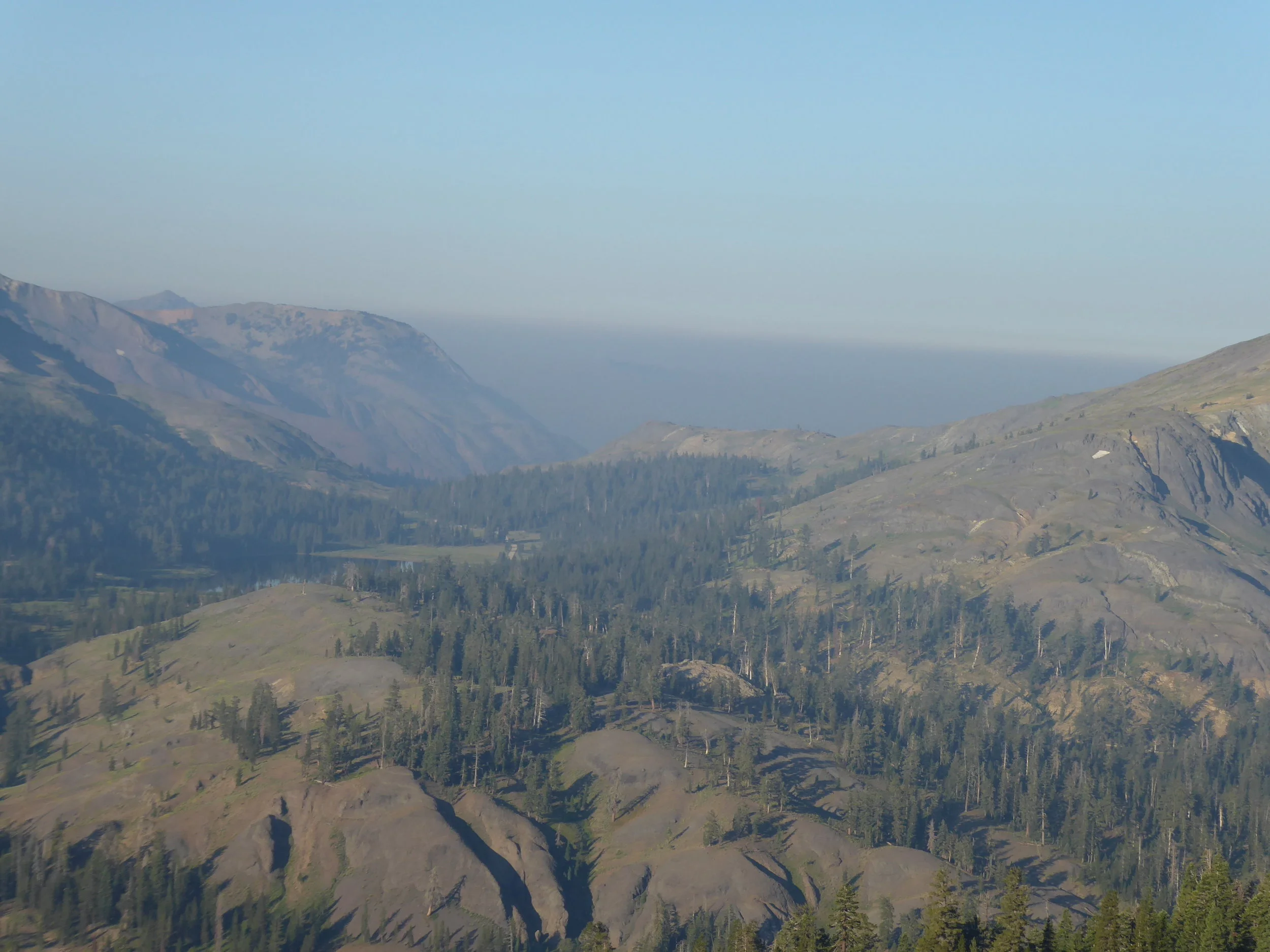
The smoke seemed to dissipate some today and we are hoping that tomorrow will be better. It just really depends which way the wind is blowing as there are now more fires in the area that are burning. In fact we have been told that Yosemite Valley has been closed. We pass a small steam and take notice of the smoke filled suns reflection in the water.
We stop and have dinner beside a beautiful flowing stream. A dragonfly has gotten stuck in a eddie and we watch it circle around numerous times. We try to assist it, but it is just our of our reach. We repack our packs and take off. Several hours later as it begins to darken we were able to find a flat spot near a lake to call home.
Miles hiked 22
July 22
It is always enjoyable to sleep next to a lake and hear the sound of water lapping the shore line. We even decided to to do a leisurely morning. Tomorrow we plan to get our last resupply from Sonoran Resupply. They should be at the trail head sometime after 8 so we will plan to be near the trail head tonight. Meanwhile we start out on a trail that is lined with stones. No problem with route finding here.

We stop to check out this flower.
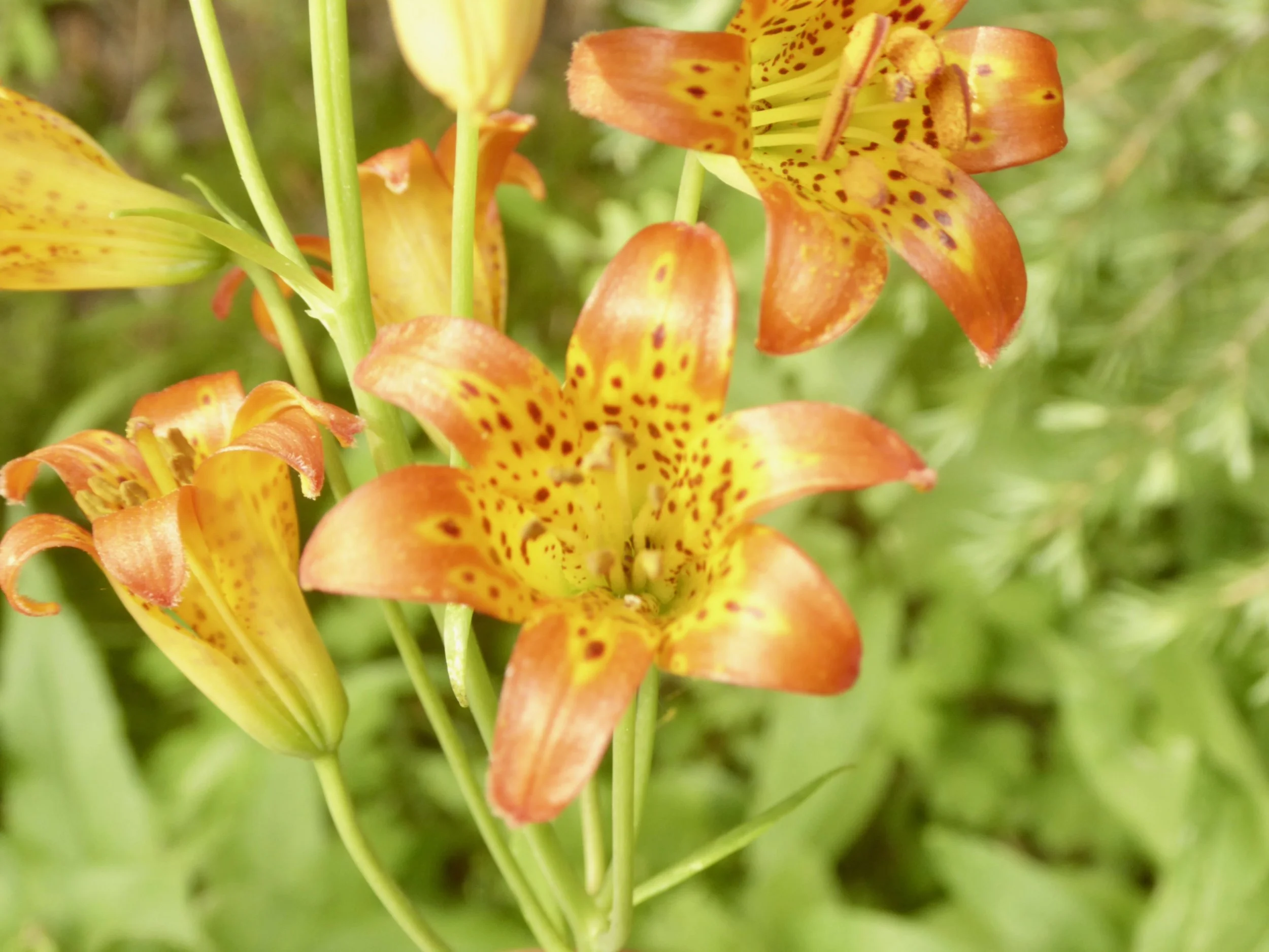
This hike has truly been a wild flower tour!
Today the pass we headed over is called Sonoran Pass. There seems to be little written about this pass and when we hiked out of the forest and saw the pass we were struck by how different it was than most of the passes we had hiked over to the south of us.

Wildflowers are abundant along the trail
Soon we are making our way upwards and upon reaching what we thought was the pass, the trail just continues upward.

We look back at the trail which we just hiked.

We also check out the trees along the way that are testament to the strong winds that must scour this area. We are thankful for the relative calm this morning. There is quite a bit of smoke in the valley.

We check out the sign pointing in the direction we are headed.

As usual a clump of yellow flowers catches our eye.

As the trail continues to go up we begin to wonder if there is really a pass.

Eventually we reach the pass where a group of hikers are taking protection behind some rocks to get out of the wind which is increasing. Dark clouds in the distance are quite storm like. Not wanting to linger we pass some information about the trail and hurry on. We pass a snowfield on the way down.

About a month ago we met a hiker who had just come thru this area and thought it was the hardest section of trail that he had hiked. Seeing the amount of snow that is still left, we imagine what it would have been like.
Now we are headed toward more scenic vistas minus snow.


And of course more flowers.


We have been keeping a steady pace, but stopping often to take in the views. This pace come to a stop when Donna stops to talk to a couple of hikers. They ask where we were planning to camp tonight and when she said near the road head because we plan to pick up our resupply tomorrow. They mentioned that Casey the owner of Sonoran Resupply would be there till 4:00 today and that he most likely had our box in his van. We look at each other and say perhaps we can get to the trailhead before 4. It is mostly downhill now and our packs are light. We kick into fast mode and start the trek downward. Only taking one plant photo.

The trail is dirt with small rocks that are unstable. Donna’s shoes are treadless and this kind of trail is hazardous. Even being somewhat cautious she slips three times. It is time to retire her shoes. The other factor in moving down quickly is a storm with plenty of lightning and thunder is approaching. There is no place to take shelter so we want to move quickly downward. Then to our surprise we see a bolt of lightning below us. This is going to be an interesting storm. Fortunately it is moving rapidly and after a couple more strikes it has moved from the area. We make our way to the road and find the area where the white van is parked. Sure enough Casey has our box of food plus fresh water. This is a great service to the PCT hikers. Since the weather seems to be quite unsettled we pitch our fly and organize our food. Casey pulls out and then stops to warn us that he has just gotten a text saying severe weather is in the area and that flash flooding and hail is likely. I think we will stay put! Before we can move our tent to a better spot the rain begins followed by lots of hail. We have streams running close to the tent. We pile all our gear and are able to keep relatively dry.

Glad we had the fly pitched before the storm started.
After several hours of heavy rain, the sun reappeared.

Still lots of smoke in the atmosphere.
The mountains to the north had plenty of hail on their slopes.

We are staying here for the night. We scouted out a better place for our tent and soon were eating dinner. One of the hikers that had stayed here during the storm was Mountain Gold. we had met him in April at Hiker Heaven where he had been volunteering. He was calling it quits here and heading back East. It will be interesting to see how the hikers fared that were leaving when we arrived. Perhaps we will see them tomorrow, but for now it is time to get into our warm sleeping bags.
Miles hiked 18
July 23
After a relatively rain free night, we were ready to continue our journey northward. We would be climbing a steep trail out of Sonoran Pass. Along the trail we saw hail that had been left behind from the storm.

Glad we had stayed put last night!
The rain from last night seemed to clear the air from some of the smoke.

The trail had been washed out in several places due to the heavy rainfall. Once again we were happy for our decision to stay put. Later in the morning we passed a group of hikers that had been caught in the storm as they hiked up the trail. They commented that the trail had been a river of water and that they had gotten completely soaked. Thankfully the sun shone warmly in the morning and it was drying out their gear.

Smoke to the south of us doesn’t look good.
But the direction we are heading looks a lot better. This could change if the wind shifts.

It is a beautiful trail filled with unique rock formations.
The trail as we head down a valley become lush with wildflowers blooming on both sides.

On the other side of the valley were granite mountains. Not a bad setting for enjoying the morning.

Another thing that is making us enjoy the morning are the old cedar trees. We enjoy touching their bark as we head down the trail.

A tree has to be tough to grow old in this environment.

As usual we stop to admire more flowers.


In May we were walking past the green leaves of the False Hellebore. Today we are walking past the flowering plant.

It has been a good hiking day. Met some PCT hikers as well as several hikers who were out for a week. After talking to the week long hikers we discovered that we had mutual friends. Towards the end of the day we came to gates that were shut with signs asking us to make sure they were closed. We soon found out that we were sharing the trail with herds of cattle. It seemed that each little group had a cow with a bell around its neck. It was almost musical with the different rhythms of ringing.

Fortunately the cows weren’t interested in us.
We found a nice flat campsite and went to sleep with cow bells ringing in the distance and coyotes howling.
Miles hiked 24
July 24
We were on the trail by 6, hopefully leaving our musical cows behind. As we look towards the south the smoke looks quite thick.
But fortunately to the North the skies are blue.

We are hiking thru old volcanic terrain.

Once again we are amazed at how trees can grow here. We wish they could talk and tell us stories of what they have experienced.

We pass a small stream and the flowers multiply. The joys of water!

We look down…we look up…we look around….it is a beautiful hike


There is afternoon build up to the south of us and we hear thunder, but it is far away.

Don heads up one more hill as we continue the hike of the gentle up and downs.

We are beginning to feel that the end of this journey is coming to a close. Our feelings are mixed of happy to be ending to ones of sadness. We find a spot to cook dinner before hiking on several more miles.
Miles hiked 24
July 25
This could be our final hiking day or we could camp close to the trail head and get a ride into South Lake Tahoe tomorrow. Either way we have some hiking to do today. We have fun playing with our shadows.

I think my pack looks a lot bigger than Don’s ummmm.

If our legs were this long we would have an amazing hiking pace.
Flowers, beautiful lakes and scenic vistas make our morning hike go quickly.


After a food break, we are back on the trail heading for Ebetts Pass.

Today we went over two passes, the first one was Ebbets. At the road after the pass a man on a bike stopped to talk for quite a while. He mentioned that we had missed a man who had done trail magic for the last three weeks at this location. I guess we are behind the bubble of hikers. The next pass we headed to was Carson. It was another one of those passes that keeps going up and up.


A flower adds color to the trail.

And finally there is the marker that we have been looking for.

Now it is downhill (mostly) to a trailhead and road crossing.
At the road there is a forest service building and to our surprise and gratitude trail magic. The building is staffed by volunteers who take turns bringing in treats for the hikers. Today there was fruit. chips and soda. They were excited to see us as we were to see them.

Many day hikers were on the trail today enjoying the peak of the wildflowers. A wild Iris was one of the flowers.

As we topped a hill, in the distance we saw Lake Tahoe.

On the shores of this lake is the town of South Lake Tahoe where our hike will come to an end. Depending on the trail which currently was quite nice, perhaps just perhaps we could make it into town tonight. The trail has been dry and dusty and we are in need of a shower. With that in mind we pick up our pace but still taking time to admire our surroundings. The clouds are quite beautiful today.

My pants are so stiff with dirt that when we come to a lake that has swimming possibilities, we both jump in with our clothes on and do our best to get rid of some of the dust. It was successful at least for a little while. We felt the cleanest we have felt for several days. The trail continues to be mostly downhill which helps to set a fast pace. At the last flat spot for camping we decide to go for it and try to make it to the road before dark. The trail which had been a cruise, turns rocky and our pace slows. I have to stop though and take a photo of Fireweed which reminds me of Alaska.

We think that we might have made a bad decision in hiking to the road. When we do get to the road it is getting dark and we are at a location that encourages drivers to be on the move. We are not having any luck of getting a ride. I mention Uber and Don has an ap on the iPhone. He gives it a try and soon we have a uber icon moving our way. We are on our way to town with visions of clean sheets and a shower. The driver says good luck on that one. we have hit one of the busiest weekends in the town. All of the hotels are full at least any that are in our price range. Our last option is a campground which was near downtown. The driver drops us there and it is unbelievable but we have gotten the last available site. There are over 400 sites at this campground and we are talking close quarters. We are ok with that we just want to eat, sleep and take a shower in the morning. It is by far the most expensive tent site that we have ever had.

Our camp the next morning
Last night was quite the event. Sometime after midnight we were wakened by car alarms going off and people banging pots and yelling. We were clueless to what was going on so we just got deeper into our bags. In the morning we found out that bears which often visit this campground were out looking for food.
Miles hiked 24
July 26 and Beyond
Needless to say when we checked out and were asked if we wanted to stay another night we politely declined. We had reserved a rental car and felt fortunate when we were told we had gotten the last one. Back to Lake Isabella we went to hopefully find a car that would turn on after sitting for a month in 100 degree weather. The car started right up, but four warning lights remained on. After checking the manual, we decided to stop at a Toyota dealer in Bakersfield CA. They gave us an analysis of a sensor gone bad. They first thought that a rodent had chewed one of the wires, but did not see any evidence of that. For only 1200 dollars they could have it fixed by tomorrow. They also thought that we could probably drive to San Diego and get it fixed there. We chose that option, but first checked out an all you can eat home cooked buffet. We had hiker hunger to the max and probably over did it. When the main courses were completed we headed over to the desert section.

We enjoyed each bite!
Now it was back into the car and return to San Diego where we got to spend the week cleaning gear and visiting with Ryan and Beth. Just a short note about the car. We had Ryan’s mechanic give it a check out and he found where a rodent had chewed the wire. It was less than a 200 dollar fix. Getting a second opinion was worth a lot of money.
At Ryan’s and Beth’s house we were treated to a celebratory end of trip dinner. It was served on the picnic table made by Beth and Ryan.

We also thought that our calves were worthy of a photo. Not sure if they will ever be this developed.

Donna’s

Don’s
And of course on an early morning walk in San Diego we were awed by the Queen of Night Cactus in Bloom. A plant that only blooms once a year at night.

We headed north to Portland to visit our younger son Jeff and his girlfriend Emily. They surprised Don with a birthday cake.

And a delicious home cooked meal.

Our drive north happened to coincide with the Pacific Crest Trail Days held at Cascade Locks in Oregon.

It is a celebration of the trail where vendors show off their latest gear and hikers get to spend time with other hikers. We were excited to see other hikers that we had met on the trail sometimes months before.

Aziz also known as Ramen Shaman
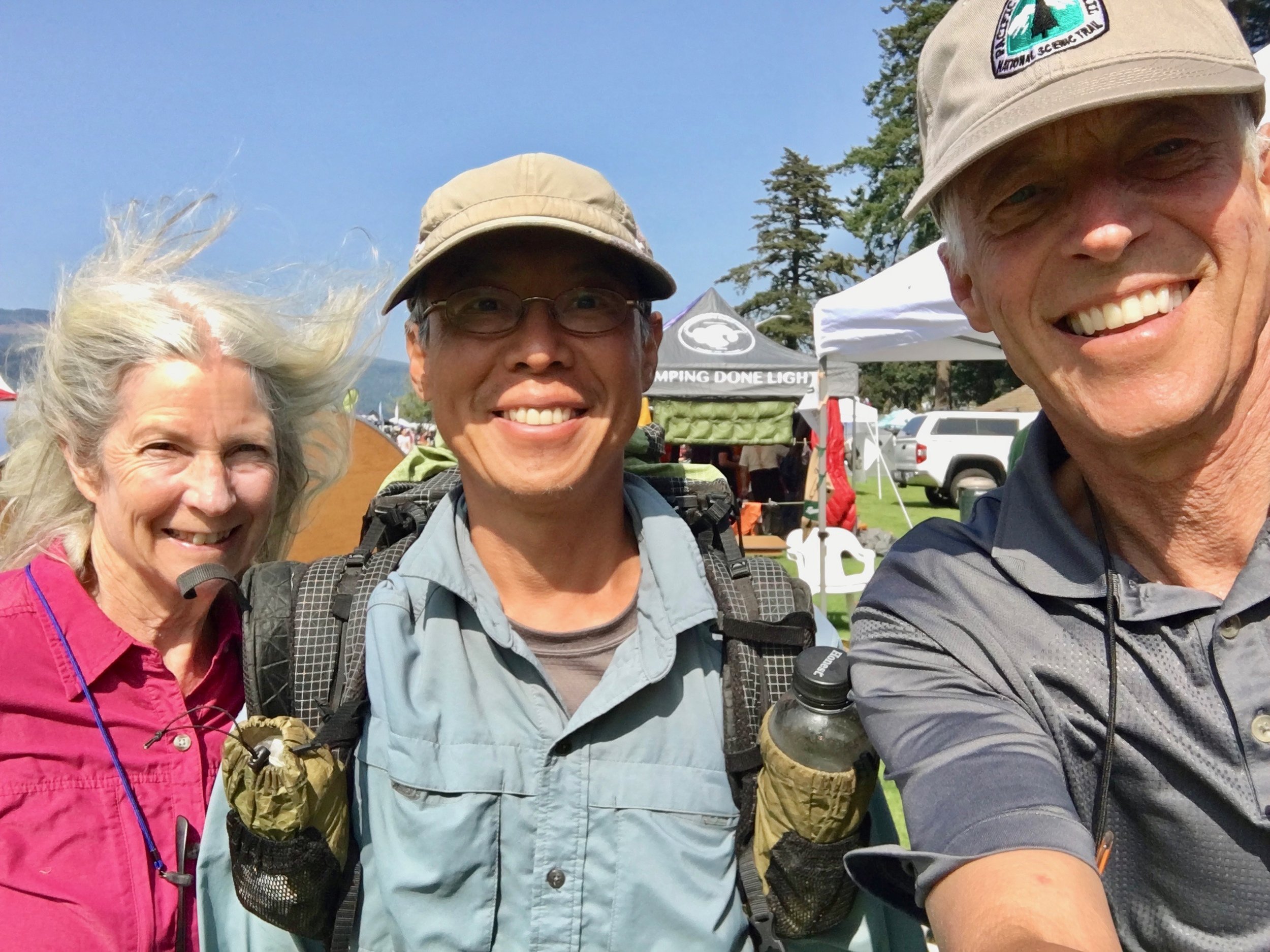
Super Vegan

Spiceman who we met the very first day of ur hike.

It was really fun to feel the enthusiasm here from all of the hikers.
This event brought some closure to our hike. We have now hiked the trail from the Mexican Border to the Canadian border. When we had completed the CA section this year, we were ready to be off trail. Now however, it would be pretty easy to repack the pack and head down the trail once again! The Pacific Crest Trail has been quite the adventure.