Dec. 19-22
We have four full days in Hobart to visit museums, check out the famous Salamanca market, buy food for our trip, check out recommended bakeries, look for the elusive platypus and weather permitting climb Mt. Wellington. Mt. Wellington frames the city of Hobart and so far has mostly been cloud covered. Then on the morning of Dec. 23 if the weather permits we will be flying into Melalueuca to start our hike of the South Coast Track.
Dec. 19
Pip has driven from her house to our hotel to drop off our luggage and some food that we had left at her house. . Chris and Pip have been a huge help in supporting us while in Tasmania. We head off to Strive and Scoops, two stores that we can purchase most of the food that we will need on our hike. It is only about a mile away. It is fun looking at the different building styles as we walk there. A lot of Hobart was build by convicts in the early to mid 1800’s. During our time in Tasmania we plan on visiting Port Arthur which should give us an understanding of what it was like during that time period. Now though we are concentrating just on Hobart.
One of the museums here that holds a lot of interest for us is the Mawson Arctic Museum. It is quite close to our hotel and we spend several hours looking at videos and talking to one of the staff. Before going to Antarctica we read several accounts of Mawson’s expeditions . Having spent time in Antarctica gives us a better understanding of what he accomplished during his time there.


The building and rooms are replicas of his hut in Antarctica . Some of the videos that were shown are actual footage fro m the expedition.
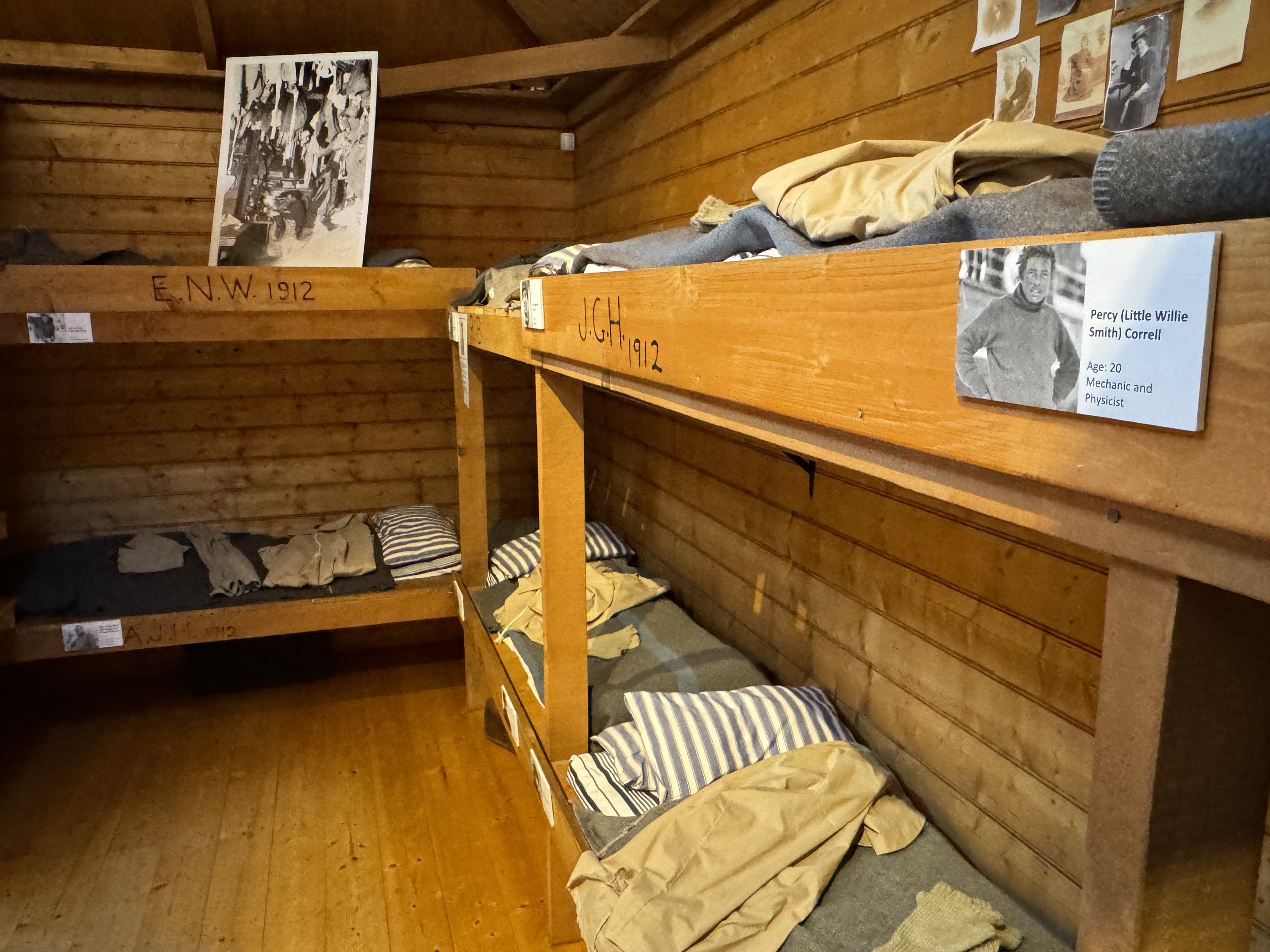
Bunk beds for the crew.

This was Mawson’s room. The organ was actually the one that he took to Antarctica. Some of the furnishings were taken from the original hut or donated by family members of the crew.

The museum does a great job of explaining about the expedition’s time there.
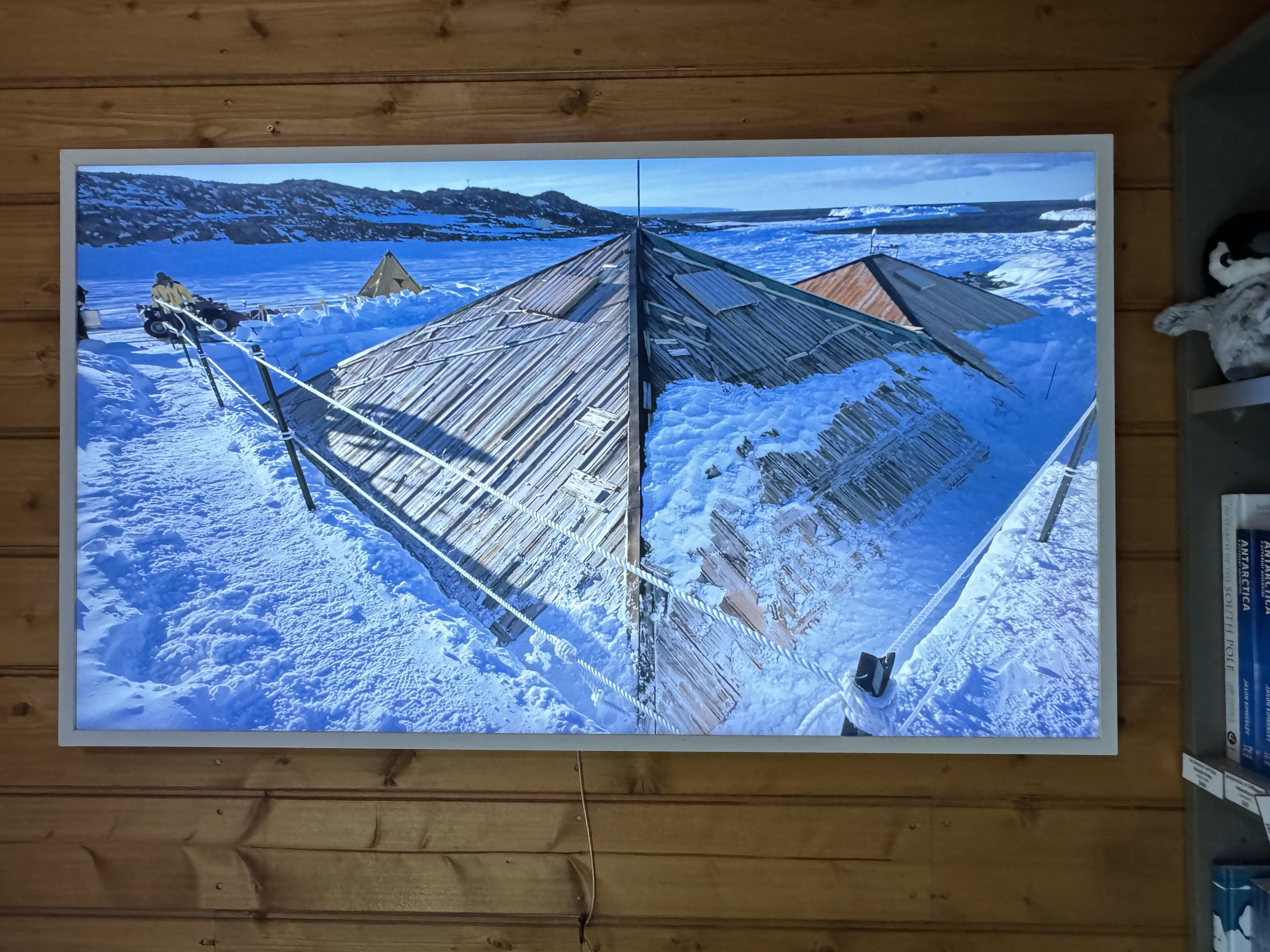
Photo of the actual hut and doing restorations on it.
There was a lot to see, and it was so interesting.
We checked out an aboriginal art store. We were fascinated by the colorful displays. There were two very large cruise ships in the harbor which made for quite the busy streets. They will be gone by tomorrow and the crowds will go down considerably. We made a reservation for a shuttle to take us to Mt. Wellington tomorrow. We are hoping for clear weather.
Wed. morning (Dec. 21) we head to the pickup point for the shuttle. The driver checks us in and we start the drive up the mountain. Our plan is to take the shuttle to the top and walk back to our hotel. This plan was changed a little when we discovered that the trail from the top is closed for maintenance. We however can be dropped at the next trail head down from the summit..
As we approach the top the view is obscured by clouds. This is a regular occurrence at this time of the year. The driver gives us 30 minutes to check out the summit which we know only because of the sign, we really can’t see anything and it is cold. Most people are back on the bus before the 30 minutes are up.

If the view was clear, we would be able to see Hobart below us.
The driver drops us off and we begin our descent.

As we descend there is a break in the cloud cover and we get a glimpse of Hobart below us.

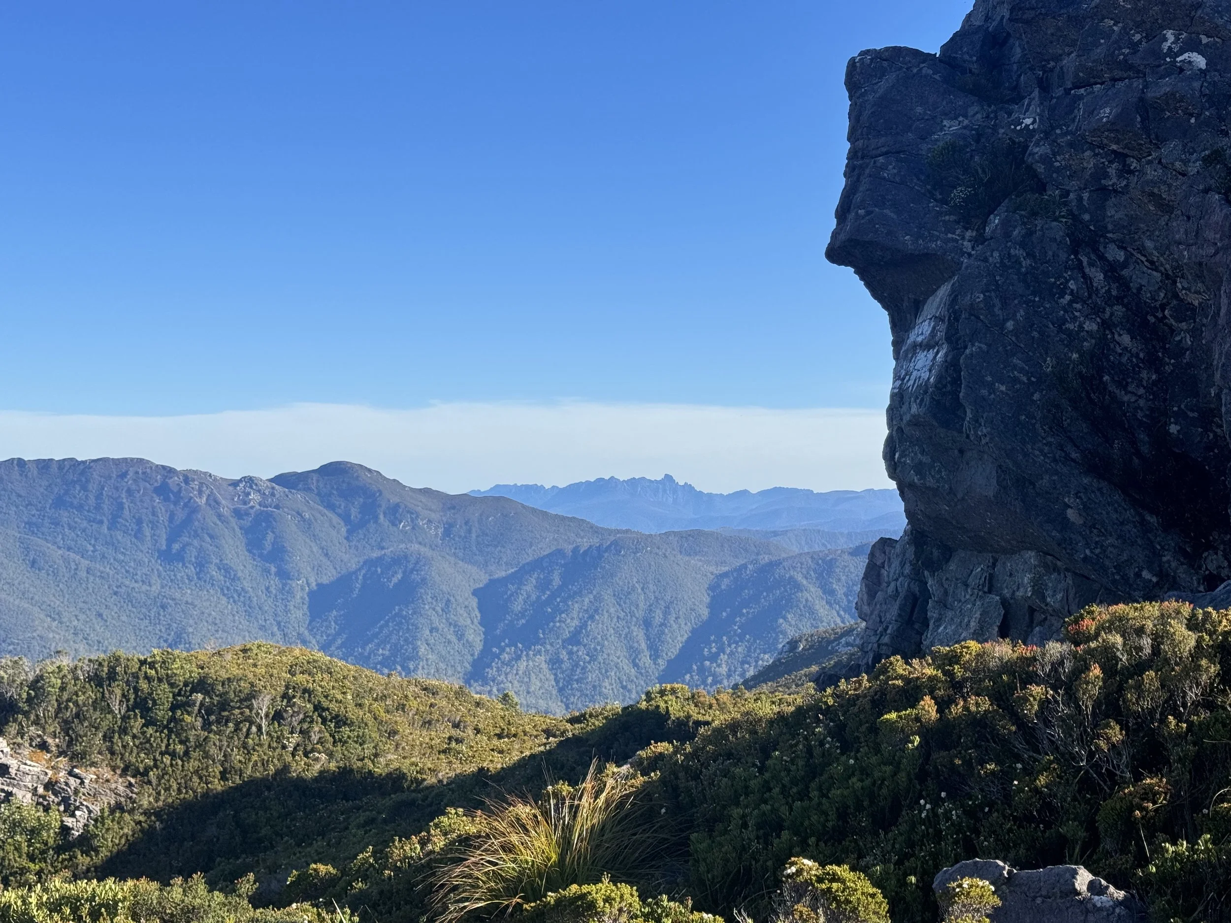
We are fortunate that the clouds also uncover a section of the trail called Organ Pipes.

After we pass this section of trail we are hiking mostly in the woods. We pass over small streams as we descend to the city. We pass an area called the waterworks and hear the sound of the Laughing Kookaburra. Their call is easy to identify.

This bird isn’t native to Tasmania , but now is common. We love its call.
As we head closer to town, we decide to check out a stream that has a reputation of having platypuses . We walk and sit quietly by the stream, but no platypus appears today. We do here the screeching of the swamp hen. and see a couple of adults with their young.
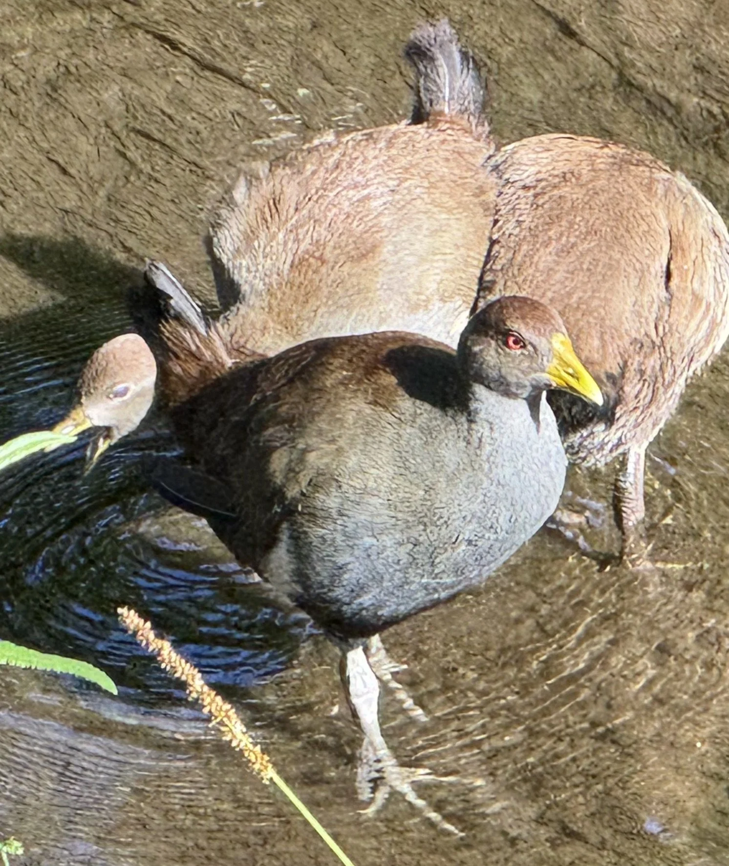
They sure can make a very loud noise. If I was a platypus I wouldn’t want to hang out near them.
The day went well and we even got a text from the driver making sure that we had made it down.
Dec. 22
With our packs mostly packed we decided to do another day of exploring Hobart. We discovered that the Pigeon Hole Bakery lives up to its reputation. We tried several of its delicious products. We also went to Miss Piggy bakery, that specialized in French Pastries. It is a good thing that we are leaving tomorrow as all the good food here is expanding out waists!
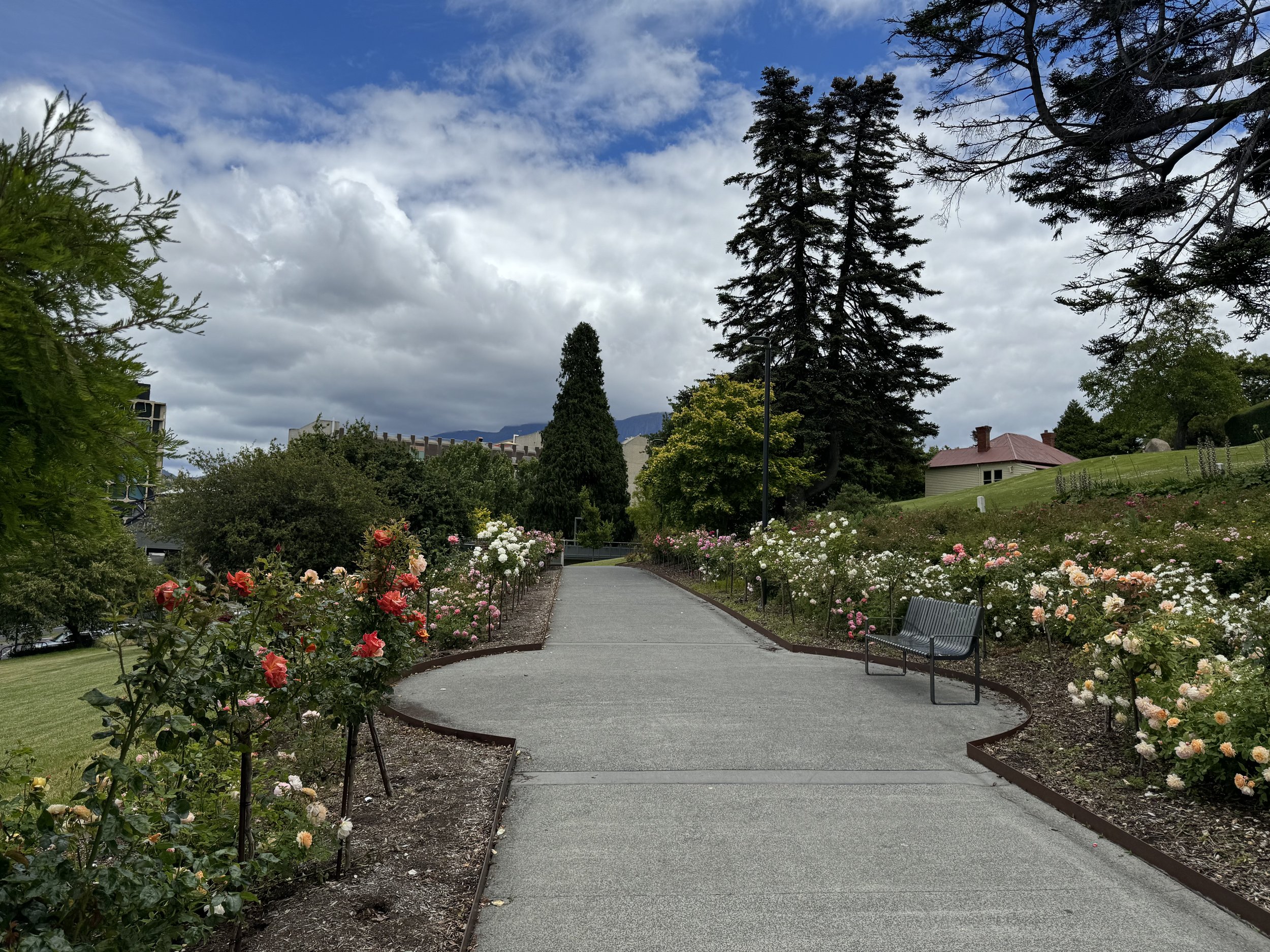
We walked to the Queens Domain, an area of beautiful flower gardens and old buildings.


An Australian Magpie posed for us.

Evening found us checking out the Christmas tree, eating food at the Friday Market and listening to music at a concert in the park.

We have enjoyed our time here, but are ready to return to the wilderness. The weather looks good for the flight in tomorrow.
Dec. 23
Chris and Pip are arriving at 10;15 to take us to the small airport to board the flight to Melaleuca. We have several hours before their arrival and plan to go check out one of the largest Saturday markets in Australia. It opens at 9, but it already had quite a crowd by 8. The streets were packed full of tents and the choices of products were overwhelming. From food to crafts to clothing the aisles soon become crowded with people. Being close to Christmas there was a lot of purchasing happening. We were only looking to buy some cherries that we could give to the volunteers at Melaleuca.
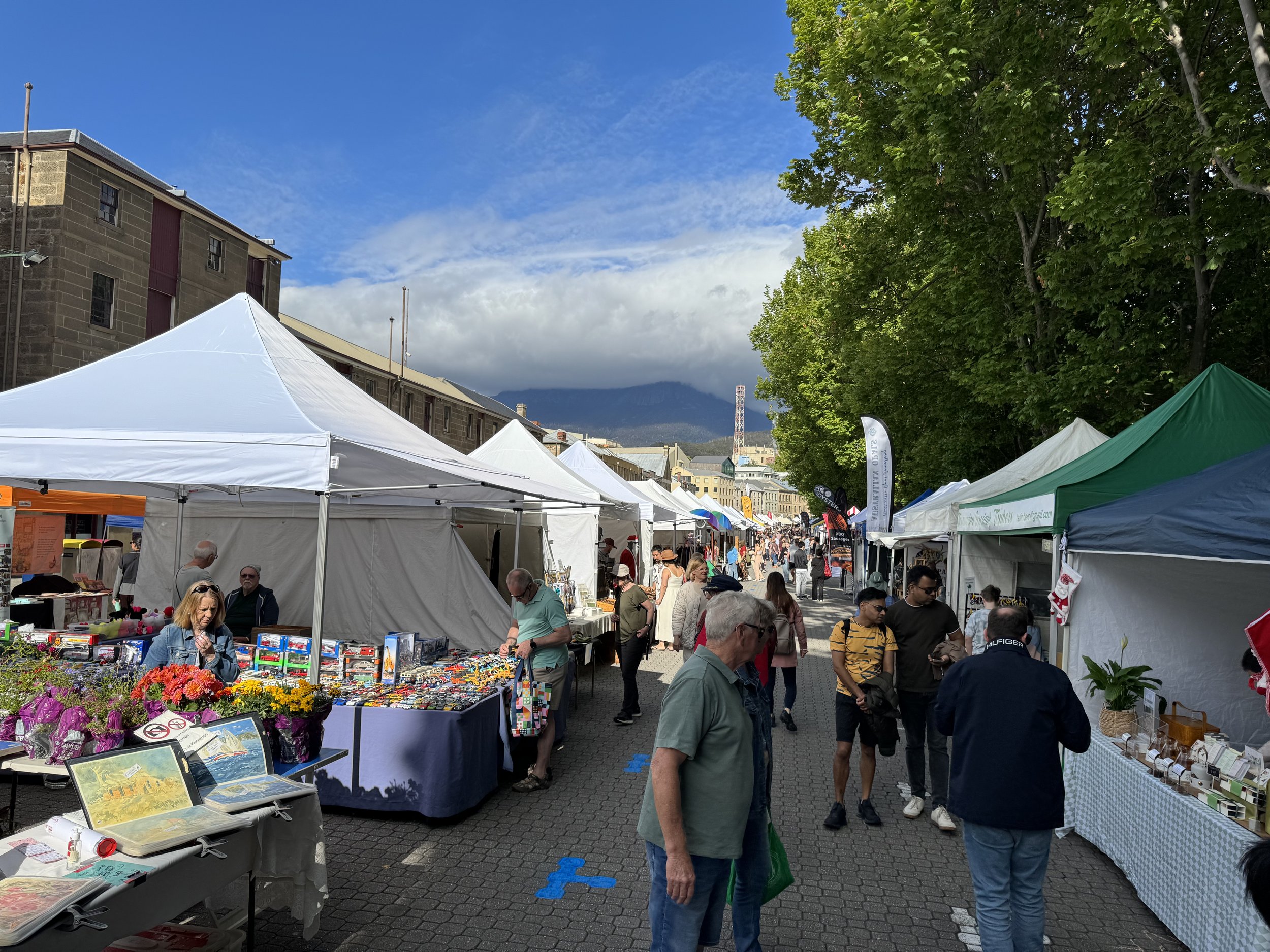
Before we left to head back to our hotel, it was wall to wall people.
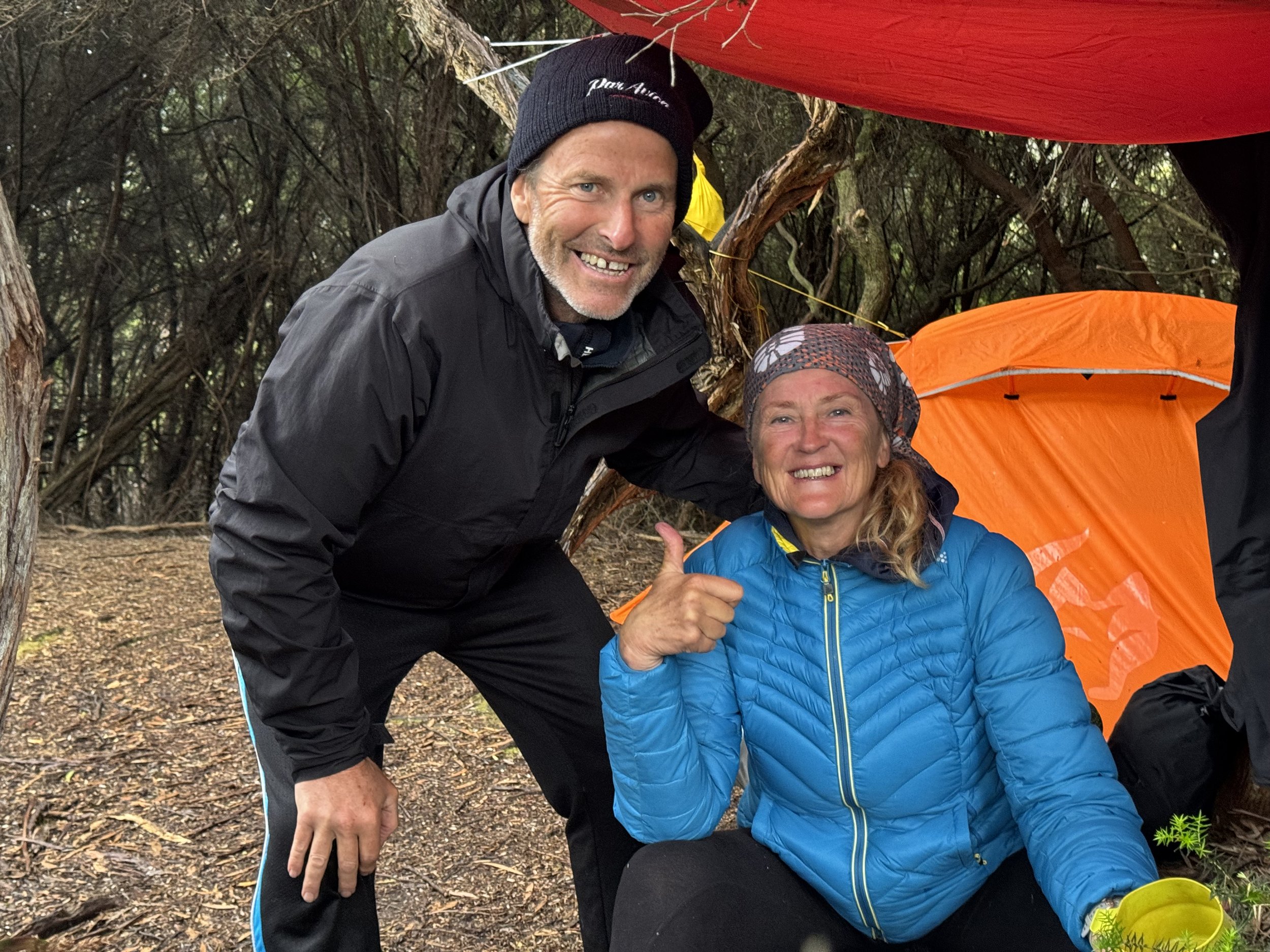
Chris and Pip arrived on schedule. Happy to report that Pip is close to being 100 percent. Back in Alaska when we were preparing for the trip, Pip had given us the advice that we needed to book our flights early for this hike as they fill up quickly. There isn’t a permit required for the hike unlike the Overland. This hike is known for its difficulty and for the potential of severe weather. I hope we are prepared. We had gotten the date that we wanted and the weather has cooperated. It is not uncommon for flights to be canceled due to weather.

We say goodby to Chris and Pip. They are planning to pick us up at the end of the trail and then we will get to spend some time with them at their home on Bruny Island.
We head in to the office to get our packs weighed and to get flight instructions. My pack weighed in at 29 pounds and Don’s at 33 pounds. This was without water included. We have planned for 6 nights and 7 days with some extra food. We feel good about our weight especially when the man sitting next to us had a pack that weighed close to 50 pounds. He was definitely interested in what we were carrying. He said I think that I have everything but the kitchen sink. We feel pretty good about what have.
There will be two planes flying in today. The weight of the people and gear is computed and we are given our plane assignment. We are assigned the plane that has the capacity of 4 people plus the pilot. We are also given seat assignments.

We are flying with Par Avion
Often the weather is too windy to fly over the mountains and the coastal route is taken. The wind is in our favor today which means not only will the flight be shorter but we will be flying over the mountain ranges of southern Tasmania.
Out of the planes window we first get to see the summit of Mt. Wellington. Looks like the hikers there today will have great views.

We make out the Organ Pipe Rocks that we hiked by several days ago.

Looking down at the city of Hobart.

Flying over the mountain ranges
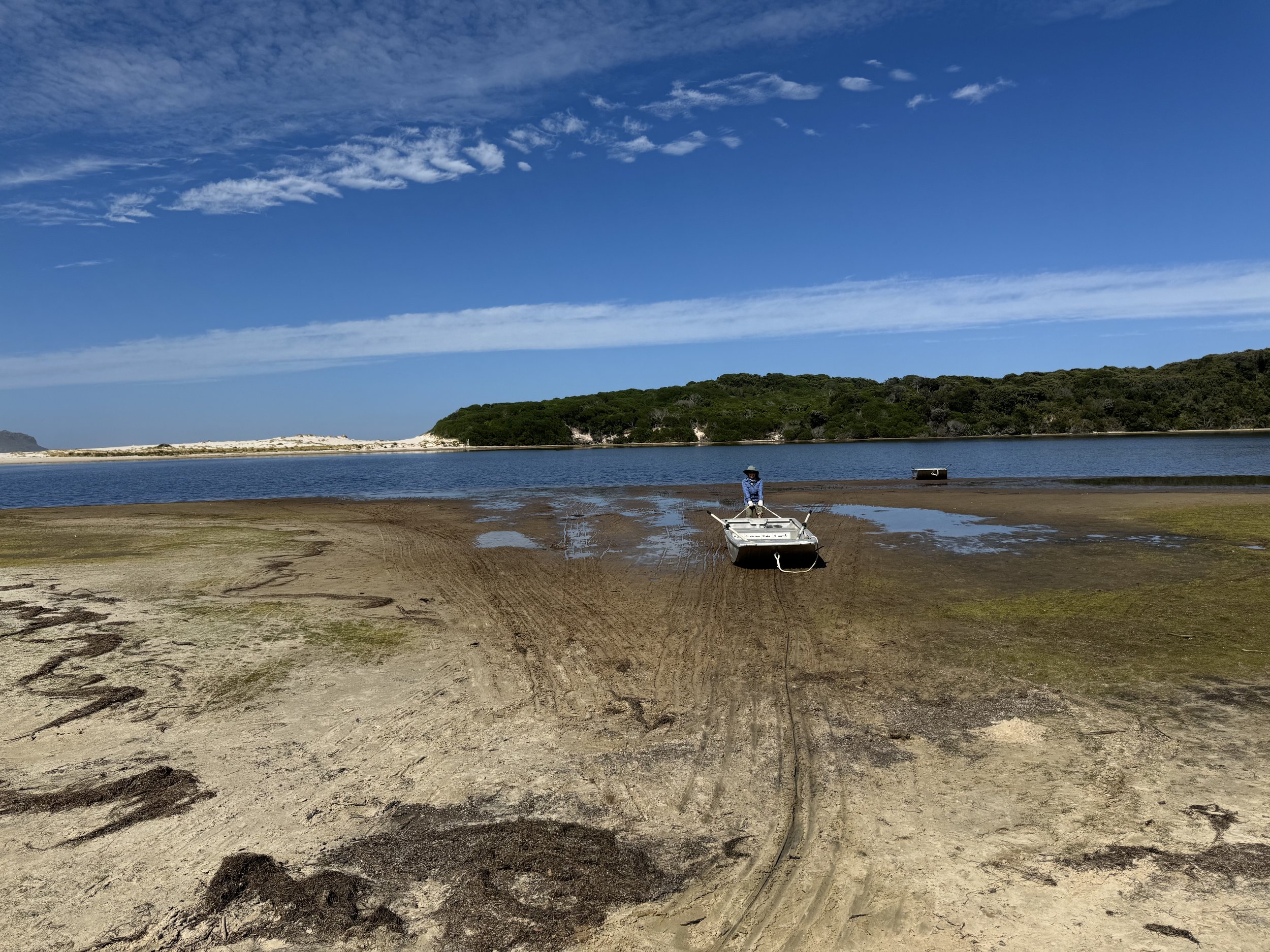
After about 45 minutes our destination comes into view. We make out the airstrip and the boardwalk that is the start of the South Coast Track.

Upon landing we are given the fuel that we had preordered. There is a shed here that has the fuel for the hikers.
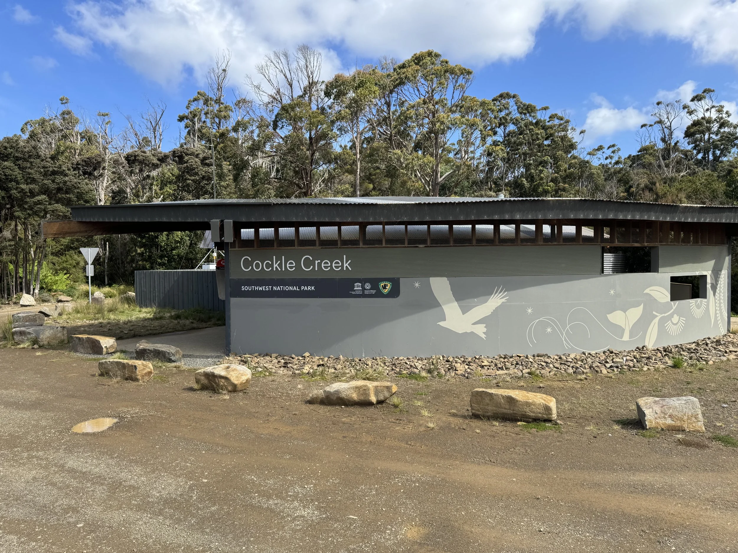
Most of the passengers on the planes, after getting their backpacks from the plane, sign in at the registry and head down the track. Pip has recommended that we spend a day here checking out the site of Melaleuca.

There are two huts here that hikers may stay in. These are the only huts on the track. We check out one and so far we are the only ones here. We leave our packs on a bunk and go out to check an aboriginal walk and the Denny King Museum. If we are lucky we may even see the Orange Bellied Parrot.
The hike on mostly boardwalks takes us thru the forest and down to the water. There are several informative sites with examples of aboriginal shelters and an example of a canoe.

The next stop is the Denny King Museum. The museum tells about Denny King and his life here. He was a tin miner as well as many other occupations. When one realizes how isolated it is here it is impressive with what he was able to accomplish. At the museum there are comfortable chairs to sit in while perusing the information. Windows are facing a bird feeder where we hope to see the endangered orange bellied parrot. The first bird we see is the colorful Rosella Parrot.

We are told when this bird is feeding, we probably won’t see the Orange bellied Parrot. The rosella is a bully and doesn’t like to share the food. We see another colorful bird called the Bronze Wing.

We can see how it gets his name.
We have been told that if there are no Orange Bellied Parrots at the bird feeder, we should head over to where there is a nest and another bird blind. We find the blind and see the nest. There are some parrots about but they are always on the move so we don’t get to take any photos. We do feel fortunate that we have got to see one as there are less than 300 of these parrots in the world. They have slowly been making a comeback and the volunteers here that are observing them are encouraged.
A flash of red catches our eye and we watch as the Beautiful Firetail lands in front of us.

We can see how it got its name.
We decide to head back to the museum in case we might see the Orange Bellied Parrot. We can’t believe our fortune when we see that there are two parrots hanging out by the bird feeder.

They are a lot smaller than we realized, a little larger than a robin. The orange belly is quite distinct.

good information
We head back to the hut and before we even get inside we hear the voices of many people. Several planes arrived while we were at the museum and there are now 9 people in the hut. They are having a Christmas dinner with all the fixings. They will be on the trail Christmas Day so decide to celebrate it now and tomorrow they can send out any trash with the incoming planes. We decide that setting up our tent outside is to our advantage.
As we are setting up our tent we meet another camper. She is from Nome . Alaska and told us that several years ago she discovered Tasmania and spends her winter vacation here. She brought a boat this year and has been having fun exploring the bays around the area. Time for dinner and to take in the beauty of the area. We are surrounded by water, plains and mountains. One of the volunteers told us that the weather has been quite lousy this past week, but there is an indication that is about to change, I hope she is right. It is too early to go to bed so we walk back to the museum and enjoy the luxury of chairs, watch the colorful birds and do some more reading. Tomorrow we will be starting the hike of the South Coast Track
Dec.24
So glad that we took Pip’s advice to spend a day at Melaleuca before starting the tract. We were up by 5 as the first light was beginning to appear. By 6:30 we had breakfast and packed our packs. The track is calling! After signing the register, we start the hike. In the last few years the amount of board walk that has been added to the trail has almost doubled. It does a lot for keeping the area from being impacted from hikers who didn’t stay on the main trail.

Easy to get into a rhythm.

There are gravel paths as well.

After walking on the plains for several hours, we descend to the beach. This track has a variety of environments that one gets to experience.
The South coast Track is more difficult than most of the other hikes in Tasmania. It is wild, remote and unpredictable. The first day was easier than expected. We got to the first designated site at Point Eric , but it was too early to make camp
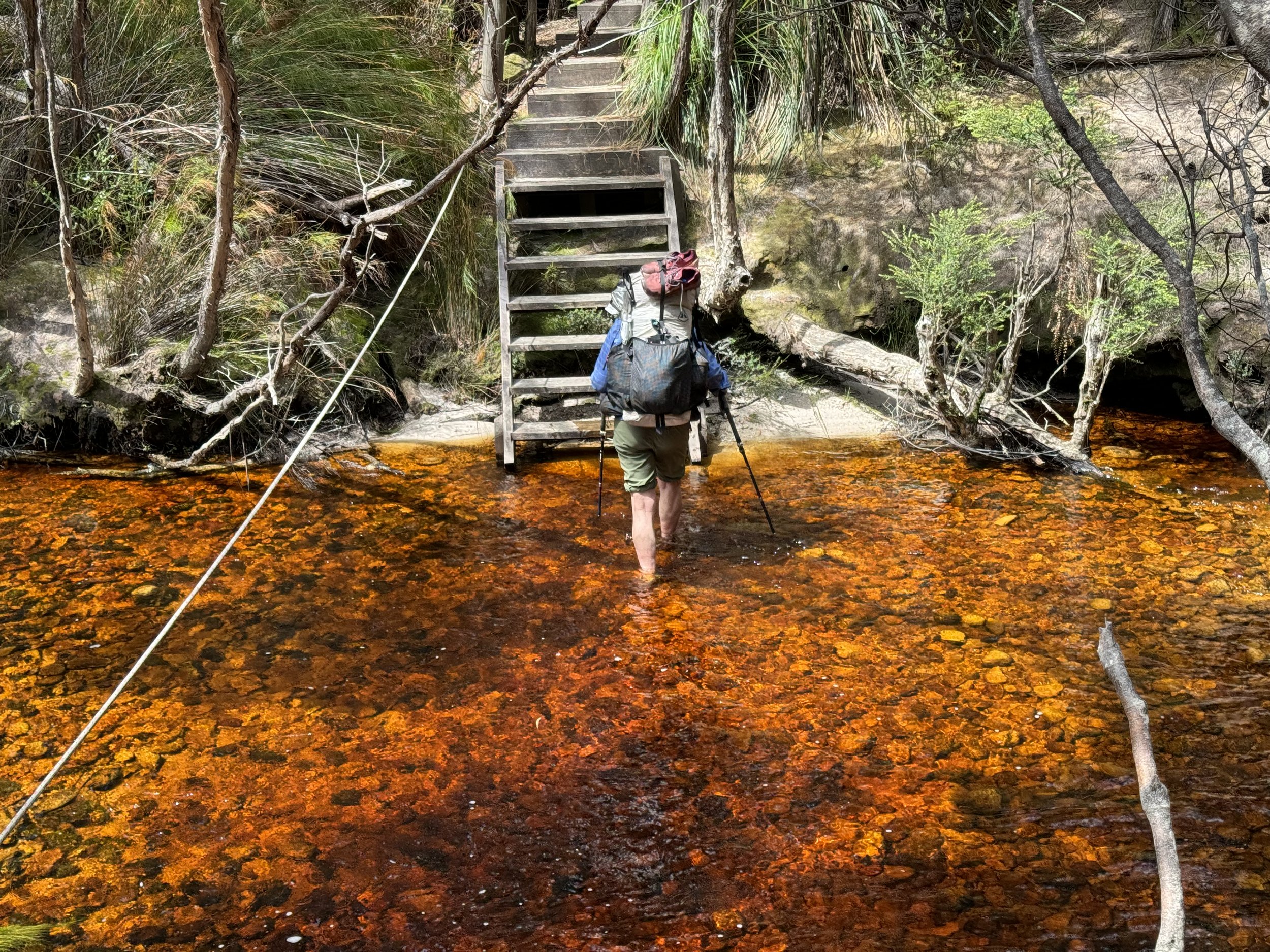
We passed a water source and soon realize that their description of being prepared to drink brown colored water was accurate. The water has a lot of tannin which makes for the brown color.

Will have to get use to the color of the water.
We are prepared for a variety of temperatures and today we are glad that we have our umbrellas to protect us from the sun.

Time for lunch.
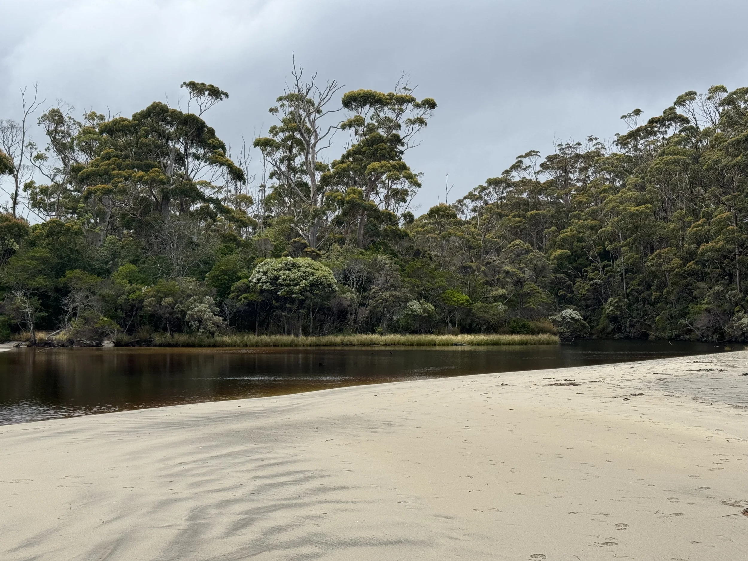
We arrive at the first campsite and the board walk is now a beach walk.

Tent sites were scattered among the trees.
So far we haven’t seen any hikers, but we have seen footprints in the sand. We assume that they are from the hikers that started after we landed yesterday.
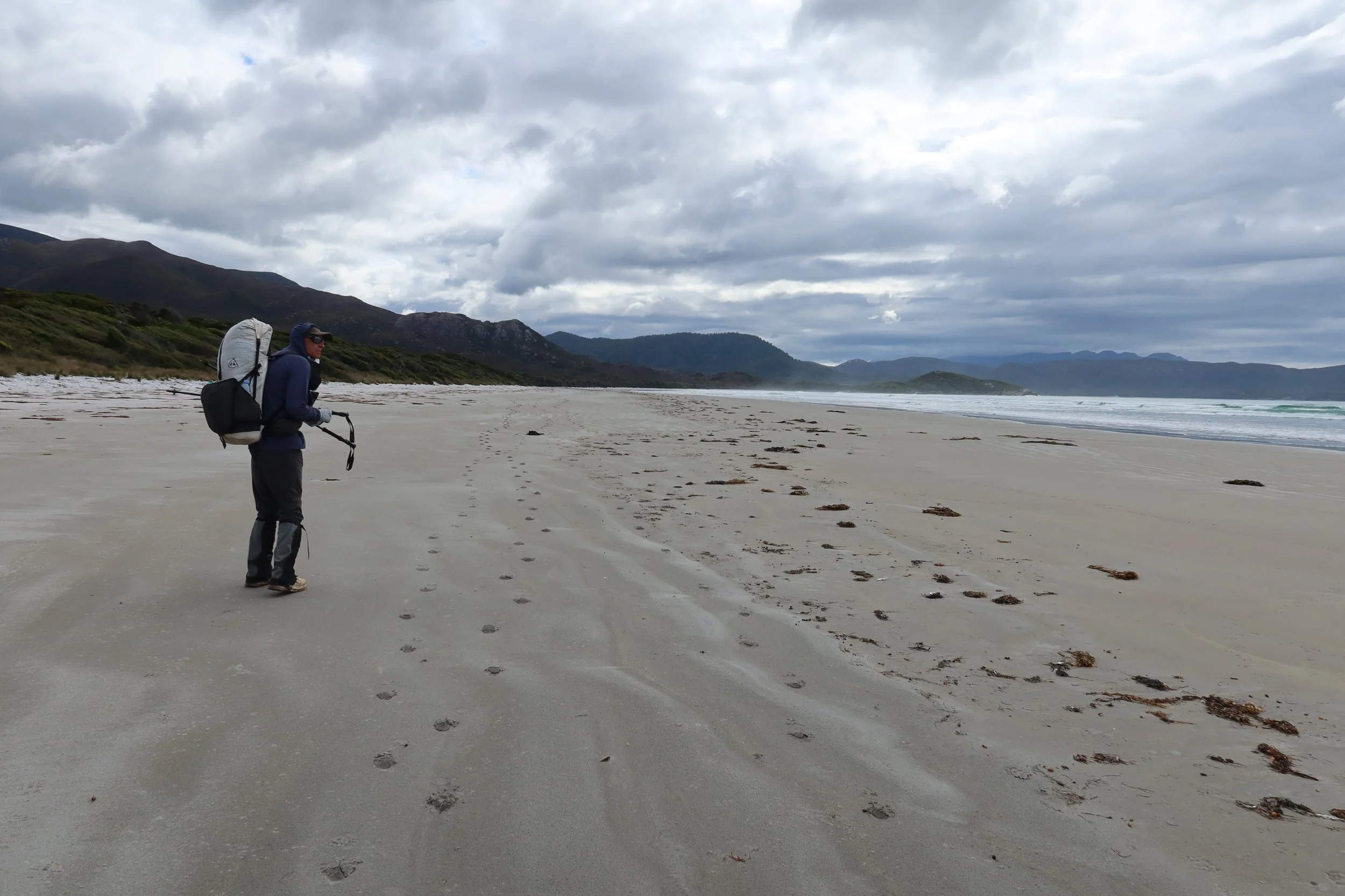
If the tide is timed right, walking the beaches can be easy.

We did encounter some rocky sections and had to navigate streams that were flowing into the ocean. One stream that was noted in the guide book as need to wade was one that we could jump. One of the hazards on this trail is the river crossings. If we don’t get much rain, high water may not be a problem.

It was fun to spot a Sulfur Cockatoo

The trail so far has been well marked with orange posts indicating our beach walk is over and we are back in the woods.
There was a relative steep section of trail today, but nothing like the Iron bounds that we will be encountering in a couple of days.
We came to our first river crossing. We weren’t upset that the river wasn’t hard to cross. There is a rope across the stream and is to be used when the water is higher. The water was refreshing and felt good on the feet.

Faraway Creek.
Once we crossed this creek, we took a look at the map and decided to go ahead to Louisa Creek. We found an area that was a good place to set up a tent. Tomorrow we are going to take a side trip to Louisa Bay and then camp at Louisa river.
We thoroughly enjoyed our introduction day to the South Coast Track. The weather was great, the rivers low and no bugs!
We decided to sleep with our food between us. We have been warned about rats so hope our system of wrapping our food in double garbage bags work. We hiked about 15 miles today.
Dec 25
Christmas Day..We miss not being with family, but the last few years we have taken advantage of spending time with them between our travels. We reminisce about Christmases spent in Baja. Being close to the ocean brings up memories of our time spent there. A Christmas spent kayaking the Sea of Cortez with Ryan and Jeff still makes us smile! Now though we are focused on the hike of today. It was a peaceful night at our camp tucked into the trees and the sound of the creek nearby. No other hikers shared our spot. At 6:30 we were on the trail heading to Louisa Bay. First we had to cross Louisa Creek which again was quite mellow.

It was a cool morning, which made for a great temperature for hiking. Today we are going to take a side trip to Louisa Bay. Reading about Louisa Bay sounds like it is a spot that shouldn’t be missed. There is a campsite there but after reading about the trail description to get there we decide a walk there without packs, is a good plan. It is only a mile to where the trail forks to Louisa Bay. We walk a little way down the trail before removing our packs and put on the rain covers to protect them from curious birds or animals. It is about 2 miles to the bay. We walk through button grass, swampy areas that have no board walks (we appreciate the boardwalks) and forests of trees. Before getting to the bay there is a very steep decent to the beach. Leaving our packs was a great idea.
Louisa Bay lives up to its description. The day is sunny and the color of the water contrasted to the sandy beaches is idyllic.

This is the hill we had to descend The trail was marked with various items that had floated to the beach. Not having packs on, made for an easier hike down.


It was a great place to take a break and just watch the waves break on the shore.
There were a couple of hikers here and we met Dale. He is on a 9 day hike so his pack is heavy. This site does not have a guarantee of drinking water so that added to his load. He shares his enthusiasm of the beauty of this location, although he is a bit envious of our day hike here. He plans to hike to Louisa River campsite tonight so most likely we will see him there.
We make our way back to our packs and relieved that they weren't visited by anyone. After a short food break we head to Louisa River. Before dropping down to the river we catch a view of the trail that heads up to the Iron Bound Range. Any description that we have read of the trail always mentions this section of the hike as being the most difficult. We have had a short hike today so the plan will be to get up early tomorrow and head up the trail.

We check out the faint trail that heads up to the summit of the mountain. At least a couple days of being on the trail has made our packs lighter and there is several water sources on the trail so we won’t have to carry a lot of water.
Before getting to the campsite, we must cross Louisa River. There have been warnings that if it is raining and the waters are rising do not attempt a crossing. Reports of hikers needing to spend several days waiting here has made us grateful of the low water today.

Today the river is only shin deep, well at least for Don. More of the challenge today is to avoid falling on the slippery rocks. Using trekking poles is helpful. It is quite obvious why in deeper and faster water this could be challenging.
We are the first group to arrive to the camp and from past experiences it is always good to put the packs down and check out the various campsites. We find one that is a single site tucked into the woods that will provide some shade as well as being private. We have a hot lunch, take advantage of the river for bathing and Don takes a nap while I contemplate the movement of water over the rocks. The campsites all have outhouses which is great for Leave no trace camping. By late afternoon and early evening the campsite fills up. Dale who we met earlier today camps nearby.
Total mileage today was just over 8 miles.
Dec. 26
This is the day that makes the South Coast Track have the reputation of being difficult. With that in mind we start the day by getting up at 4:30 and on the trail by 6:30. We wanted an early start to make sure that we would make it to our destination tonight, and also to be able to hike before the sun beats down on the track. Yesterday when hiking to Louisa River campsite, we noticed that the trail gets full sun for most of the day.
We are off and soon in the shade provided by the mountain peaks.

The goal is to keep moving and miss most of the sun.

We keep a steady pace as we steadily climb upwards. We appreciate the wooden steps that are placed on the track.

Like any mountain hike, the summit is just around the next bend…the next bend….the next bend. We are doing a good job of keeping in the shade.

The beauty of the ocean is below us. We can make out where we hiked yesterday.
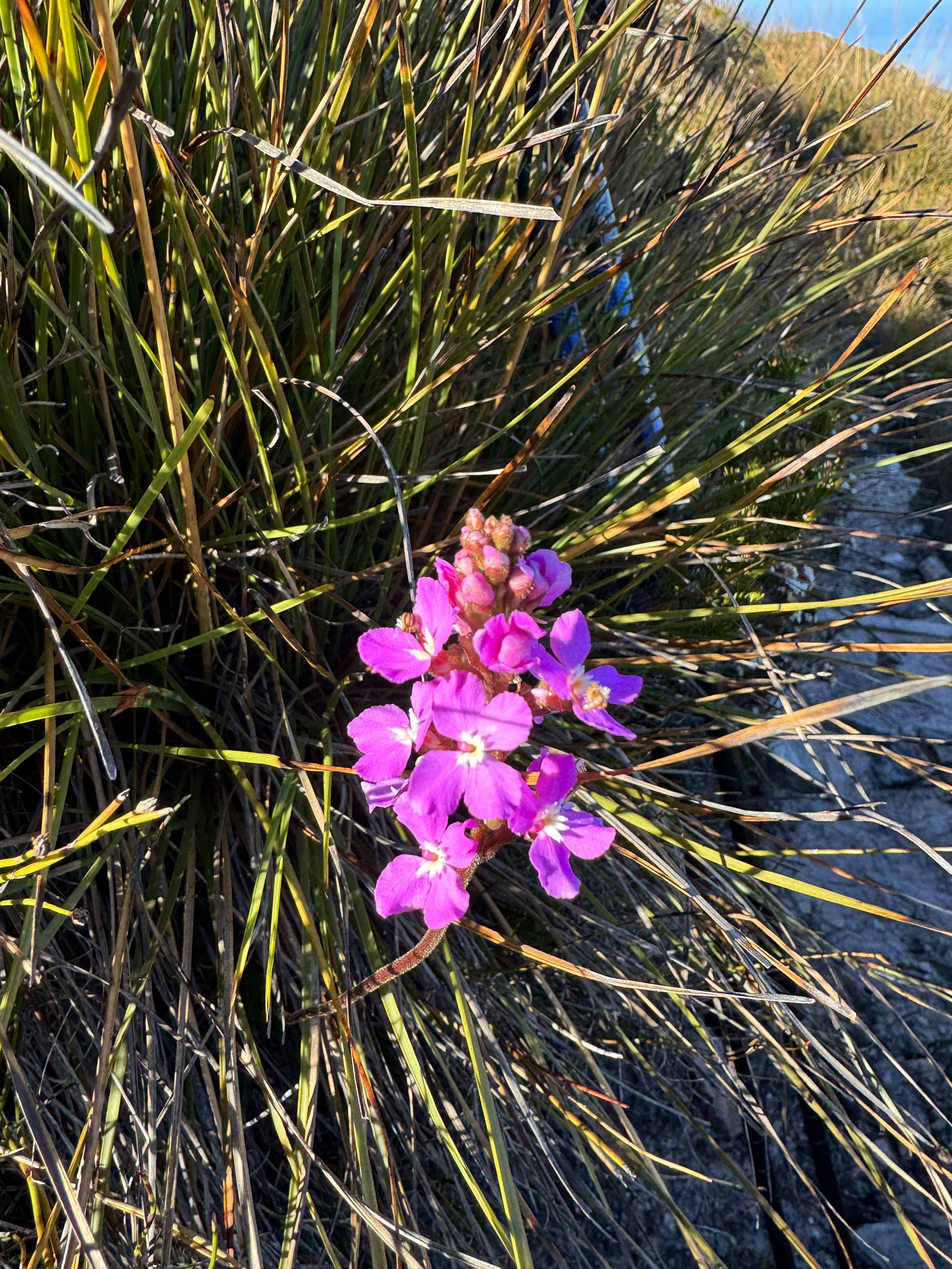
Flowers along the way gives us a reason to take a photo.


Christmas bells bloom around Christmas
The mountains also give us pause.
Our day is beautiful and without wind. We feel blessed by the conditions. The mountains are known for strong winds and track warnings are not to go over the summit if the winds are blowing.
Dale, the hiker we met yesterday passes us near the summit. He has the same pack brand that we are using. According to Dale there were only 3 packs of this type shipped to a sporting goods store in Hobart and he has one of them. With the shipping fee and import fee, we are happy to hear that he likes it.

Once we are most of the way to the summit the familiar boardwalk shows up. We think to ourselves that so far the Iron bound hasn’t lived up to its reputation. There is a water source near the summit as well as single campsite. We meet Mike and Anka who camped here last night. They told us that the sunrise made it worth the hike up last night.

In the distance we see a beach that we will be going to. Our first thought that it wasn’t far and how hard could it be?
We soon discovered that what we thought was not reality. Soon we are hiking a trail that in reality was right up there as being one of the more difficult hikes we have been on.

The trail soon becomes a maze of rocks and roots.

In some places there were signs of an old trail, but most of it was in disarray.

Sometimes you crawled under branches

Sometimes you went over large logs.
At one point I hear Don give out a yelp. When I see him coming down the trail, he has blood on his forehead and nose. He and a tree branch hit head on.

The trail definitely took some maneuvering.
Eventually we made it down to the best water source that we had seen on the trail.

First though there was a little more of getting around a tree.

This was a well deserved rest area. We stopped. pulled out our lunch for the day and enjoyed the coolness of the rock.
It also gave us an opportunity to wash off the battle wounds that we had acquired on the way down.

This bright red fungus stood out.
Finally the sandy beach, we won’t be dealing with tree branches for awhile.We arrive to our destination tonight at Deadman’s Bay. We don’t want to find out how this bay became named.

Words can’t do justice to the beauty of this place. Just a slight breeze with gentle waves. Dale is here and fast asleep in his tent. We walk by him and find a great place for our tent. Mike and Anka show up about 3 hours later and we all share the challenges of the trail

Great place to make dinner.
We retire to our tent early feeling relieved that the climb up and over the IronBound range is completed. According to the guide there is one more day of difficult hiking. No worries tonight though, we can deal with the next difficult trail on another day. We hiked about 8 miles today and it took us about 9 hours.
Dec.27
It was a peaceful night. After we were in bed however, and about 5 hours after we had arrived we hear the noise of several hiking groups just arriving. They put in a long day. One group was the folks that we had met in the hut at Melaleuca. They had some younger hikers in the group and the reward of hiking over the IronBounds was that they could have a day off from hiking.
We have been enjoying the pace we are on and don’t feel the need for a rest day. We had a hot breakfast and began hiking by 6:00. The sun treated us to a spectacular sunrise .

We started off on what we thought was the trail and then realized that it was a trail to get water. We pulled out our Far Out App that uses Gps and quickly learned that we needed to go back to the beach. There was just a short stretch on a rocky beach and if we had looked more carefully, we would have seen the orange marker. Back on the trail we follow a well marked trail to a beach. Once again we are impressed with the boardwalk that eliminates so much of hiking on a muddy trail.

It seems that the newer board walk is made out of a metal material. It should last longer than the wooden boards which on some parts of the trail are rotting.
The track heads to a beach with a stream coming in. We decided not to fill our water bottles, since they were mostly full. This was a mistake as a source that we had counted on getting water from later was brackish.
There was a lot of beach walking today and depending on the tide was easy walking or slow walking.

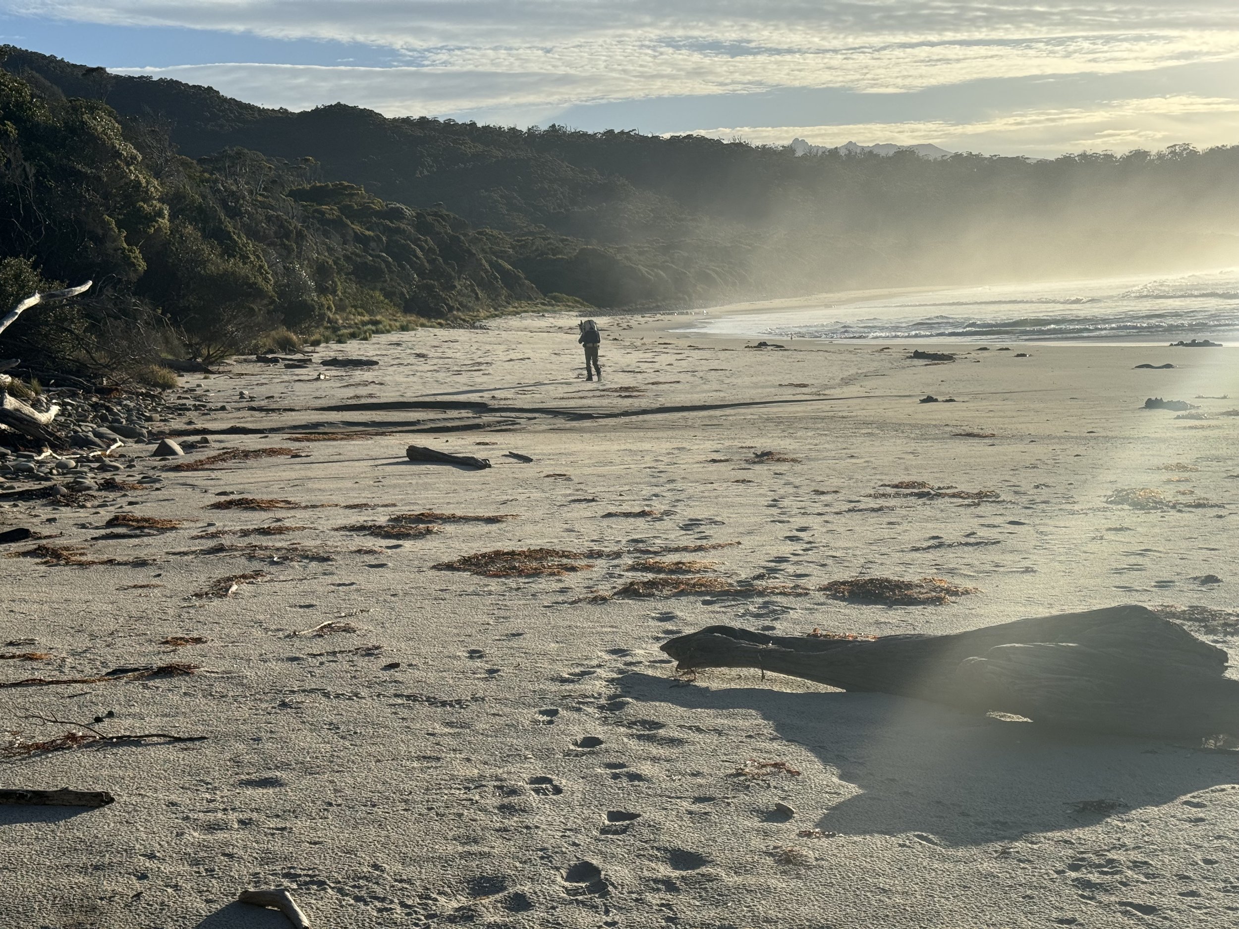

We were lucky that we didn’t have to do any wading today. Somehow we had hit the tide at the right level.
One of the guides that we were using called this day easy, but another said medium to medium hard. We agreed with the later. It wasn’t as difficult as yesterday, but there were sections that had a lot of branches over the trail. It was my turn to have an encounter with a branch that put me on my back and gave me a nice bruise.
We would have had to wait out this section if the tide was higher.
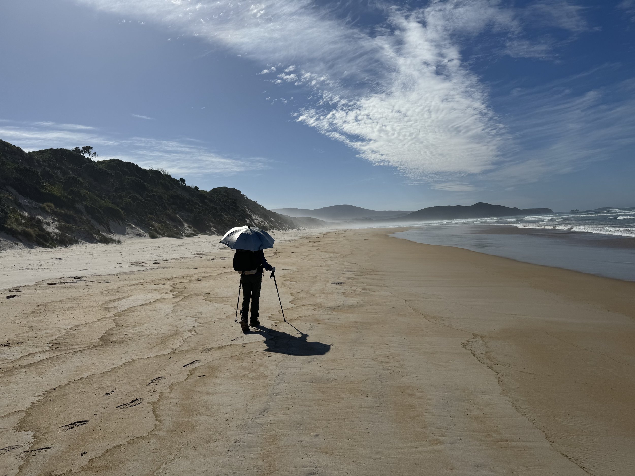
More beach walking and glad that we had our sun umbrellas.
One of the common shore birds that we are seeing is called the Pied Oystercatcher which is native to Australia. We always enjoy watching their antics.
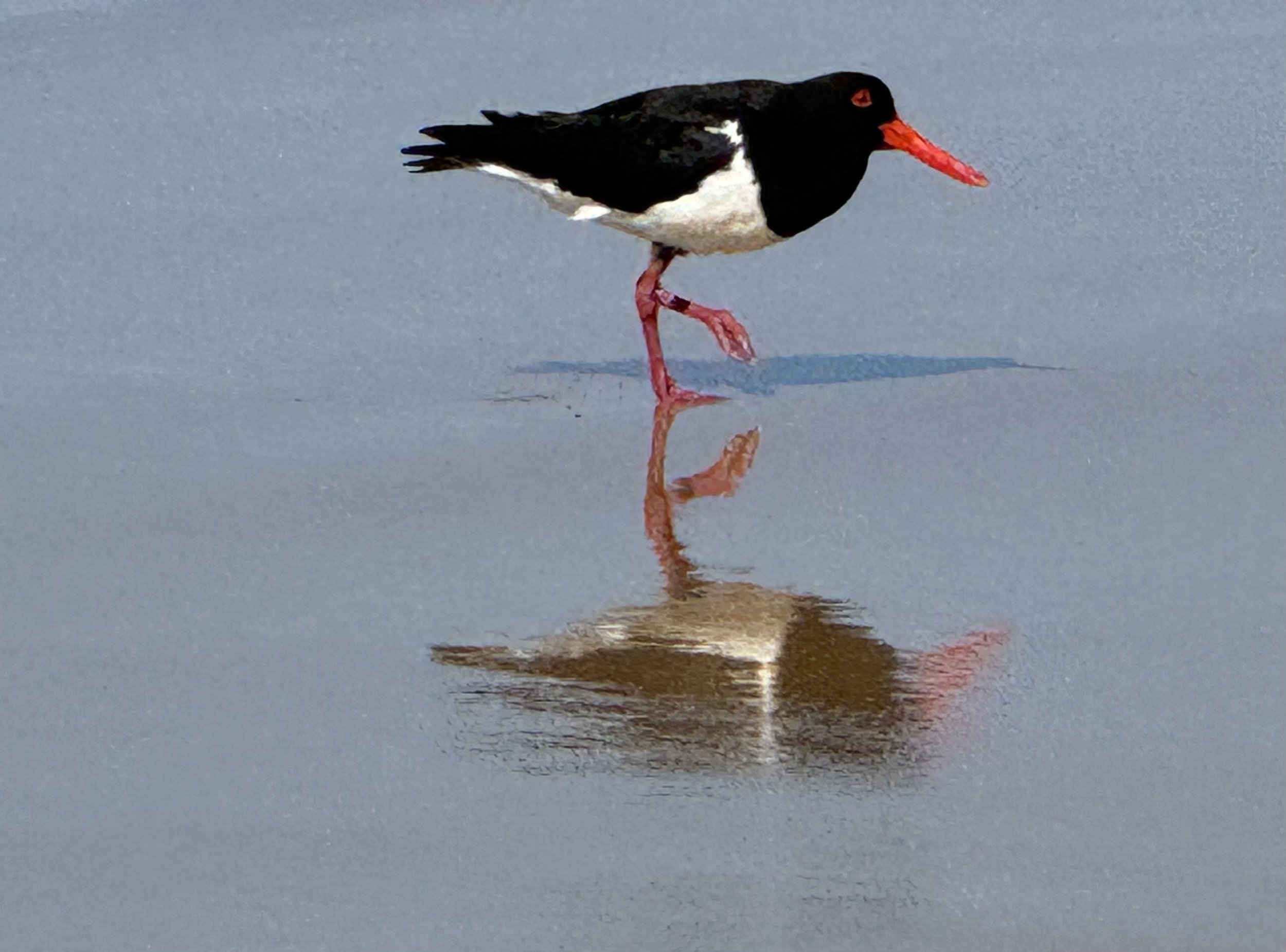
Don gets a great photo!
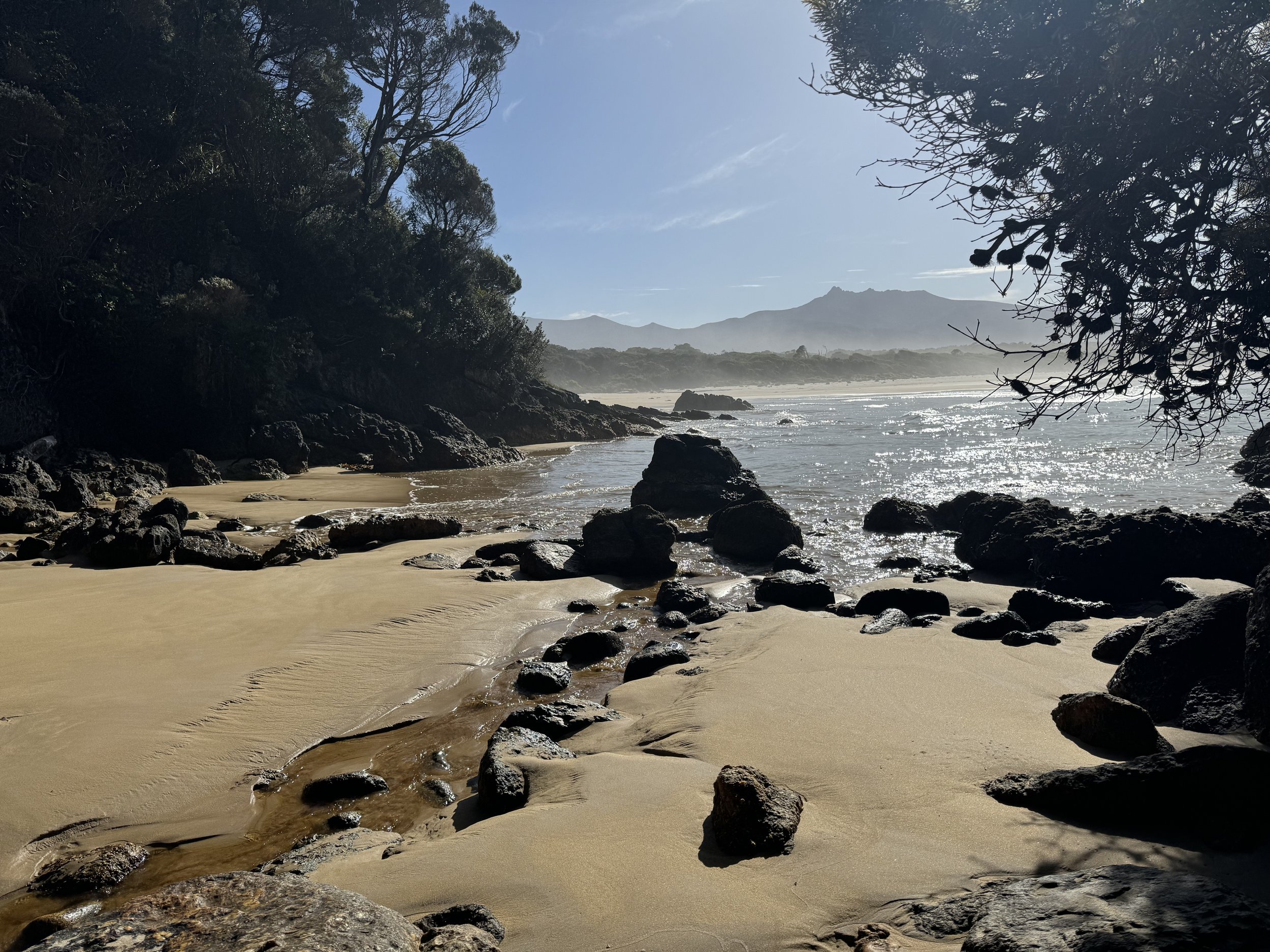
We have one more beach to walk till we get to the Prion Boat Crossing.
We see the New River Lagoon and see why boats are necessary to cross it.
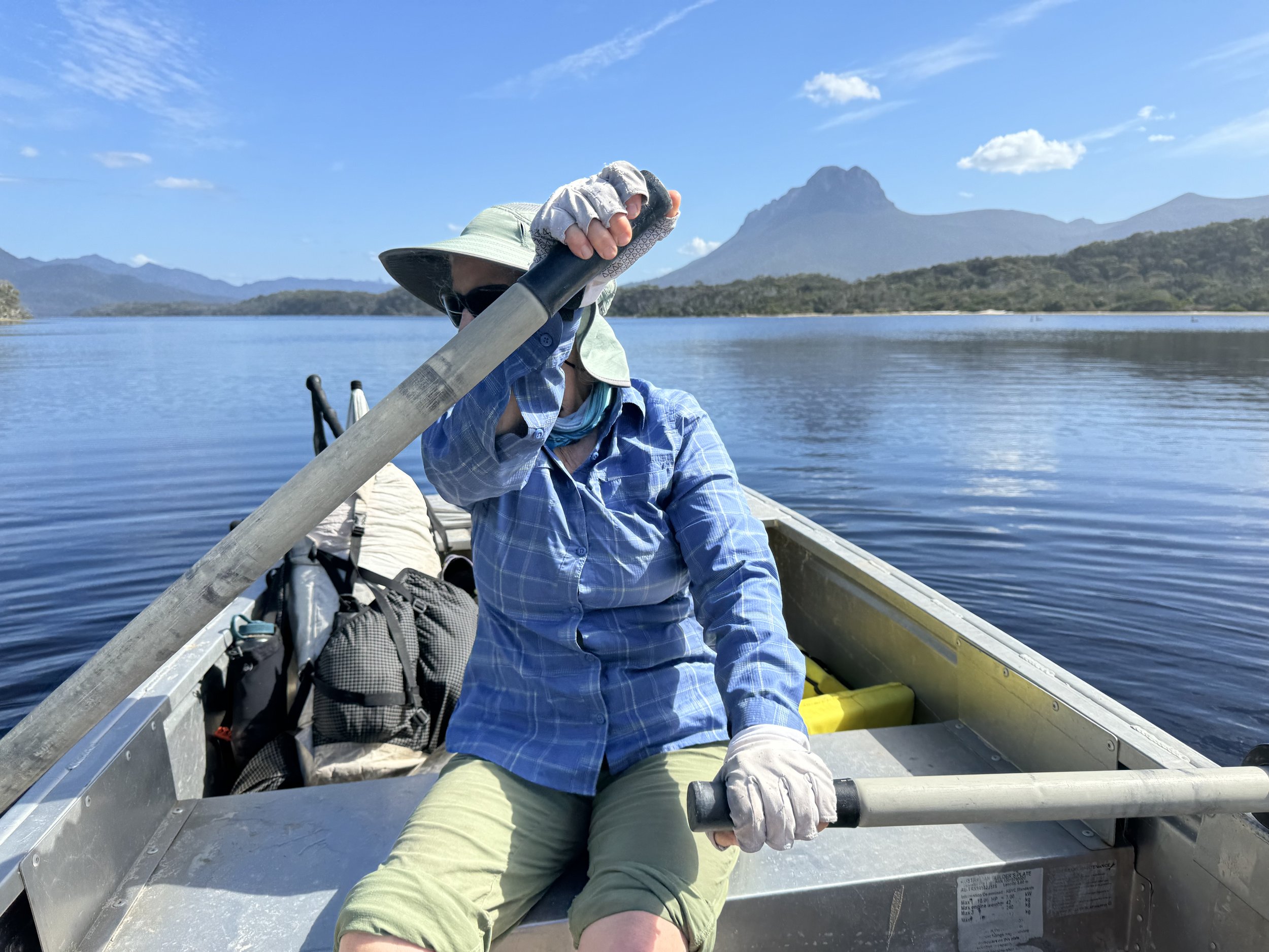
At this location there are three heavy aluminum boats with oars and lifejackets. One always has to leave one boat on one of the shores tied to a post. If you are lucky there will be two boats on your side when you arrive. If not one follows this procedure. Push and or pull the boat to the water. Paddle across to the other side, push and pull the boat that is tied there to the boat you have just brought across. One ties that boat to the boat that you have just paddled across the lagoon and tows it to the shore that you started. Leave one boat tied to the post and then return to the side to start hiking again.
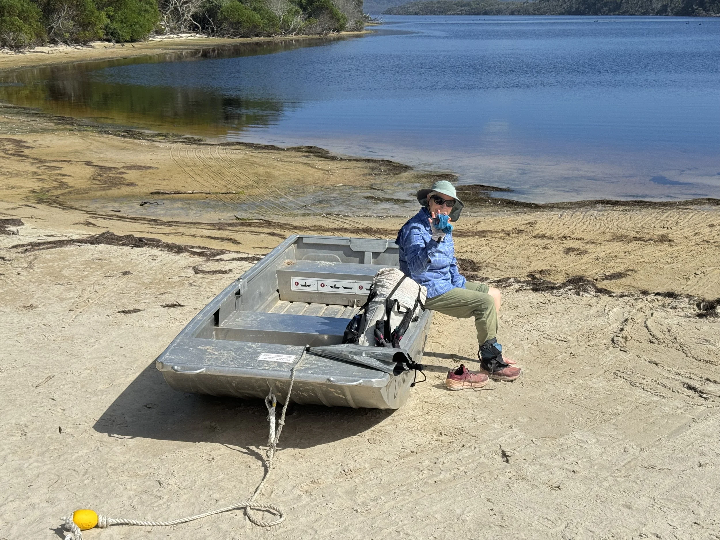
The one boat on the beach

Paddles that we need.
Heading across the lagoon to get the second boat.
We got lots of exercise, pushing, pulling and paddling.
We wished that the tide had been higher. It would have been challenging to move this boat by yourself. We took a swim and even waited for awhile hoping some hiker might come that we could help if needed. No one came so we loaded our packs and headed out.

Black swans were swimming in the lagoon.

We could see why the trail kept you away from the beach as it would be impossible to cross the new river.

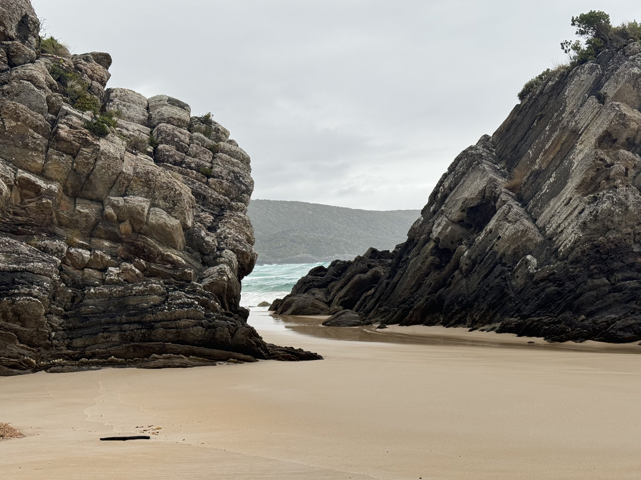
The coastline was rugged and spectacular.
The guidebook that we were using was printed before a bridge was put over Milford creek. We knew that there was one there due to a recent blog that I had read. It was a huge bridge and made for a very easy river crossing. We took a break on the other side hoping to refill a water bottle. Don makes his way to the edge of the creek and decides to taste it and quickly realizes it is brackish. We plan to camp tonight at Osmiridium.Beach. The quide book says water is seasonal. We hope that we are in the right season. We have a little water and will conserve it now that we know it is what we have.
We are hoping for an easy trail to the campsite, but that is not to be as we loose the trail for awhile and have to backtrack. It takes about an hour to go just one mile. We didn’t need that with our water getting lower. We finally see the sign that goes to the beach we want. It is not used as well as the main trail and it is quite muddy in some places. There are numerous trails trying to avoid the muddy sections. We know the direction we want to go and eventually make it there and breathe a sigh of relief when our seasonal creek is running. The water looks like well steeped ice tea. We convince ourselves it tastes great and is even a tad cool. We drink a lot! so happy it is here. Dale is here and Mike and Anka arrive a little later. We all have taken a wrong turn and hope that tomorrow will be better. A walk to the beach is deemed necessary. No swimming here tonight, there are lots of currents.

We walk past the outlet of the river and spend some time watching the waves roll in.
It feels good to crawl into our sleeping bags. This day was harder than we had anticipated.
Dec. 28
The title for this post could read Lost. We have had some small detours getting off trail, but today was major. It all started as soon as we had left our campsite. Yesterday we had to go around several muddy spots and it looked like the trail we had chosen to leave camp today might be on higher ground.

Wasn’t easy finding the path thru all of this vegetation
The trail that we were on, didn’t seem to be going in the right direction. We decided to see if our app would at least give us our location. It told us that we were still in camp, we knew that was wrong so we forged on ahead going in what we thought was the main trail. Eventually we did find the trail and soon were headed in the right direction. We passed a stream that in the guide said had water, but was dry. Our water bottles were full so no stress in that regard.
The trail was straight forward for a while and we appreciated all the board walks over some of the muddy sections. Some of the board walks were underwater so we could just imagine what it would be like when there was a lot of rain.
Speaking of rain, it started falling about an hour after we left camp and stayed that way for most of the day. With all that rain we could understand why we were hiking by large trees.

As our usual mode of operation we usually touch the bark and soak up some of the tree’s energy.
We needed it, because as we were hiking on the trail at a good pace, we came to a dead end. We thought that there were footsteps going down the hill and followed them for awhile trying to make sense of where we were. We pulled out the app again and the map and realized that we were not where we should be. The trail was higher up. We slowly made our way up and came upon the obvious trail. Not sure where we went wrong, but we weren’t the only ones getting lost that day.
After hiking thru the woods on a non trail we have much more appreciation for the people that put in the trails.
Dale caught up to us and also had gotten lost. At one point the trail went up a rock face and someone had put a sign showing the way, because it did not look obvious. We made our way down to a beach
nice walking for awhile
then it was back to the forests and once again we found ourselves lost.

At one point we even made a circle and soon realized we were looking at the same tree. There were pink ribbons on trees, but we realized that they were not marking the trail. We back tracked some and found a trail that looked promising. We walked on it thinking that we were finally on the right trail. It led us to a steep trail that had the beach below us that we wanted to go. The only safe way to descend this trail was on our rears, using our feet as brakes. It didn’t seem to be correct but it was in the direction we wanted to go and others had also taken this path. It worked and the only mishap was Don tore his rain cover on the way down when it got ripped by a branch. When we both made it to the bottom and cleaned off the dirt, we saw a set of stairs going up the hill about 20 feet from us. Later we learned that Dale had also taken this steep hill down. We guessed that we were on an old trail and there was a new section of trail, complete with steps to navigate the steep descent.
We have made it to Granite beach and it is obvious how it got its name.
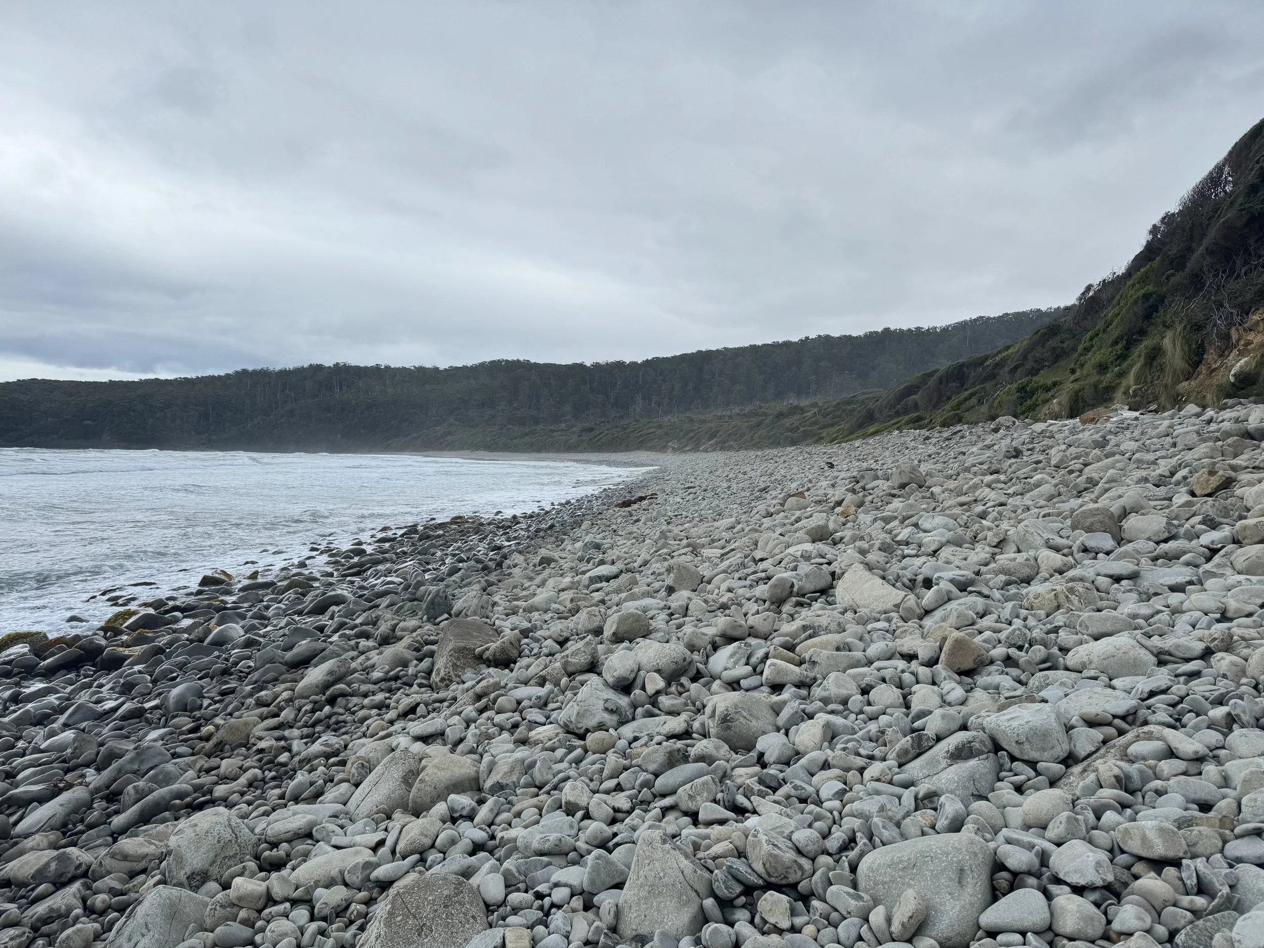
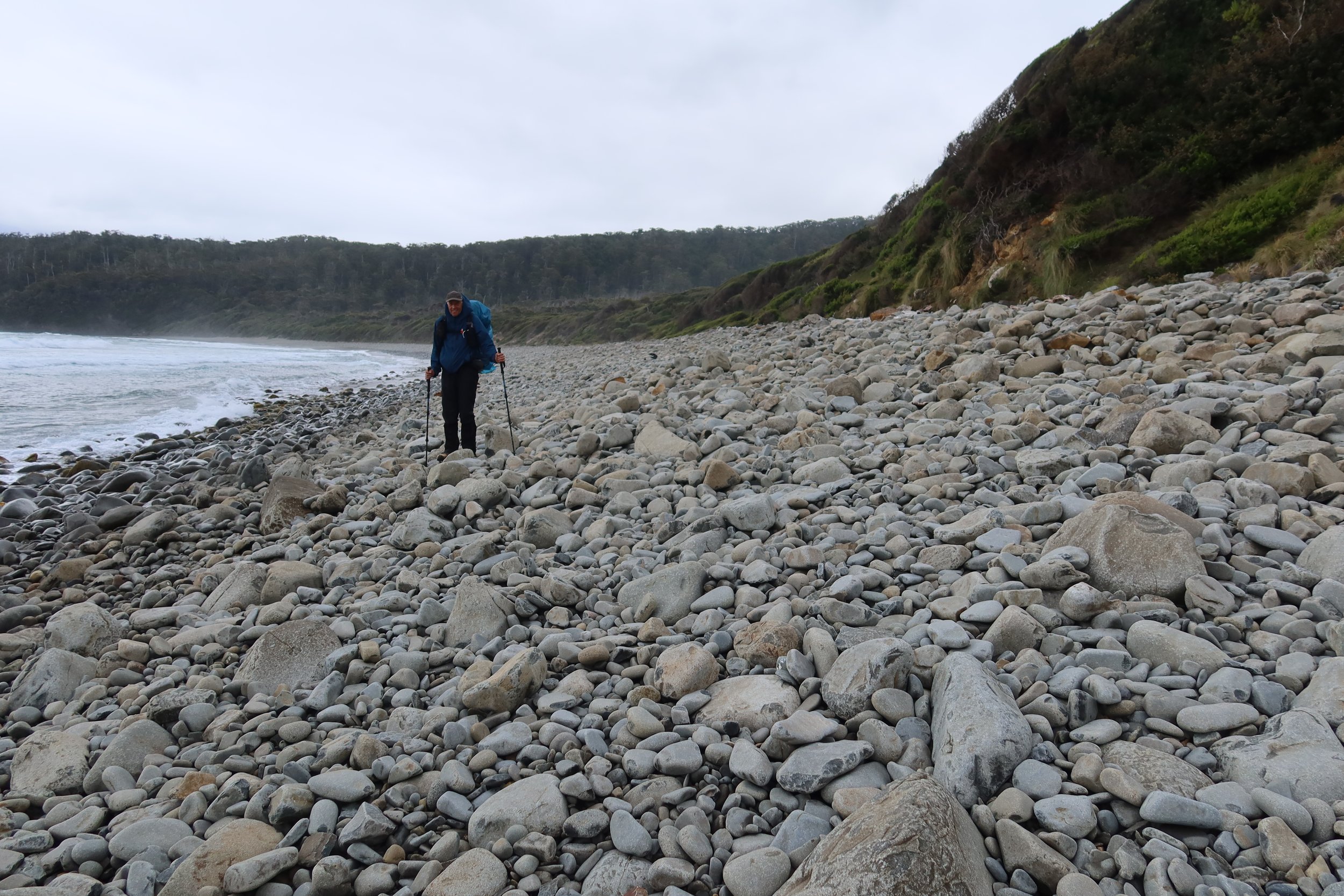
It made for some rocky walking. At the beginning of the beach the tide was out far enough that we could walk on the edge of the rocks, but eventually we were making our way through the rocks.
We were looking for a water fall that would indicate where the trail went. On a warm sunny day the waterfall would be a good place to rinse off, but with the rain and cool weather we chose to stay a little dirty. The water is clear and we look forward to filling up our water bottles.


It is a bit of a scramble to get up to the campsite.
Dale is here and we talk of all the detours that we both had made today. In an earlier blog about this campsite that I had read, it had mentioned that at this site there was a single site tucked into some trees a short distance away form the general campsites. We set the packs down and do a little scouting. We find it and soon our tarp and tent has found a home.

We only went about 6 miles today and it took us 6 hours!
We ate our lunch, Don took a nap while I sewed his rain cover. In our little spot we have great protection against the wind.
Later we make it down to where others are camped. Dale is going to hike out tomorrow and we plan to camp for another day.
Fun to spend time talking to him and learning about all the adventures he has been on.
We also talk more to Mike and Anka. They also had a rough hike today and ask if they could hike with us tomorrow.This is one of their first multi day hikes and Anka is not sure how she feels about hiking. We make a plan to meet in the morning. Tomorrow is going over the South Cape Range and it is known for being muddy and challenging.We head back to camp feeling glad to be here!
Dec.29
The map describes this day as first having a long ascent to Flat Rock Plain then ascending again to the top of the South coast range. There are no campsites in the range and water is scarce. The trail will take you thru very muddy spots and over numerous buttress roots. After going thru the forest you descend to the South Cape Beach. Here there is the South Cape rivulet which when the water is high is very difficult to cross.
With that description in our mind, we head down to see if Mike and Anka are ready to go. They aren’t ready yet and suggest that we should go ahead. We tell them that if any of the trail becomes confusing we will wait for them. We look for Dale who is gone. When talking to another hiker he tell us that there was a rat attack during the early morning and those in the surrounding tents were awakened. The rat had gotten between the inner and outer part of their tent and was making quite the racket. Dale must have given up on sleep and headed out.
The trail true to the description was quite muddy in places.

We had heard horror stories of hikers loosing shoes when they took a step into bottomless mud. We were careful to test the depth of the mud with our trekking poles. More than once we were amazed by how deep the mud was. Other than yesterday the weather had been dry so overall the mud wasn’t too bad. It was slow going though as you careful made your way around some of the muddy sections. This trail had been worked on recently and it was well marked. We don’t think Mike and Anka will have any navigation problems today. We took a long break, but when they didn’t catch up we continued on. A group of younger hikers passed us and said that they were hiking with another couple and probably would not catch up to us.
We made it up to the Flat rock Plains and were awed by the plants and the ocean in the distance.

There was a nice old boardwalk thru the area

After the flat plains area we were once again in a wooded area.

Love all the contrasts of this trail
Today we have had to deal with muddy trails more than any other of the sections.

It is always nice to pop out of the woods and see a boardwalk.
Most people camp at the South Cape Rivulet campsite. After talking to Josh at the St. Clair Visitor center he warned us that this site was known for rats. We decided that we didn’t want to take any chances here so headed on to the next campsite at Lion Rock.
We weren’t sure what to expect at South Cape rivulet. We saw picture of people wading it with water up to their waist, people that had to wait a day for it to go down and those who crossed the rivulet at ankle depth. We are hoping for the later.
We got the wish it was just above our ankles. It was difficult to tell the depth due to the color so we felt the way across using our trekking poles to check for the depth.

The wind is up and waves are building. It seems like a storm is moving in.
We hike across the beach and have one more section of wooded trail before reaching another beach where we will find our campsite. We are getting close to the end of the trail at Cockle beach. Some people do the hike here as a day hike from Cockle Beach. We encounter more people today than we have the entire trip. Another group of hikers with backpacks that are hiking this direction, is because the weather to fly into Melaleuca was so bad they had to cancel the flights in. Once a flight is canceled there is no guarantee that you can fly in on a later date. All dates are full so unless someone cancels you are out of luck. The only option one has is to get transport to Cockle beach and start there. We also encounter a guided group. Their packs look heavy and are breathing pretty hard. Hope they know that trail will only get harder. They also had planned to start at Melaleuca.

The wind is picking up
We arrive to the location of Lion Rock Campsite and notice a long flight of stairs going up the hill. Our campsite is located at the top. We are the first ones here so we have our choice of sites. We storm proof our tent and tarp in preparation of the wind picking up tonight. Tomorrow the day should be easier. When we left Pip and Chris had planned to meet us tomorrow. We don’t have cell service, but we can text on our in reach We get a text saying they plan on seeing us day after tomorrow. That should give us a day to explore Cockle Beach. Our food will be completely done by then. Unfortunately there are no restaurants here,
Dec. 30
Last night the storm came thru with plenty of power. The rain pummeled our tent, the temperature dropped and the noise of the waves increased. The wind is very strong this morning so we decide we will just eat a power bar in the tent and head down the trail. When we arrive to the steps, we realize that just walking down them is impossible with the wind being so strong we could be blown off.

We both just sit down and lower ourselves down step by step.
When we reach the beach that strength of the wind hits us head on. We are glad to have our trekking poles to balance. We are now looking at the South Cape, the closest land form to Antarctica. The waves are foaming as their crests are being knocked off.

We are reminded of a wind storm that we had experienced in Antarctica.
With the wind and the tide up, we have to run across the beach, We time our runs when the waves are retreating. We are glad when we see the steep stairs leading up to a bench above the coast. There is a warning saying stay back from the edge. No need to test that warning. We are glad when we are back in the forest which will give us some protection from the wind. I am a little ahead of Don and stop to put on my sunglasses. I take a step off the trail and find myself falling backwards. I land on my back just below the trail. Don walks by me and I have to yell at him to come and help. Glad I wasn’t unconscious or who knows when he would have come to find me. He helps me up and we are on our way. The trail is mostly flat and very well maintained. The weather during the hike out is unpredictable. First we have rain, then sun then a hail storm. It is hard to know how to use our layers as it seems we are either putting more on or taking more off.
The last 5 miles are the easiest of the whole trail and soon we are signing our names on the resister saying we have completed the trail
There is a visitor center here, but the inside is closed. There are informative signs near the building that describes the history of the area. One such era was the taking of whales during the early 1800’s. This area was a calving ground and the whalers took advantage of that killing so many whales that the water ran red.
We confirm that Chris and Pip are planning to pick us up tomorrow so we need to find a place to put up our tent. It is an Australian Holiday and the sites are filled with RVs and tents. We are lucky when we find a private site that is a little off of the main road. We set up our tent and are visited by a curious Pademelon.
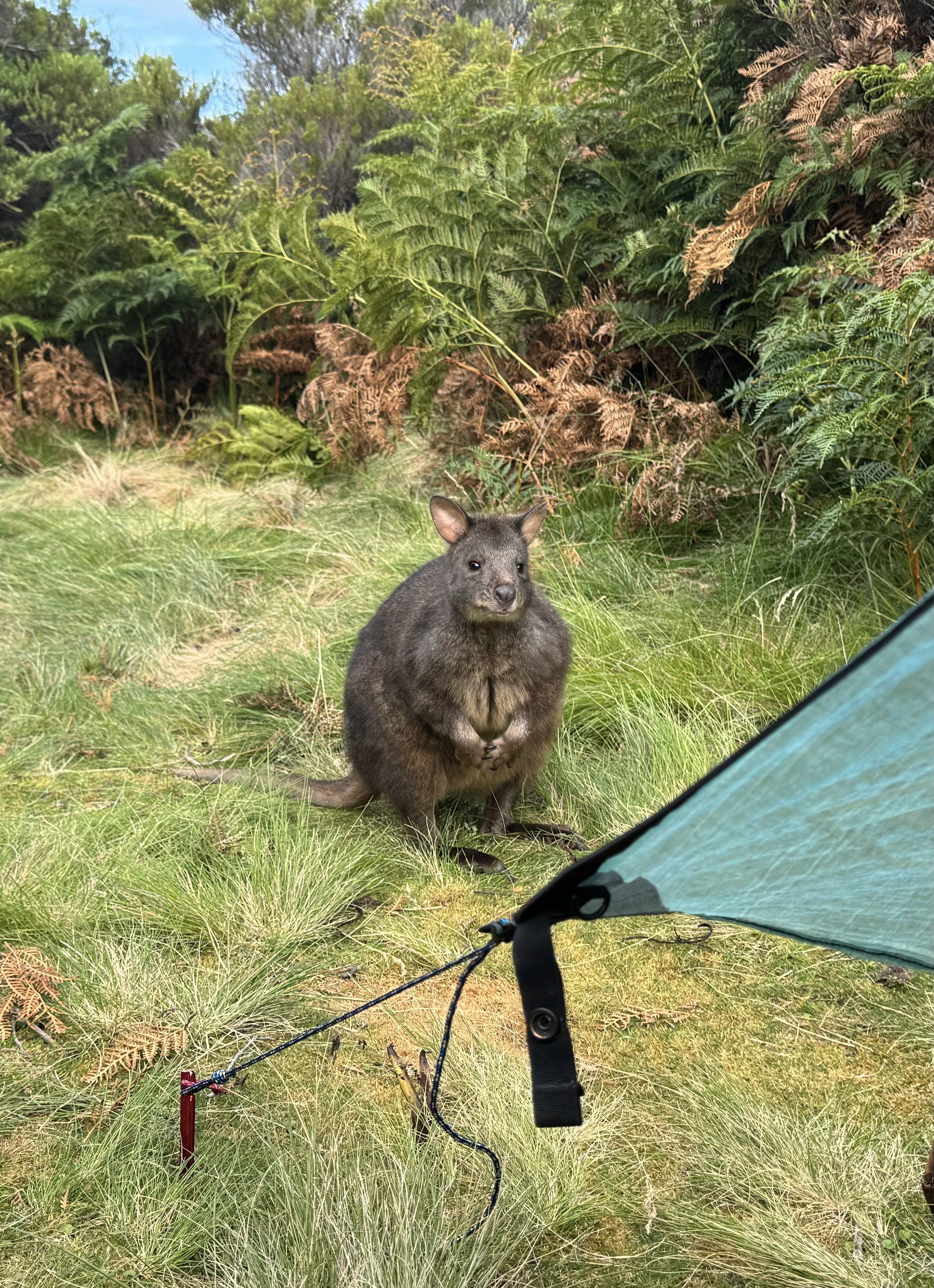
They are a small marsupial.
Later we see a flash of brilliant blue and are able to take a photo of the Superb Fairy Wren.

A women stops by to see how we are doing. She is waiting for a hiker that is planning to be here tomorrow. She tells me that she is 82 and doesn’t hike but does ride horses. She is here in her van and plans to do a road trip for 6 months in Northern Australia. She wants to give us some fresh lettuce from her garden. We can’t refuse that, She also offers us some more food, but we have enough. We walk down to the end of the road and check out the memorial to the right Whale.

One can almost feel the sadness in its eyes.
Some statistics
The trail is around 60 miles and took us 6 nights - 7 days which doesnt include the first day that we stayed at Melaleuca.
Part of it were difficult and parts were quite easy
All of the designated campsites had toilets
Several stretches had scant water supplies
No permit is needed, but there is a cost of the flight into or leaving Melaleuca.
Weather like anywhere is unpredictable so one needs to be prepared to be delayed especially for river crossings.
We thoroughly enjoyed the various environments that we encountered
So glad we had the opportunity to hike the trail!
This public notice was at the start of the trail

There is some truth in the notice.
Dec. 31
Pip, Chris and Sabe show up around 1 and bring us sandwiches and of course Tasmanian Cherries. Back to their house on Bruny Island where we shower and get ready for a New Years Eve Celebration. They had invited some friends who live on the island that are amazing gardeners. It was a great meal of fresh vegetable and excellent meat cooked by Chris. Their friends left and not quite sure how we did it, but we managed to stay up till midnight watching the city of Sydney welcoming in the new year.

A TV screen shot! Happy New Year!