Hornaday River Expedition

In July of 1982 Don and I were driving a NOLS (organization that we worked for as outdoor instructors) vehicle to Yellowknife, Canada to prepare for a two month NOLS alumni trip on the Hanbury-Thelon Rivers in the Northwest Territories. Once we left Edmonton, Canada the roads were mostly gravel and Great Slave Lake was still frozen. Our plan to barge the course across the lake to start our course was in jeopardy, Fast forward to July 2024. Don and I are once again headed to Yellowknife to paddle a river in the Northwest Territories. This time there is a paved road all the way to Yellowknife and it has been awhile for Great Slave Lake to be frozen in July.

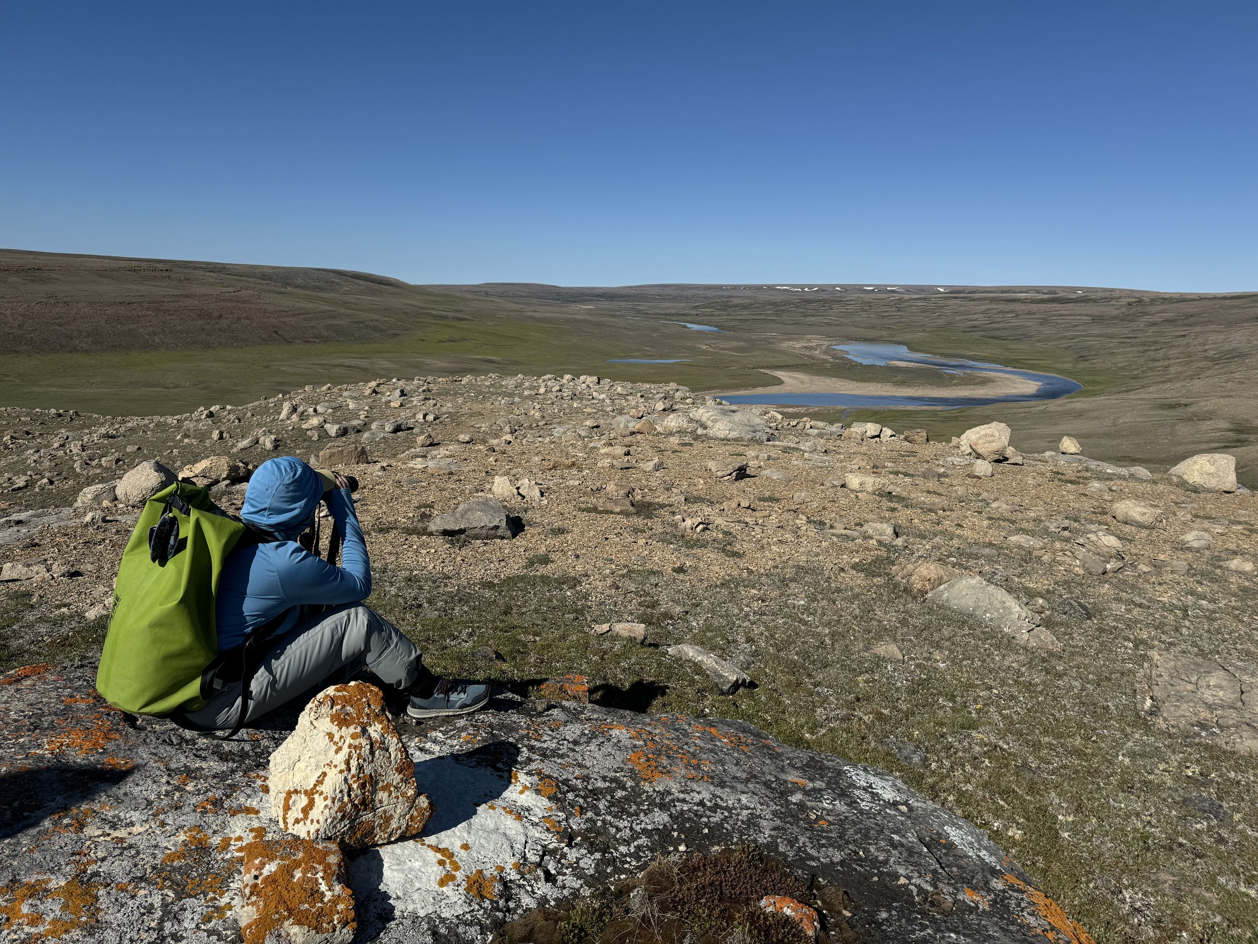
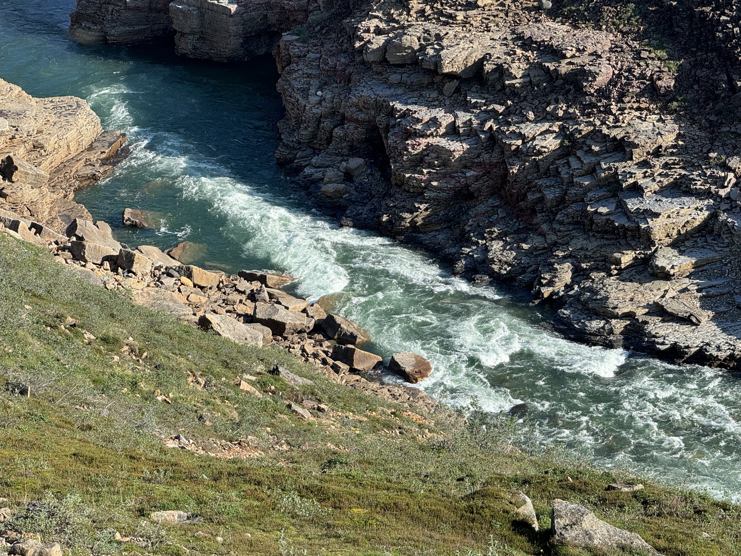
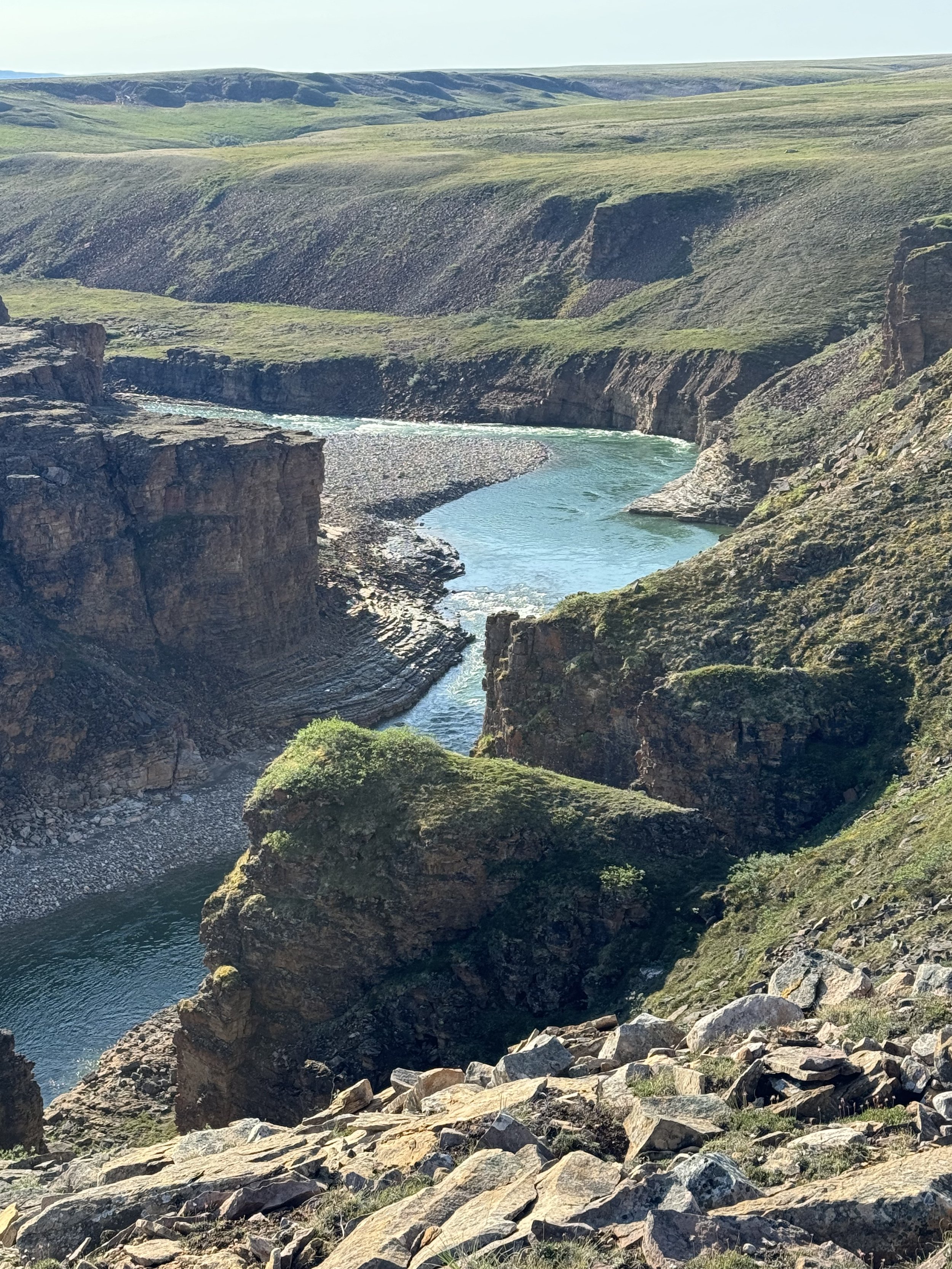
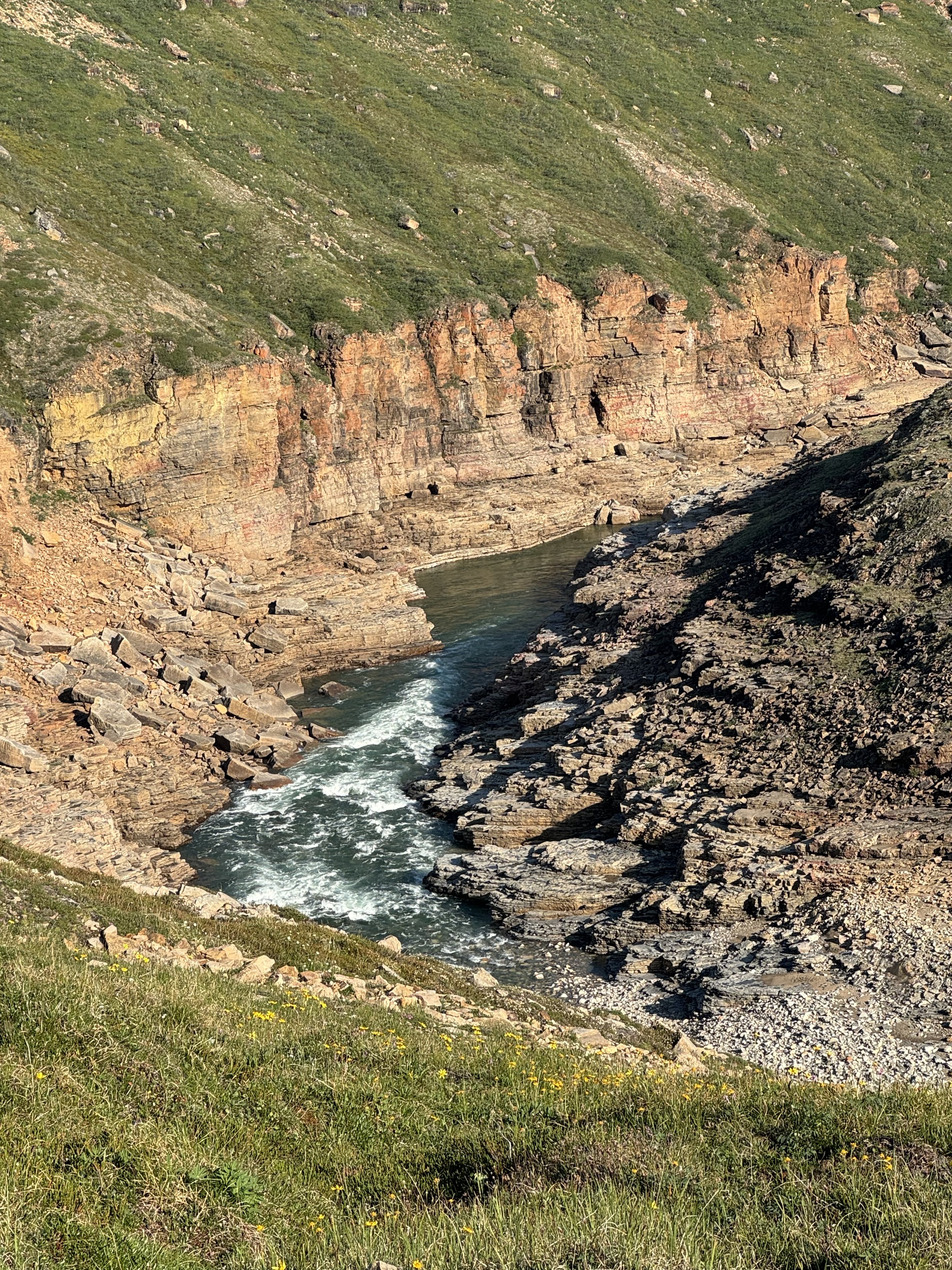
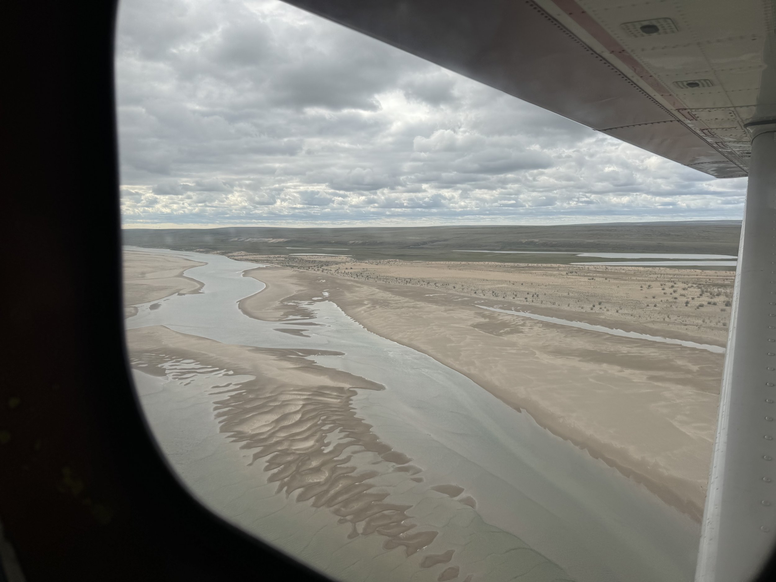
So how did we get into this situation of paddling a river in the NWT? In the early part of this year, Don and I were having traveling adventures in Australia and then Japan. We were pretty focused on the moment when we received an email from Jim, a crew member on our Antarctica trip. He and his paddling partner Brian had been researching the Little Hornaday River that flows into the Hornaday River. The rivers are located in Tuktut Nogait National Park. A statement from a travel guide states that this park is one of the least visited parks in Canada and that more people orbit the earth in a year than set foot in this park. We were intrigued and without much more thought added our names to the permit. Often only one permit per summer is issued to a group. Jim and Brian had been doing Arctic rivers together since 2012. Usually they have done the rivers as a duo, but the charter to get to this river was expensive so they were looking for paddlers and hikers to share the cost since this trip would also include a 5 day backpacking trip to a very remote falls. Since we wouldn’t be back to the states till the end of April most of our planning was done while hiking the 88 pilgrimage route in Japan. This was mainly done in conversation and coming up with ideas of how we were going to pull this off.

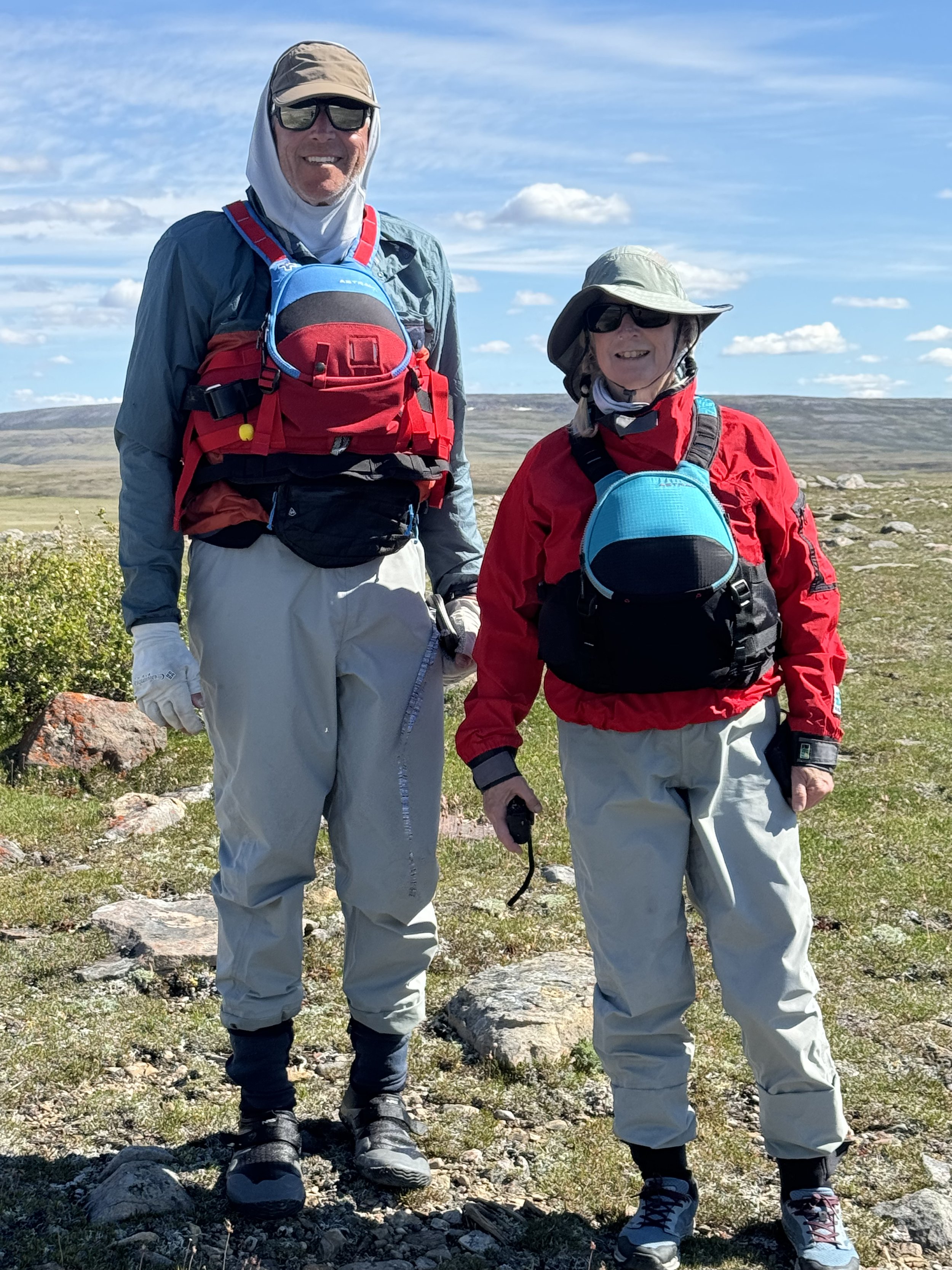
The end of April found us flying to San Diego from Tokyo. Our logistic plan had come together. We were going to be in San Diego for about 10 days. I started working on food planning and we both worked on lists for what we would need for the trip. We picked up the Sprinter Van that we share with Ryan and Beth and drove to Portland Oregon where our younger son lives. Our plan involved leaving the van here then flying to Alaska. We had about 10 days in Oregon before our flight. I finished the food prep and we organized our hiking gear. Most of our paddling gear for canoeing was all in Alaska. The last time it was in use was when we paddled the Yukon River in 2017. Brian and Jim are quite experienced whitewater paddlers, Don and I not so much. We don’t keep that thought in our mind. We organized the food and as much gear as we had in Portland. When we return from Alaska we will only have a couple of days to pack our canoeing packs and drive the 1800 miles to Yellowknife. Our time in Alaska was less than a month. We visited with friends, and tried to do as much day hiking as we could. We pulled out paddling gear from the shelves and dusted it off. We repacked our gear into two canoe barrels and two large waterproof bags. By the time we left to return to Portland our luggage ended up weighing around 150 pounds. We are switching from light weight backpacking to taking more comfort items to put into the canoes.

When we were in Portland and getting ready to fly to Alaska we got a disturbing email from Jim. The pilot that we had hired and paid to drop us off on the Hornaday Lake had run into a snafu with the Canadian Park Service. He was not sure that he had the proper paperwork and the trip was off. He would refund our money, Fortunately both Brian and Jim were not ready to cancel the trip and after several phone calls to the park and the pilot, the confusion was eliminated and the trip was back on. We must admit when we got the email confirming the trip we were all smiles.

The van we drove to Yellowknife

Back to Portland, we spent several days repacking food and gear into the canoe barrels and bags. Then it was time to head North. We encountered more traffic going around Seattle than we had seen for the last 7 months. We may look for another route back to Portland when our river trip is over.

June 29-July 2nd. On the road again!

After battling traffic for more hours than we imagined we finally made it thru the border and ended up in a rest area for the night. Unlike the states it seems that one can take up residence in rest areas so we shared our space with numerous trailers that had done that. Other than people working on home projects it was a relatively quiet night. By early morning we were ready to continue our journey. It seemed a little strange to be not heading towards Alaska as most of our drives recently have been migrating there. However, we are looking forward to checking out new terrain and the highways today did not disappoint. There was little traffic on the road and we marveled at the scenic views. We thought that we might stop before reaching Jasper National Park, but with the long daylight hours, we managed to drive thru the park and take advantage of no traffic on the road and the impressive views. All the campgrounds were full and we understood why. Perhaps on the return drive we may try to take our time thru the area. June 30th It was another day of mostly driving. We are impressed with the condition of the highways. We could probably count the potholes that we have seen on one hand. Nothing like the condition of the roads 40 years ago. The towns are prosperous and new looking. Large fields border both side of the road.
There has been a lot of rain this year and the color green is the prominent color of the ground. Last year especially to the north of this area, major fires caused immense damage. Our destination for the night is the NWT border at the 60 degree parallel. There is a campground there that we hope to stay. Upon arrival the skies open up with rain and we watch the lightning bolts lighten up the sky. We hope that the lightning won’t cause the same condition that caused the forests to burn last year. With the rain pelting the van we stay inside hoping that the storm cell will pass. Eventually it does and we head to the visitor center which is opened till 8. There is a vacancy at the campground and the hosts tells us of the devastating fires of 2023. They were here for only a short time last summer when they were told to evacuate. A house that they had recently bought in a small town north of here burned to the ground. We smell smoke and they tell us that the fire is still burning underground and firemen are working to extinguish it. We head to bed hoping we won’t be awakened in the middle of the night with the warning to evacuate now!

July 1 Canada Day

The campground hosts tell us that we should go to Hay River for the Canada Day Parade and free food. We have managed to be in Canada on July 1st two other times. Once in Yellowknife in 1982 and once in Whitehorse in 2017 when we were paddling the Yukon. It is a little out of our way, but we have the time and decide that we probably won’t be here again. On our way to Hay River we pass miles and miles of burnt forests. We also pass the town of Enterprise that essentially burned to the ground. Burnt out vehicles and house foundations are what is left. The town is rebuilding and a new sign welcomes one to the area.

A familiar scene on both sides of the highway.

We arrive at Hay River and stop at the visitor center. We were fortunate to catch an employee there as the visitor center will be closed for the rest of the day. She gives us information of where we could camp and also where to go for the parade and hamburgers. We have a couple of hours before the parade so we check out the campgrounds. It is hot and the bugs are out in full force We decide to continue on after the parade is over.

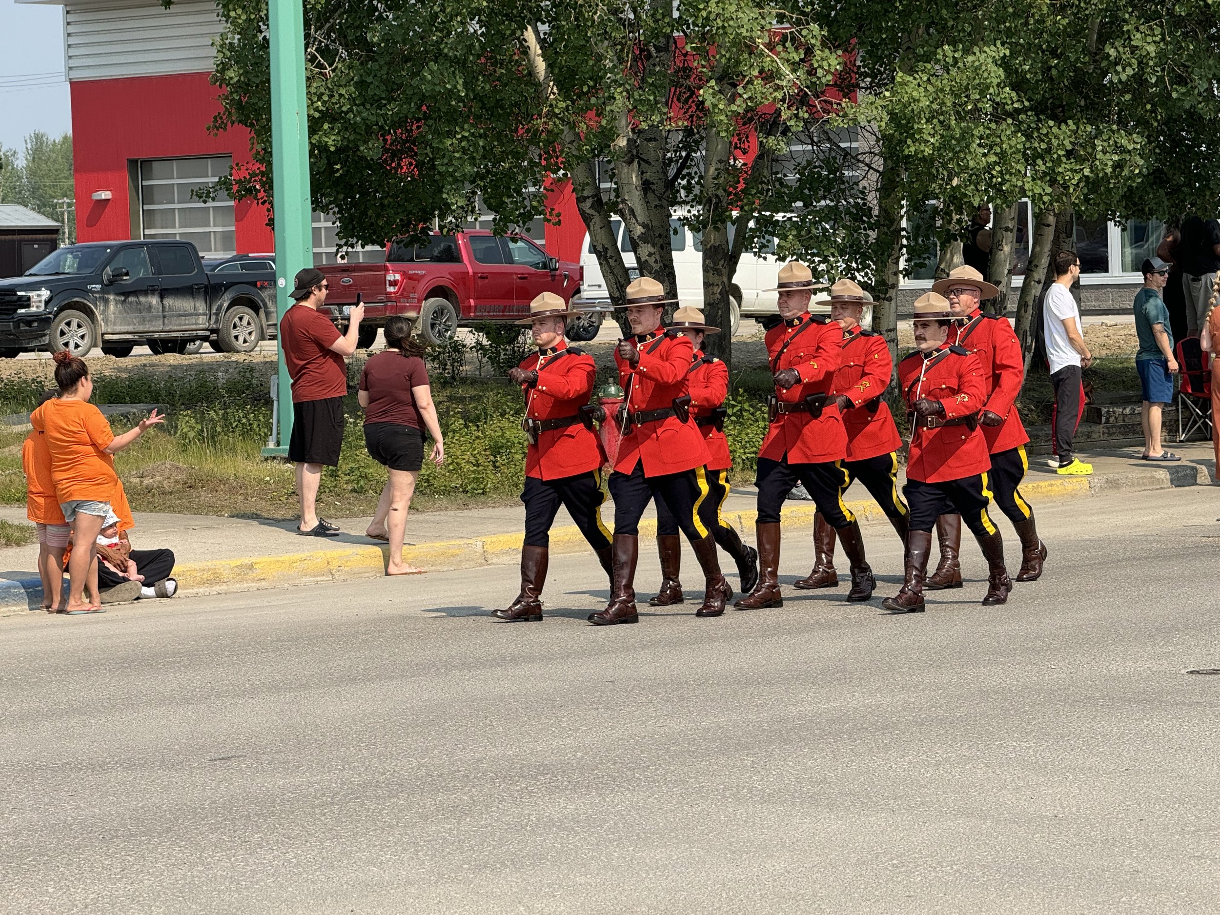
The Canadian Mounties always lead the parade. In Whitehorse they were on horseback.

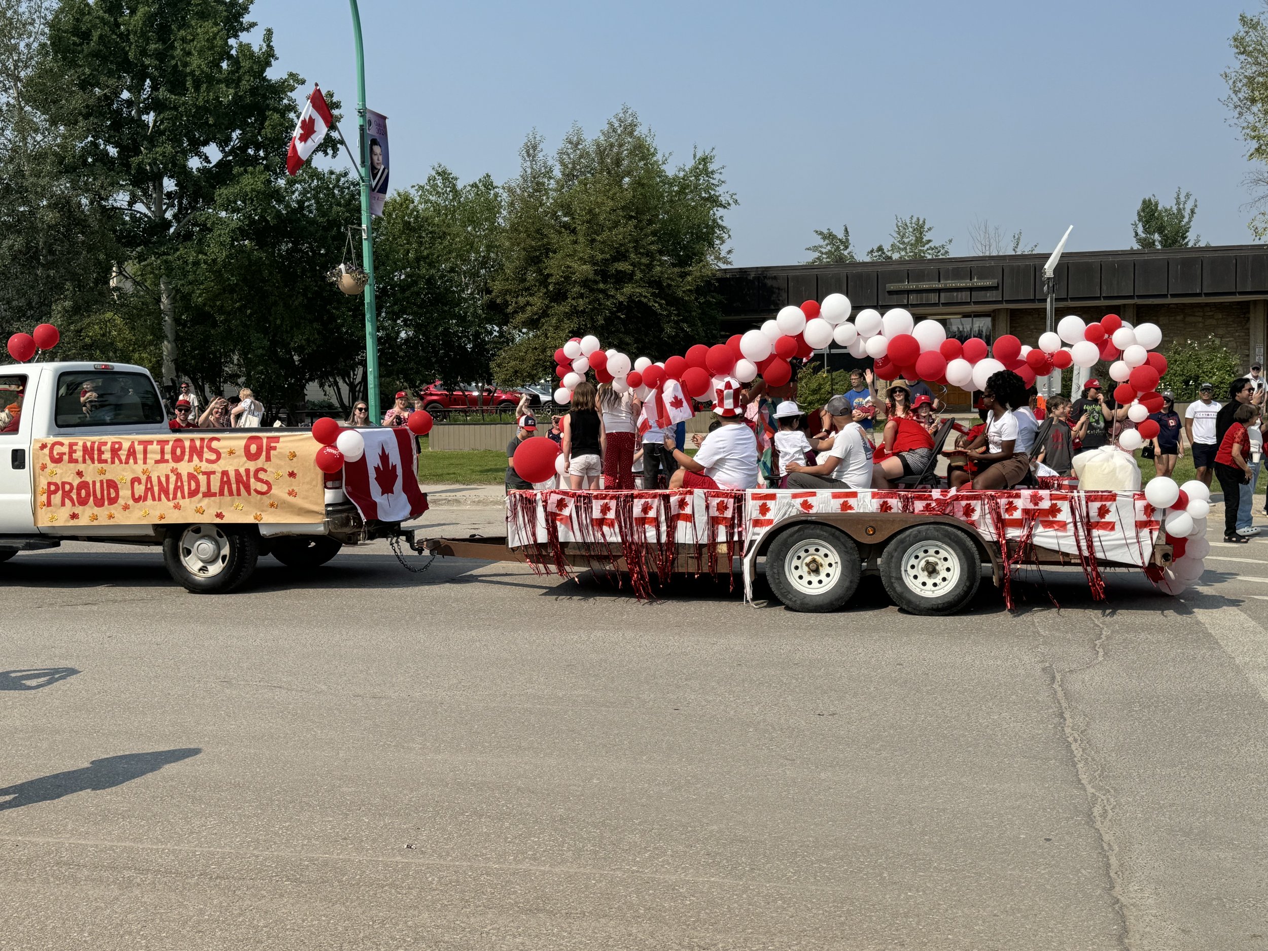
Colors of red and white were the theme of the parade.

With windows up and the AC on we head to Fort Providence for the night. We pass more burned forests and Don takes a quick look for morels, but comes up empty handed. Before getting to our destination for the night we stop at a stoplight which has a 5 minute cycle. We will soon be given the permission to cross over the bridge which spans the mighty McKenzie River. This is the only bridge that spans this river. It was completed in 2012 and is the longest bridge in Northern Canada. It has cattle grates on the north side to prevent wood bison from wandering on the spans. Due to the extreme weather here, the bridge expands and contracts as much as 47 inches between summer and winter. When we came here in 1982, the only way to cross the river was by ferry. The 5 minute wait is so short in comparison to waiting for the ferry. During the wait for the light to change we are bombarded by horse flies and mosquitoes. We hope that this is not going to be the case for when we are on the river. Have to add this tidbit, our youngest son Jeff has the middle name Mackenzie. We figured that a mighty river would be good name for our son! We arrive to the campground at Fort Providence.There is some shade and it is right on the river, The temperature ,however, is around 88 degrees so between the bugs and heat we stay mainly in the van.

Mackenzie River

July 2

We left Fort Providence with a light steady rain. The fire danger sign along the road says extreme. I hope that the rain helps. We are on the lookout for the Wood Buffalo. The Wood Buffalo National Park borders the highway and numerous signs tell us to beware of Buffalo on the road. It isn’t long before we pass by two very large adults eating as fast as they can while continuing to use their tail to swipe at the bugs.
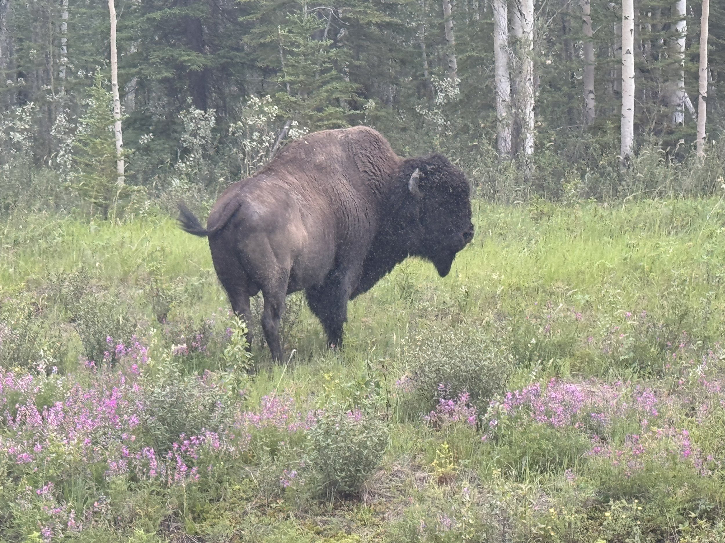
Wood Buffalo

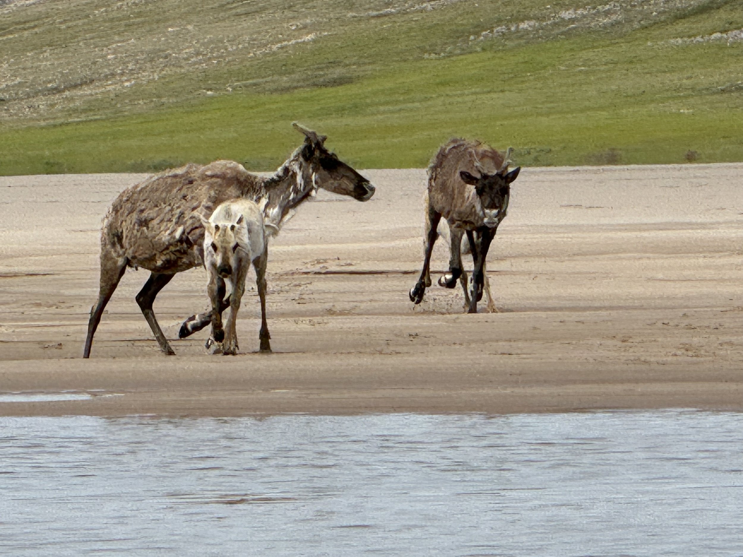
We passed by several more males that were meandering beside the road. Then we began to see lots of scat on the highway and it looked fresh. Close by was the herd with lots of young babies. The babies were playful and were good entertainment for us.

It was a healthy looking herd with lots of babies.

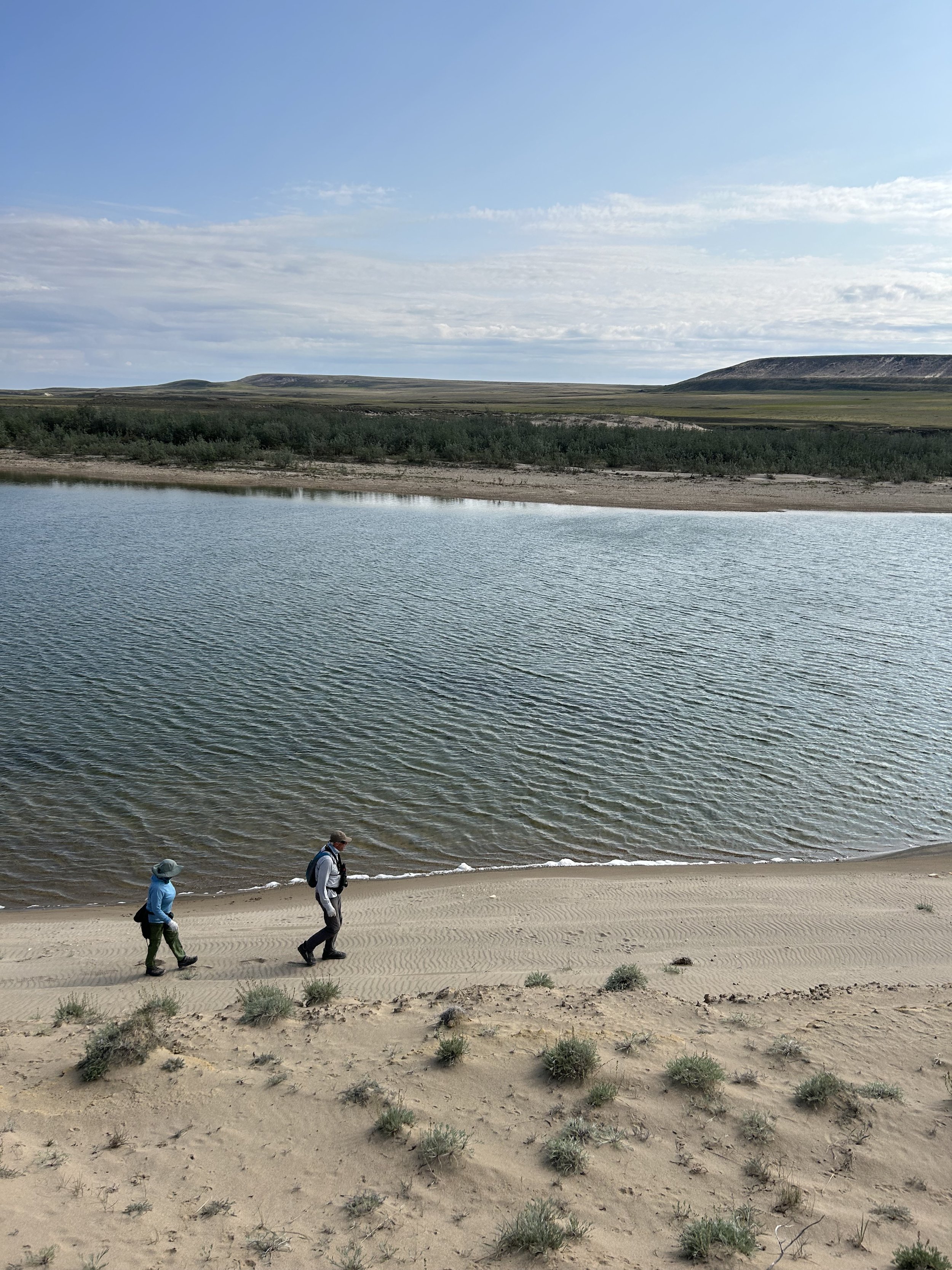
As we continued the last stretch of highway to Yellowknife, we saw more signs of the fire that moved thru this area so quickly. There were burnt out vehicles as well as destroyed houses. The whole town of Yellowknife, population of 20,000, was evacuated last year on the only highway out of the town. It was 3 weeks before they could return, not knowing what they would find. The firefighters did an incredible job of saving the town proper. Unfortunately houses on the outskirts of town were burned. We arrived to an enormous large provincial campground that was called Fred Henne. Henne was a labour leader, businessman and politician in the NWT. The campsites are well spread out and most are surrounded by shade trees, It will be perfect as we sort out the logistics for the next couple of days. Tomorrow we plan to meet up with Brian and Jim. Tonight we learn that there is a farmer's market which includes local food vendors as well as music. The evening is cooler than it has been and the sky blue. We head off to town and have a relaxing evening. The 1800 miles of driving is behind us,

This musk ox sculpture was in the park

July 3

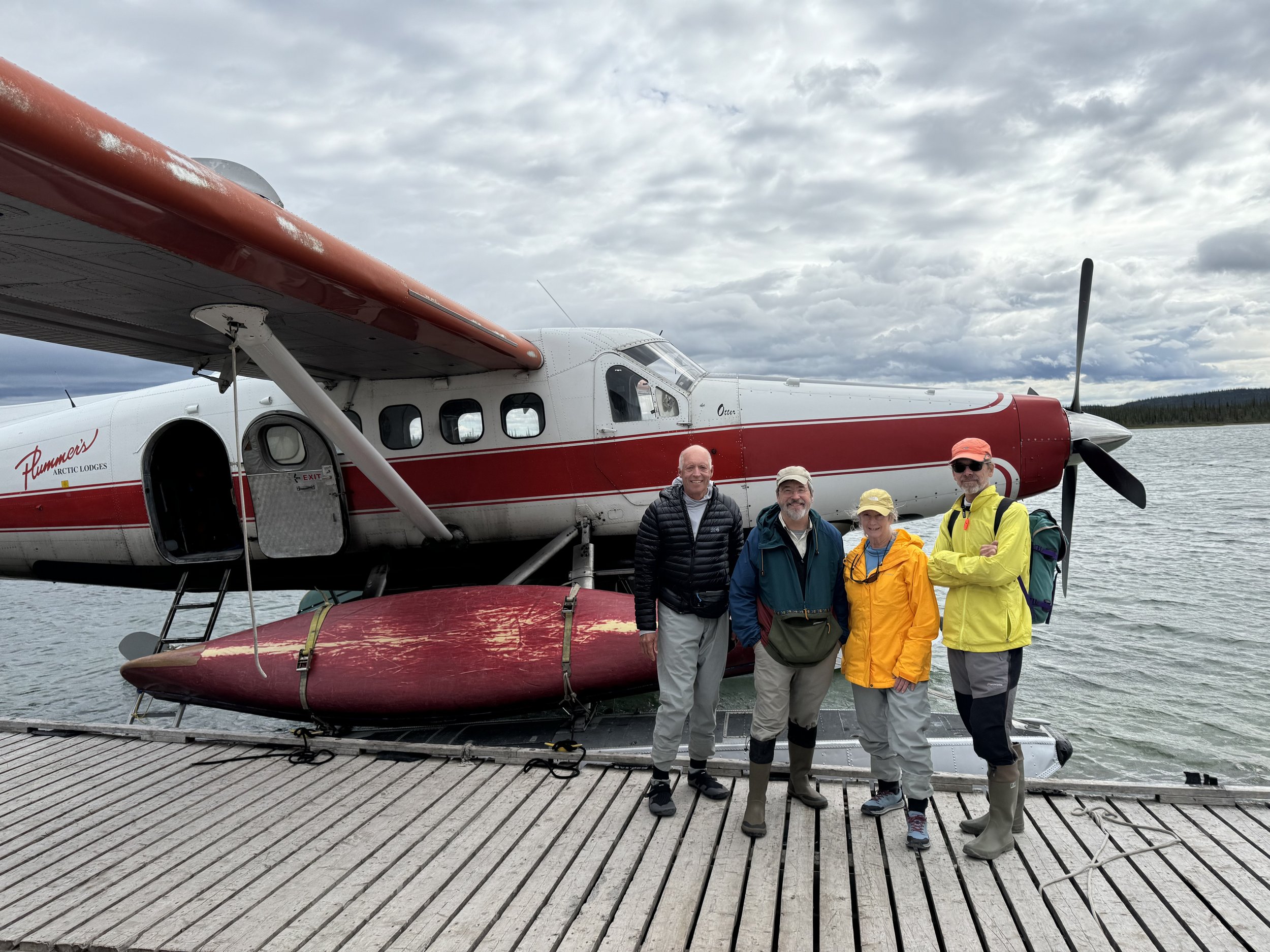
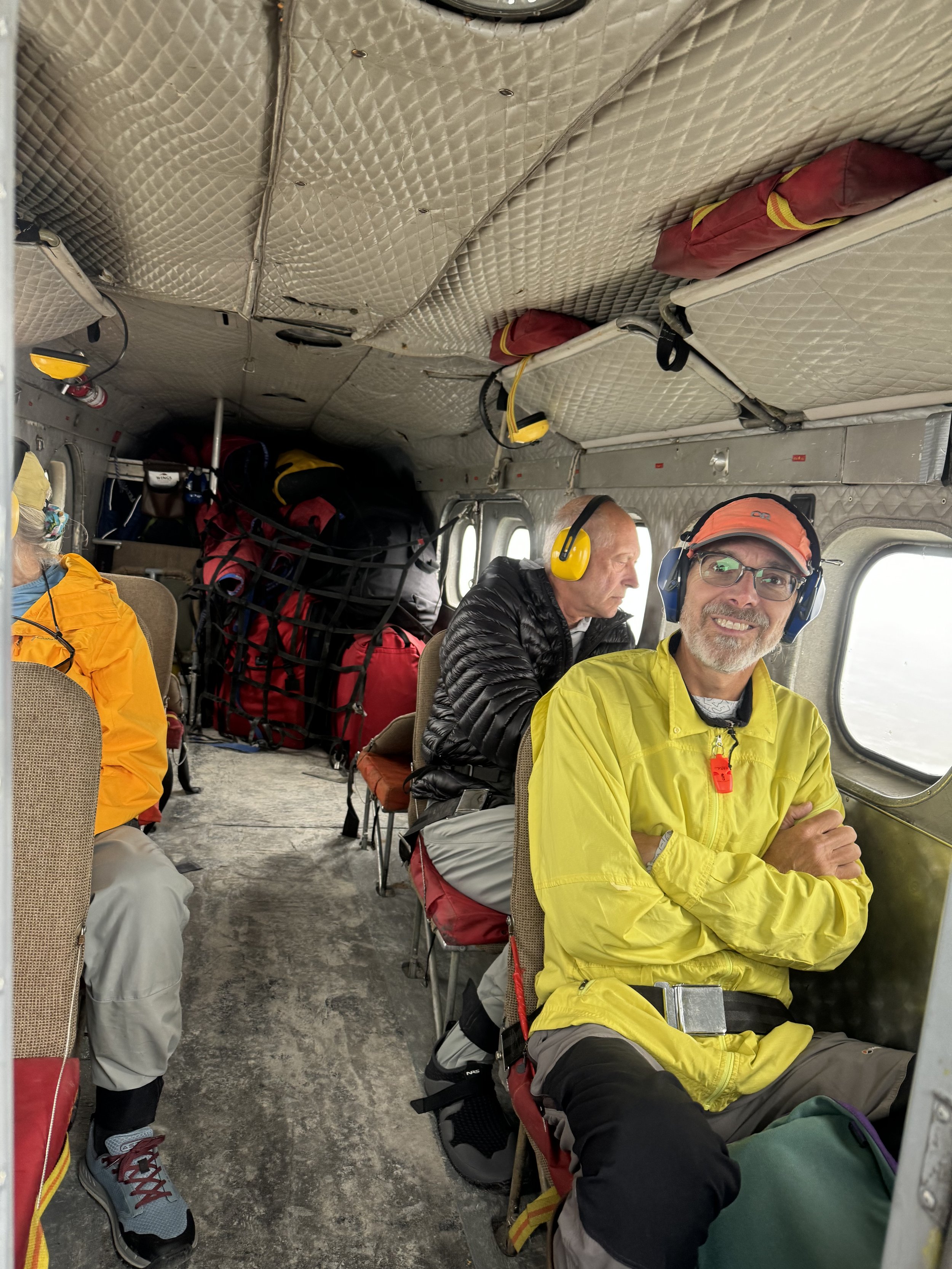
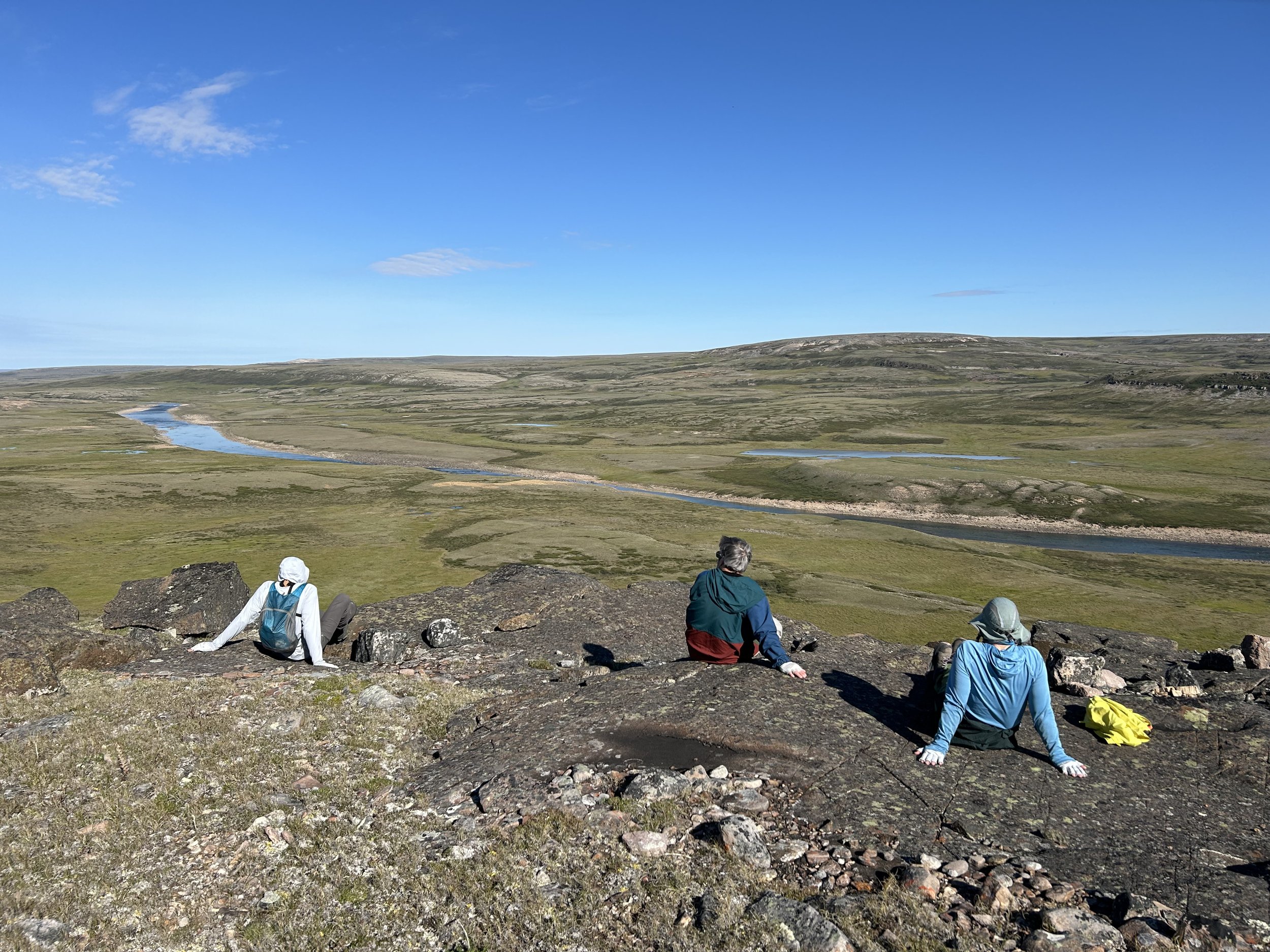
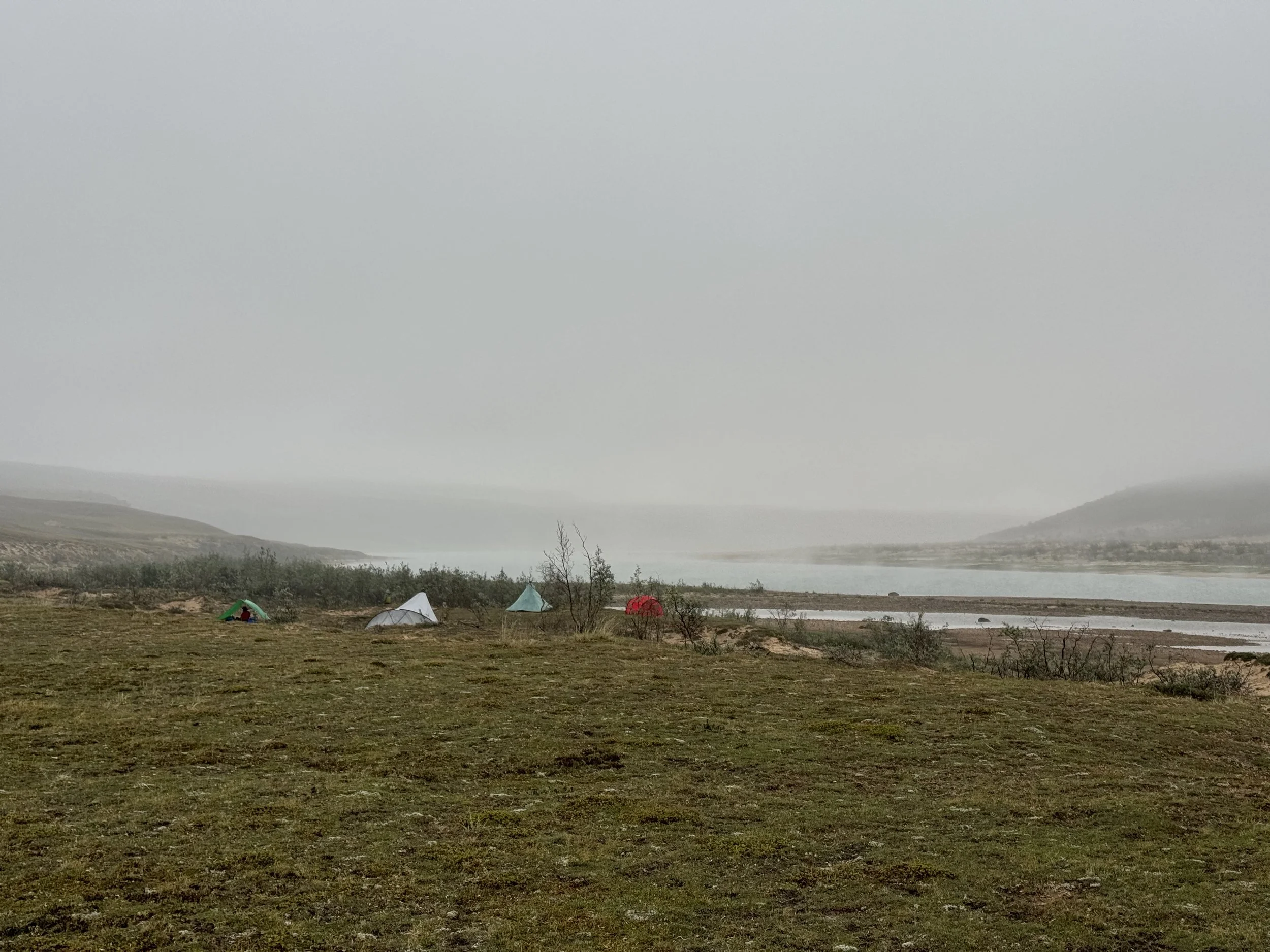
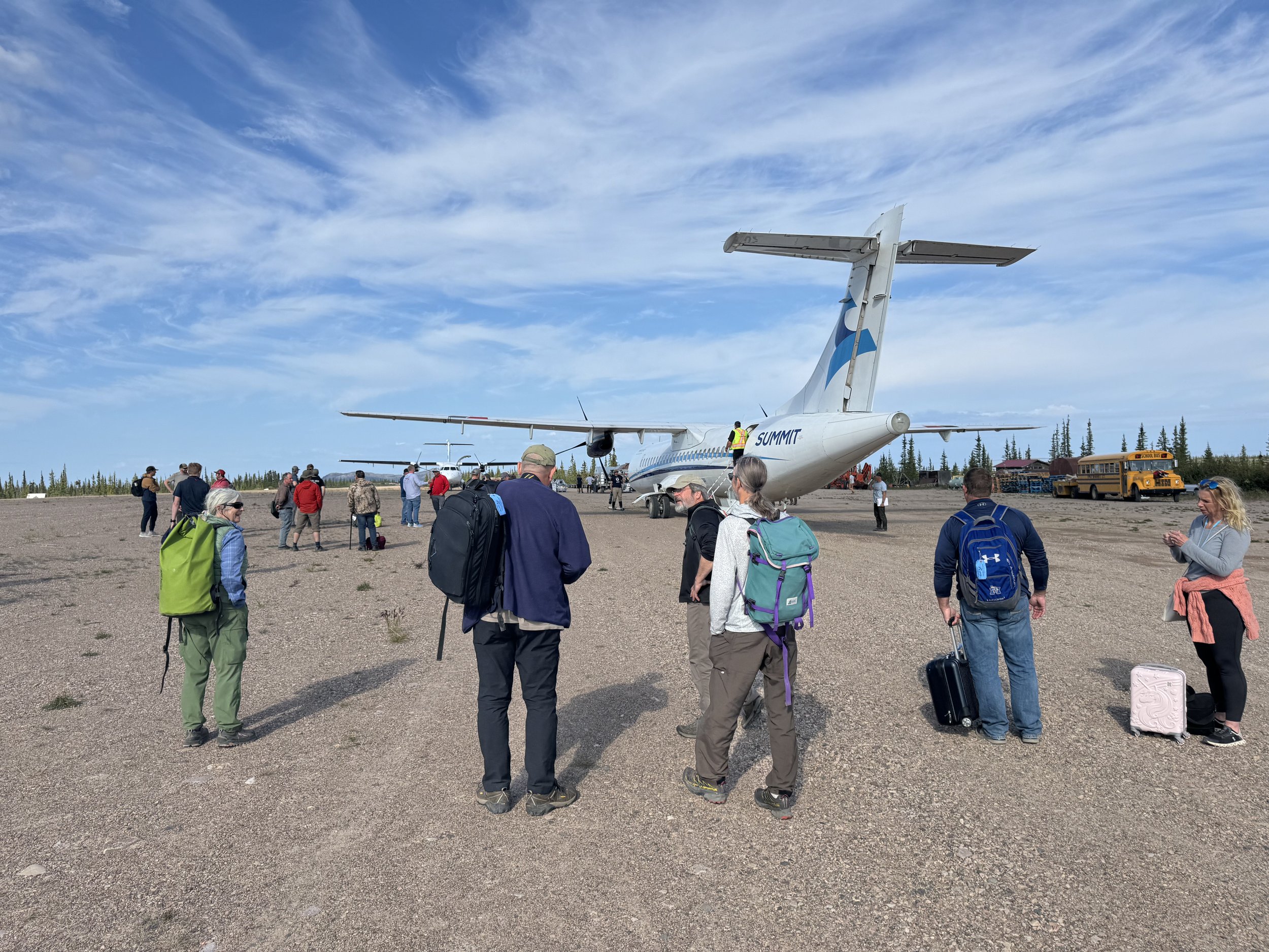
Today is the day to tie up loose ends. We head to the air charter that we will be flying on for the first part of our trip. We need to drop off our gear there tomorrow, so it can be weighed and loaded before our flight leaves on the 5th. We check out the business where we can park our van. It looks great and is a relief for us. Brian and Jim text us with the news that their flight has been canceled and they have been rebooked. They hope to be here early afternoon tomorrow. We hope that is accurate, because our chartered flight only flies on Friday and if they don’t make it…hope we won’t have to play out that scenario With our logistics complete we headed back to the campground and do a 4 km hike on a trail there. There is an interesting sign that says do not drink any of the water in the lakes due to arsenic. There has been a lot of mining in the area and now there is a mining boom for diamonds.

July 4

With all the logistics figured out yesterday we just need to implement them today. After doing some exercises at a covered shelter at the campground. we head to Summit air, the airline charter and hand over our gear, all 200 pounds of it. Next stop is the parking location for our van. We check it twice to make sure we are not leaving anything behind and then walk the 3 miles to our hotel, the Nova Chateau. The latest word from Brian and Jim is that they have had another flight cancellation, but should be here late tonight. Our drive here was uneventful compared to their flights.

Headed to the River

July 5

We got a text from Brian and Jim last night that they were on a flight to Yellowknife and would meet us in the morning. Whew that is cutting it close. Glad that they had given themselves a couple of extra days for travel headaches. Glad to report that when we walked into the dining room this morning we spotted Jim and did come catching up during breakfast.

A shuttle arrived and we loaded up with a bus filled with fisherman going to Plumbers Lodge on Great Bear Lake. That is our first stop, but then we will be continuing on.

This map should give you an idea of where we are headed. Locate Yellowknife on Great Slave Lake. It is on the northern arm. From here we will fly on a chartered flight to Great Bear Lake and then load into a single Otter that will transport the four of us and our gear to Hornaday Lake located in Tuktut National Park. It is the yellow part of the map north of Great Bear Lake. The first flight will take about an hour, the second flight will take about an hour and half. The further we go the more remote it becomes!

We arrive to Summit Air, the charter that will take us to Great Bear Lake. All the passengers except for us are heading to the fishing lodge for the week. There are only a couple of females. Most are men who are looking for the fishing experience of a lifetime. This flight only occurs on Friday so if you miss it you are out of luck.


The plane ride will take about an hour. We turn off our phones, knowing that once we get on the plane we will be out of cell service for the next 3 weeks. No complaints from us.

As we depart from Yellowknife, the city is soon left behind and soon the trees will be also. We are spending the next 3 weeks in the Canadian Arctic above tree line. This area is also known as the Barren Grounds or Barren Lands. We fly over a landscape dotted with lakes and rivers. This map gives you an idea of what we are seeing from the plane.

It is a landscape that would be hard to navigate in the summer except for connecting rivers. Winter travel would be easier except for the extreme cold temperatures.

The plane ride is smooth and soon we see the white buildings with the red roofs.

Plumbers fishing Lodge juts out on a small peninsula on Great Bear Lake.

Most of the passengers on the plane will spend the week here hoping to catch and then release (after a photo) the large number of fish that inhabit the lake.

A boat is shuttling clients from the lodge to the airplane that just landed. We wait our turn and then hop on one of the fishing boats that shuttle us to the lodge. Once arriving to the dock we are greeted by one of the lodge hosts. We also meet the pilot who will be flying us to our destination. He is dropping off some clients and will be back in a couple of hours. He shows us where to put our gear and canoes. We have a couple of tasks to accomplish in the next couple of hours. One is to get canoes and spraydecks and the other is to find our bear spray and fuel that was brought here several week earlier on a smaller plane.

Since we are the only paddlers for the summer, we have our pick of canoes. We select two and take them to the dock

While we are waiting for the pilot we use the facility which seems appropriate for fisherman.

Glad they were all encased in plastic.

After a bowl of chili, we are alerted that the pilot is here and we can begin to load the plane.

Our gear

The boats are latched to the floats and soon we are off

The anticipation is building.

The pre trip photo is taken.

This will be the first time that the pilot will be flying to Hornaday Lake so Jim takes the co pilot seat with the coordinates and to answer any questions.

The trees are all gone and the landscape is truly the Barren Lands!

We sit in the back of the plane with our gear. The plane is quite noisy so we were glad to be wearing ear protection.

A group of 10 muskoxen run across the ground spooked by the plane. We can imagine that we could have heard the thundering of their hooves. We are surprised that no caribou was spotted, This is the home of the Bluenose Caribou Herd. A herd that has numbered in the 60,000.

We hope to see some of this herd in the next couple of weeks. The pilot keeps pointing out to Jim that most of the rivers are quite low. Jim assures him that there should be plenty of water in the river we plan to paddle. Finally we see the lake and are glad to see that it is ice free. Jim points out where he has been told of a possible landing site. The pilot does a couple of loops checking it out then lands near a sandy beach. The pilot warns us that we need to stay well away from the propellers and we heed his advice. The gear is unloaded as well as the canoes.

There is a strong wind blowing so the pilot takes advantage of it to move away from the shore. He then turns and soon the floats are lifted from the water. We watch as he quickly becomes a speck in the sky. We are the only group paddling the Little Hornaday this summer. The river can be paddled soon after the ice leaves the lake, which is usually early July. Wait too long and the river begins to drop and you may find yourself doing more wading then paddling. We are hoping that our timing is good. Today though is not the day to figure that out. It is windy and large white caps have formed on the lake.

It is easily to have made the decision to make camp. Tents are put up. Jim and Brian have a shelter for eating called the Mantis.

Don and I have the green pyramid tent, Brian and Jim have the red tunnel tent and the grey shelter is the Mantis used for cooking and hanging out.

The mantis goes up quickly and has mosquito netting for the sides if the bugs are intolerable. Don and I take a look and are somewhat envious. The mantis was created for Arctic trips, unfortunately it has not been manufactured for several years and is no longer available. We have a tarp with a thermacell and hope that it will be the answer to bugs and weather. Meanwhile Jim and Brian make room for us in the Mantis. We are impressed. The decision to stay here today is easy. Paddling in the wind would not be fun and the length of the river is relatively short. We plan to add day hikes to most of our days. We are not concerned with needing to make lots of river miles. After eating we head out to check the surrounding terrain .

The remoteness of this trip is coming real. We have been warned by the Canada National Parks that this is one of the most remote parks in Canada and not to expect any immediate help.

There are tracks of caribou and wolf on the shore. None seem to be recent. We do encounter several birds on our hike

The first one is the young of a Lapland Larkspur. The parents warn us not to get too close.

One can see the downy feathers.

The second bird was a Jaeger. Most likely a parasitic or long tail Jaeger. They are known for their hunting ability. They did several exact maneuvers over our heads.

Jaeger

We are far enough north to have 24 hours of daylight. It has been a long day so after dinner we head to our tents and the wind continues to blow, It seems like we may be here for another day.

July 6 Winded In

The wind blew all night and by morning the decision was made to stay here and go hiking.

The ground cover is quite lumpy. We many be challenged finding flat spaces to set up our tents. The vegetation crunches under our feet. The landscape is often referred as desert like. Rain storms can be frequent, but the land doesn’t absorb the moisture.

Mountain Avens are beginning to appear. Summer is short so the flowers take advantage of the 24 hours of daylight for growing.

Patches of snow cover some of the hills.

It is a quiet afternoon with all of us catching up on some sleep after a busy last couple of days.

Don and I make some brownies to share with Brian and Jim.

Don and I take an evening walk to check out the river we hope to start paddling tomorrow. The wind is dying so that is a good omen.

Checking out the Little Hornaday River

A wolf track on the beach.

We are amazed at the trunk of the willows that grow here. They are 2 to 3 inches in diameter and instead of the branches growing up they spread out on the ground.; It has been awhile that we have traveled on an extended trip with others. Brian and Jim are very competent in this environment so it is enjoyable to follow their lead.

July 7 On the River.

The wind died some during the night. It died enough that by morning it was a go to head to the outlet of the Hornaday Lake and start paddling down the Little Hornaday River. After a breakfast of pancakes and dried fruit we loaded the boats and pushed away from the shore.

It is always a relief when the spray deck fits easily over the packs.

The Little Hornaday is a fast flowing clear stream. There are many rocky obstacles on the river that one must maneuver around as you head down river. We have read a couple of blogs about the river, but there isn’t a lot of information of what to expect. So much depends on the water level as what one will find when paddling. The adrenaline flows as we near the outlet and the current picks up. We are on the river.

It is a cool rainy morning so our extra layers fill good. The weather has eliminated any mosquitoes which we appreciate. The landscape is spectacular as we gaze at our surroundings. It feels surreal knowing that we are the only humans in this area. The first part of the river is mainly fast flowing. Jim has marked the contours on the map with how many feet fall at a certain distance. The steeper the fall, the possibility of more rapids will occur. Brian and Jim are the lead boat and sometimes we feel like a little duckling following its Mother. It is a good feeling and we like having them make the decisions for route finding. Our muscle memory takes over and we feel good about moving the boat around the rocks. The first couple of days is mostly without rapids so that will give us time to practice our white water skills. Finding campsites on the Little Hornaday supposedly is easier than the Hornaday. Today we pass many camping possibilities and after several hours of being on the water, we decide to stop and do some hiking. The hiking possibilities are endless.

We hike up a hill behind camp.

Great view of camp from the top.

Moss Campion adds color to the rocks.

Hanging out in the Mantis

Looking back up the hill from camp.

It will be a challenge to want to go to sleep. The sun shines brightly for most of the night. The battery on my watch dies and Don agrees to hang his watch on our tent pole at night, otherwise I would always want to know if it is time to get up.

Brian and Jim have a morning routine and we follow their suit. We are pleasantly surprised at the lack of insects. It wouldn’t bother us if our mosquito nets stay hidden.

Miles paddled 8.7

July 8. First Fish is caught and the rocks are everywhere in the water.

There is some wind blowing this morning which can make some of the maneuvering more difficult. We find ourselves going from one side of the river to the other to avoid some of the rocky sections. Nothing that we would call rapids, but need to know paddle strokes to avoid rocks. One of the blogs that we read called this river an intermediate whitewater river. We are not sure exactly what that means. The fact that most of the rocks are dark in color and blend in with the water makes the bow person on high alert. Don and I switch positions everyday in the canoe and it is my turn to be in the stern. Don is the on alert bow person. A fun section on the river today was the fast moving S turns. We felt like we were doing a slalom course as the current pushed us quickly from one side to the other.

Brian moves the bow around some rocks.


The day is chilly and the insects are non existent. So far we have had mostly cold weather, our warm clothing feels good.

Below one of the fast moving section is a deep eddy. Jim, also known as the fisherman readies his rod and after several casts lands a perfect size Lake Trout for eating. Don puts some time in fishing, but catching one avoids him today.

We have paddled about the same distance as yesterday and the hiking in the near hills is calling. We find a campsite and the unloading of the boats begins.

It helps to double team on some of the gear. Fortunately the boats can stay closer to the water.

As usual hiking up towards the top of a hill is appealing.

Our tents always looks so far away.

The terrain today on the hike was mostly gravel so the walking was easy. We got up pretty high before we retraced our steps.

A curious caribou checked us out. Earlier today while eating lunch a group of 10 caribou were eating on the other side of the river. Caribou often walk toward us and then as they get closer turn, and with a prancing run and upraised tail take off.

Todays walk brought many colorful flowers.

Always fun to see Lupine.

Loved the patches with color combinations.

An Arctic Ground Squirrel or a Sic Sic (the name that it is given in the Canadian Arctic) also checked us out. There are some Ground Squirrel colonies, but they seem to be rather small. No signs of bear yet and we wonder if there isn’t enough food for them to be in this area.

Sic Sic is the sound they make.

Back to camp where Jim shared some of the Lake Trout he had caught. We all agreed that it rates high on the delicious scale.

Miles paddled 8.7

July 9 Snow and Don catches a fish.

The rain started early this morning and as we were eating breakfast it turned to snow. The consensus was that this would be a good morning to head back to our tent and stay warm. The snow wasn’t sticking on the ground, but it was sticking on the hills that we had climbed yesterday.

I think we had all of our layers on this morning.

Jim gets cozy in his sleeping bag and finds this is a good time to read his book.

Don and I didn’t bring any reading material other than the notes about the river. It didn’t take long to reread them so our thoughts turned to being here in the moment. It was really hard to know what was up ahead. Our weather as to be expected was unpredictable. A quote by Okakura Kakuzo seemed to sum up how we are feeling right now. “The art of life lies in a constant readjustment to our surroundings.” Our surroundings are expansive, every time we go for a hike we feel so small and insignificant. We haven’t seen any signs of recent human activity, but we as we get closer to the Hornaday River there are numerous archaeological sites made by ancient visitors.

The snow had turned back to rain and eventually stopped. After a hot lunch, it was time to pack up and get back on the river. Several large male caribou were near the river, but when seeing us headed up the hillside and were silhouetted against the sky.

There is still rain in the area and the clouds obscure the sun. We pull off at a fishing hole and Jim lands another Lake
Trout.

If this was winter, this is what we would see. a land of white.

Don has success catching his first fish.

It’s a Grayling! Easily identified by the large dorsal fin.

Today has been a day of trying to find the best line for the canoe. We weave from one side to the other chasing the current and deeper water. Sometimes it is easier to walk thru the riffles than try to find a path thru them.

Tonight will be a fish fry with the Lake Trout and Grayling being on the menu.

Jim not only caught the fish, but cooked it up superbly.

Miles paddled 8

July 10 First named Rapids - Signs of early inhabitants

It was another cool night and the sound of mosquitoes were lacking. So far the insects have been quite tolerable, It is another day of picking our way thru rocky stretches.

So many rocks.

We stopped during the day to take a long hike.

We were heading up to some cliffs to see if we could see any Peregrine Falcons.

We found the cliffs but the Peregrines were absent.

On. the way down, we came upon some wood pieces that had be be brought here,

We pondered why they were here and who brought them to this location.

Time for Jim to catch another fish for dinner and then he caught several more as catch and release. Don is still putting in time for fishing and not catching.

This next stretch of river has marked rapids on the map. Right before looking for a place to camp we come upon the Cliff Swallow Rapids. A named rapids usually means one generally needs to scout it. We beach the boats and go check it out..

The first part is a class two rapid with some nice sized standing waves. since we have spray decks, it should be straight forward. We are more concerned what is around the corner. So we walk over to check it out.

Getting thru this section looks tricky and Don and I take the safest option by just walking our canoe.

We find camp right below the rapids and set up our tents. Not far from our camp we find a pile of rocks that we think might have been a cache for storing meat.

From here down to the confluence of the Hornaday River we are looking forward to exploring more ancient sites.

After dinner I make pizza, rolls and cinnamon bites.

It was a relief to have done the first named rapid. The water level seems like it is at a good level to paddle. There isn’t a lot of water which would have made for large standing waves today, but enough to be able to maneuver around the rocks. We always keep in mind the remoteness factor and take the most conservative route.

Miles paddled 8.3

July 11. More rapids and lots of tent rings

The sky was a deep blue when we woke up to have a breakfast of pancakes. Our days of a mosquito free environment is about to be over. We are happy to report that we have a method for putting up the tarp and the thermacell works great with the mosquitos.

This next section is described as having calm stretches interspersed with rapids.

The day is mostly wind free which help[s when we encounter rocky sections. The Little Hornaday is quite clear, In a couple of days we will be paddling the Hornaday which is characterized by many sand bars and cloudy water.

Brian is our map expert, but we do have GPS if we need to pin our exact location.

There seem to be more rapids than what the map says. Our boat follows the lead of the green boat.

Dark rocks add to the challenge.

A long hike during the day, once again gave us vistas in all directions.

A high point of the day was finding numerous tent rings along the river.

Again we have lots of questions about the people that lived in this area.

A peaceful evening with a planning section of how we were going to go thru this next set of rapids.

Miles paddled 9.1

July 12 Hottest day yet, more hiking and Stromolites.

The sun shone brightly and warm on our tent as we emerged for breakfast. With the heat and little wind, the mosquitoes have made their presence known. We are happy to say that the thermacell under the tarp works magic for eating in peace.

We have added some light weight chairs to our camping set up and have been enjoying the comfort of not sitting on the ground.

We ferried across the river to take advantage of hiking up to a summit.

I hiked with my umbrella.

The view as usual was spellbound as we looked at the river running its course.

Back to the river to load up and head down river to look for fossils.

Arctic explorers

We had the fossil location marked on our maps and then near that location some different rock formations were sighted.

We beached our canoes to get a closer look. We saw many of the fossilized formations called Stromatolite.

Sromotalites

Later when we were visiting a museum in Yellowknife we read this description.

We continued down the river usually paddling thru the rapids if feasible. Sometimes though Don and I decided it was much easier and safer to walk when the river was shallow and had numerous rocks

On our map there are oil drums marked and we see them from the fossilized site. Brian and Don go check them out. Not a pretty site and we wonder what is the story behind them.

A bit of a scar on the other wise pristine landscape.

The wind has picked up and more clouds are moving in. We make a tight camp tonight in case we get a storm. It was a short day of paddling, but did several shore excursions. We have planned to spend more time on the Little Hornaday as the fishing and hiking opportunities are greater than the Hornaday.

Miles paddled 4

July 13 First sighting of the Hornaday River

Since we are having a couple of short paddling days, we decide to do a hike this morning to the tallest point that is near our camp.

Easy to choose a path.

Taking a break on the summit and surmising where the confluence of the Hornaday is located.

We returned to our boats, loaded up and pushed off. Each turn of the river having minor rock avoidance challenges. We chose either to bump down the river leaving red and green marks on the rocks or occasionally hopping out and walking the boat. We don’t get graceful points for the hop out. We like the spray decks, but especially Don with his long legs often isn’t the quickest out. We really only had one incidence when he was slow to get out and the boat turned stern first and we had to do some tricky steps to realign it for the bow to go first. We found a nice spot in the boulders for lunch and then arrived to our camp about 3;30.

At camp we take time to take baths and then Brian, Don and I head off to check out the sand dunes and get a feel for the different flowing style of the Hornaday. Tomorrow we will join up with it and instead of rock avoidance it will be picking the right line thru all the sand bars.

We head in the direction of the Hornaday and are surprised to see a lonely willow tree in the distance. It is the first bigger tree that we have seen. As usual we touch the bark to get some of its energy.

We can only imagine how old it is.

As we approach the river, we are walking on sand dunes. This is definitely a new environment.

There is more vegetation and more birdlife than the Little Hornaday. Don using his Merlin app that identifies birds with sound, picks up the song of the Common Red Poll. the Yellow legs and the American Golden Plover. All seem to have nests nearby as they warn us of not coming too close. Warning us was not adequate enough for the Arctic Tern.

As we were walking along the shore, we noticed a fluff ball moving near us. It was a baby Arctic Tern. Their parents quickly began dive bombing us and we could see their beaks moving rapidly as they drew close. Not wanting an encounter with that sharp beak, we quickly moved away giving the adult birds and their babies plenty of room.

Several flowers were peaking thru the sand and we wondered how they survive when the sand dunes cover them up.

Gentian

Grass of Parnassus

We also came upon low bush cranberry that were just beginning to ripen.

On the way back to camp we walked by the skull of a Muskox. I was surprised at how heavy the skull was, probably weighing close to 35 pounds. Can clearly understand why you wouldn’t want to get head butted by one of them. Nearby was the horn.

Muskox horn

Miles paddled 5.3

July 14 Hornaday River , Don catches a Lake Trout

Today if all goes as planned we will be at the confluence of the Little Hornaday and the Hornaday River. We got a feel for it last night during our hike. It will be a different paddling experience. Right before the confluence there is one more rapid for us to go thru. There are nice eddies on both sides of the rapid so I suggest that we should stop and Don should try a couple of casts.

Don yells “Fish On” and soon there is a nice sized Lake Trout on the shore.

The smile says it all.

Soon after leaving the fishing hole, we round a bend and are presented with the slow flowing and wider Hornaday River.

Definitely a new landscape.

The clouds increase during the day. The terrain is a lot flatter than the Little Hornaday.

Often huge sand bars occupy both sides of the river. We search for the darker blue water that usually will be the best channel. The wind is behind us which makes us happy. We have been warned that a wind from the North will slow your progress down considerably almost to the point of not making any headway and most likely needing to take a break until the wind shifts.

A short section of Hoodoos comes into view.

With the water mostly being knee deep, we have removed our lifejackets to cool us off. This is the warmest day yet.

The current is quite a bit slower so it takes more effort to paddle. Sometimes it feels like we are on a lake rather than a river. At least we have wind to our backs. Our lifejackets are taken off soon after this photo was taken.

During a break, we check out a couple of the colorful flowers on the shore.

Arnica

River Beauty or Dwarf Fireweed

The river takes on the color of sand and is often only 3 to 4 inches deep.

A lone caribou checks us our as we paddle by it.

Jim and Brian are the lead boat and therefore the campsite selectors. They also switch seats each day and who ever is in the bow gets to go and determine if the site will work for our tents. When the hands up are given in a V formation we know that home for the night has been found. Today we checked several sites before settling on one we think might work.

The ground is quite lumpy which may be why the Hornaday is not known for having great camping sites. After putting up the tents and inflating the thermarests, we hope that our mats will equal out the lumps. That didn’t really happen and we spent the night trying to get comfortable between the lumps. Tomorrow if possible, we will be more careful of our campsite selection.

Don and I take a short walk while Jim cooks up a feast of a mushroom stew with wild rice that he has harvested from Minnesota. We cook up the fish and celebrate the fact that we had made it thru the rapids of the Little Hornaday and now are on the Hornaday.

We put a stick in by our canoes tonight to see how much the water goes down overnight. Usually one can only paddle these rivers during the month of July. Seeing how shallow the river is in places we understand that if it goes down much more, one would be dragging their boats over the sand.

Miles paddles 13

July 15 A wolf encounter

We awaken to another beautiful day on the river with a slight breeze on our backs. Life is good! Our first stop of the day is only an hour away. In one of the posts that we had read, it told of an active Wolf Den. The blog was written two years ago so we were not sure that it will be currently active. The den was described as being about a 20 minute walk from the river. In the distance we can see a slightly raised hill and head in that direction. We look for signs of tracks and scats, but don’t see anything until we approach near the hill. As we get closer to the hill more track signs are sighted as well as scat. Brian picks up a stick as he peers over the hill into one of the many entrances.

Don follows his lead and finds another fragile willow branch.

I don’t have much faith in the strength of their weapons.

There are bones scattered about, but again not fresh looking.

I take a closer look at one of the entrances and also don’t see any evidence of this being an active den.

Then we hear a howl in the distance and as we turn to face where the noise is coming from we see a very small object in the distance. There is a continuous howl and we decide that we need to back off and quickly, (but not run), and begin to head back to the boats. We glance behind us and see a rather large wolf gaining on us. We also spot another one slightly behind it. As we continue to walk the gap between us narrows.

We have a quick discussion and when we approach a small hill we all turn and face the wolf. It stops and sniffs the air. It then starts to walk toward us again, but slower. We turn and continue walking and the wolf follows but not as close as before. Don and I haven’t had a wolf encounter like this before, but Jim and Brian have had similar experiences. They seem confident that the wolf is just curious. I hope they are right, Finally we get to the bank and head down to the boats, loosing sight of the wolf. Just as we push off and into the river, the wolf appears at the top of the bank.

The wolf follows us for almost a mile, marking as it goes.

Finally it gives one more look and then off it goes.

Another fun sighting was that of two Peregrine Falcons flying closely overhead. It was amazing to see the speed at which they could dive and then recover. We kept a lookout for nests, but none were apparent. We also saw a large group of goose young who were challenging their parents who were trying to keep them together. They were so well camouflaged that none of the photos turned out. About 3 we stopped to make camp and made sure that we found a campsite with a minimum amount of lumps. After dinner we did a hike recommended by the National Park called Red Rock Rising .

It was obvious how the hike got its name.

We were happy to see a clear water stream running into the Hornaday. The water in the Hornaday isn’t bad, but if we can find clear water streams we try to fill up our water bottles.

The wind shifted as we approached camp. We may have a headwind tomorrow.

Miles paddled 13

July 16. Revenge of the mosquitoes and Caribou babies.

The mosquitoes were out in full force this morning, making enough buzzing noise to wake me up. Glad that we have our systems figured out for eating in peace. We had a morning of pancakes smothered in dried fruit and applesauce. There was a slight headwind, but the temperature was great.

In this section the river got wider and the sandbars huge. Sometimes it was difficult to determine where the sandbar ended and the river kept going. It was also challenging to determine the depth of the water. It was the realization that you are stuck on the sand and when you hop out you start sinking. Sometimes the right way was only inches away from getting stuck.

We paddled thru a section of rocky cliffs made orange by the lichen. The landscape was always changing.

An abandoned eagle nest had an impressive array of sticks.

A peregrine falcon was seen perched high on the cliff.

Several trumpeter swans hooted their way down river.

We were headed to a hike that would take us up to Look Out Mountain. We figured with a name like that we should have a great view. We looked at the mountain and came up with a plan to hike to the summit. The first part of the hike was a maze of trails made by caribou going thru small valleys that had been created by water erosion and ice flows. Eventually we made our way thru and worked our way up to the summit, which provided us with 360 degree views.

Numerous rocks were covered with this orange fungus or lichen.

We took a different route down and avoided the maze.

But had to cross a tricky section of tussocks and swampy areas

Concentrate or one would end up with very wet feet or even slip and get all wet.

Some of the hills and shorelines are covered with cotton grass.

Cotton Grass

It was a short paddle from the hike when we noticed a couple of caribous. That turned into many more as they seemed to be gathering on the sandy shores. There was a slight breeze and it was obvious they were miserable with all the insects. Their whole body would quiver as they tried to rid themselves of the biting insects.

There were quite a few adult females with their young. It was interesting to note that the females didn’t seem to keep track of their babies very well. They would take off and the babies would run behind them trying to keep up. Several young caribou were seen just lying in the water panting from all that running. We saw a young calf on our hike that was lost. When we came back from the hike the young caribou was just running up and down the beach looking for its Mom.

It was an interesting comparison when we thought back to an earlier encounter today with a duck and her flock. There were about 6 or 7 ducklings following the Mother when one got way behind. The Mother duck stopped and kept quacking until the young one made it to the group and they continued on.

Leaving the caribous, there was a calm feeling on the water, but a feeling that a storm could be approaching as the sky was becoming dark.

We picked up our speed hoping to make camp before the storm hits. Fortunately the first site we looked at, had some good spots for tents. Our camp was set up in record time. It was a good thing as soon as we had set the last stake the thunder echoed across the sky, then came a hard rain. Don and I set up our canoe barrels and canoe bags for a wind break under the tarp and also used our umbrellas to break the force of the rain that was now being blown sideways. Between cells that moved thru, I was able to take a couple photos of our camp.

Using our canoe barrels as a wind break.

And then there was a rainbow.

We managed to cook dinner, then drop the tarp so the wind wouldn’t damage it and then weigh it down with our packs. We drop our tarp each night for reasons that we won’t have to deal with a tarp in the middle of the night if a storm moves in. Jim and Brian also do the same with the Mantis. We had several major rain falls during the night as the storms moved over our camp. Our warm days may be a thing of the past. The storm has brought a major drop in temperature. In the tent we reflect that being unplugged from the world feels great.

Miles paddled 15.8

July 17 Cold windy weather. the last rapids of the trip

The blue sky of yesterday was gone replaced by a low cloud cover.

Fortunately the rain had stopped by morning and we were able to pack up our packs when our gear was somewhat dry,

Back to wearing most of our layers. The wind is now coming from the North which means our forward momentum will not be the easiest.

At least paddling hard, makes for a warmer day.

There is one more set of rapids that we will encounter on the river.We hear it before we see it. Scattered across the river is lots of rocks creating a challenging obstacle course. Brian stands up in his boat and looks for a way thru. We follow his lead and make it thru without many bumps on the rocks. When there is rapids, there is current and for awhile we get to pick up some speed. Not a lot because with the wind it balances our the current. We are thankful that for the first couple of days on the river the wind was behind our backs.

Most of the scenery is obscured by low cloud cover, but close to the shore the cotton grass is in full bloom.

We haven’t seen any caribou today and we are thinking that perhaps with the drop in temperature the mosquitoes are not as bad. The caribou don’t need to be close to the water for a breeze, but are hiding out in the willow trees. Soon the caribou will be gathering into a large herd to begin their migration. Yesterday we heard a small plane and watched it do circles to the north of us. One explanation that we had was that perhaps they were checking on the herd. We were hoping to see the herd migrate, but that may not be our luck for this trip. We are satisfied with the encounters that we have had.

At lunch we talk about a plan for getting to the Canadian Park cabin where we will stash our canoeing gear while we do our hike. If the weather cooperates we should be able to get to the cabin tomorrow and either leave for the hike later that day or head out the next. We plan to try to camp about 5 miles from the portage tonight. The portage will take us in to a lake that has the location of the cabin. The Hornaday River flows into a canyon with class 4 and 5 rapids. One needs special permission to attempt it. There have been only several groups that have attempted the canyon .Most if not all have used pack rafts. Brian has the skills to do it in a proper boat for the conditions. The rest of us probably not.

By mid afternoon we are on the look out for a campsite. We have stopped several times and have not found one that will work. A marked site from another group appears to be quite difficult to get to now. The sand bars have shifted and the river has taken a new course. We decided rather than try to camp here we will move on. Not to much farther, we come on a site that has hard packed sand on one level and tundra on the next level. The tundra is not exactly lump free, but Jim and Brian find a spot that will work. Don and I don’t like the idea of camping and eating on sand, but there is enough vegetation growing on the sand that we are ready to give it a chance. We set up our tent and shelter and comment that this may be the most flat space we have encountered. Being extra careful we make Pizza and bread. After Dinner Brian and Don hike down towards the portage. It is not a marked portage, but one that you find that works for you. It involves crossing a sandy beach into a river coming from the lake with the cabin.

We know that a group from the Canadian Park Service has been on the Hornaday this summer and probably portaged somewhere along the beach to the river. Don and Brian looked for footprints but none were to be found. They did determine a general area that we can portage across tomorrow.

The view from our kitchen.

Tomorrow our goal is to get to the cabin and switch gears for backpacking.

Miles paddled 13

July 18 Portage and winded in

Last night we had the flattest ground of the whole trip, I guess sand camping has its advantage.Don said that we had quite the rain storm, but I didn’t hear a thing! By morning the rain had let up and our tent and tarp were almost dry.

This Semipalmated Plover had a nest nearby. It was always trying to have us follow it. We assume to keep us away from its nest.

It was a short distance to the portage, but even in this short distance we found ourselves going from one side to the other to find a path thru the sand bars.;

The weather seems unsettled, we may not make it to the cabin today.

We landed on the shore, hoping that we had found the shortage distance that would take us to the river. We took a load of gear to leave on the other side.

This is the only portage of the trip.

On the first trip to the river, we spooked a small bird laying on eggs. On return trips we were glad to see that the bird had returned to its nest. We gave it a wide berth.

After the gear was taken next were the boats. None of us wanted to portage the boats on our shoulders so we developed a system to pull them across the sand.

It was much easier for the four of us. Brian is in the back.

Overall the portage only took about an hour and fifteen minutes. We have eaten over 2 weeks worth of food so the food packs were considerably lighter.

When we got to the river we were surprised at the current that we would need to paddle against. Plus now we have a headwind.

We loaded our gear and began the journey upstream. Not only is the current strong, along with the wind, there are sand bars to avoid. We find ourselves going to one side and then the other. This paddle is going to take longer than we think.Our vision of being at the cabin soon is not going to happen.

We pull off to have lunch and do a scouting trip across the land to see if we can see the lake and what are the current conditions. The information that we gleaned wasn’t great. First we were not as far along as we thought and second there were white caps on the lake. It had been hard paddling to get to this point and we still had a ways to go. We checked the area for campsites and made a plan to set up camp. We would take it easy for awhile and if the wind died we would try to make it to the cabin later today.

By 5 the wind showed no signs of dying so we made the decision to stay put and try another attempt in the morning.

Miles paddled 6.5

Backpacking Begins

July 19. last miles of paddling, finally the cabin, going backpacking, serenaded by a rain and wind storm

After an afternoon and evening of being winded in, the wind abated by morning and we were finally able to leave our good protected campsite. For the next several miles along the river we quickly realized how fortunate we were to have stopped when we did. We had stopped at the best location, If we had gone any farther, we most likely would have had to return back and camp where we had stayed. Several times we mentioned that the decision to stay was a good one. The sun and clouds set the scene for some beautiful photos.

Paddling seemed effortless compared to yesterday. When we finally rounded the point to head into the lake, we were surprised how shallow the lake was near the point. We had to go way around it in order not to get stuck in the sand. It would have been more challenging than we realized yesterday. The cabin was just across the way and off we went.

The cabin, is owned by the Canadian National Park and is also used by the local First Nation people. It was unlocked and we were able to store our paddling gear there while out on our hike.

Nearby was a tent platform that we used for changing our gear from paddling to hiking. We worked efficiently and several hours later the hiking expedition was ready to begin.

Hiking crew!

Our plan is tentatively to be gone for 5 days. This may change if the hiking is easier. Our destination is to get to the Ronciere Falls. We think it will be about 20 miles one way. The only trails are the ones made by caribou.

We wet off from the cabin and become immersed in the rolling hills of the Barren Lands.

The first couple of miles are a steady up and then back down to the river.

After about 3 miles we rejoin the river. For most of the way to the Falls we plan on walking parallel to the river.

At this point the river is mainly rocky, but we notice that the river is beginning to drop quickly. Soon we will be high above the river looking at the canyons.

It feels good to be walking and stretching our legs.

We cross several small streams and soon get a feel for what type of terrain is the easiest to walk on. We try to avoid the tussocks, but sometimes there is no other choice. Brian stays out ahead. His pack is the heaviest and finding places to give his back a rest is a high priority.

We come across what might be a fox trap according to Jim and Brian . There is a hole for the fox to enter and when he does the rocks make it difficult for it to get out.

The entrance hole.

We are into the canyon section of the River. The sides drop steeply to the bottom and many rapids are seen.

We stop often to check out the view, being careful not to get to close to the edge.

By late afternoon we are surrounded by storm cells. Thunder and then lightning become common. We don’t have a lot of options other than to keep hiking,

We are hoping that since there aren’t any trees, we may avoid attracting lightning. On the other hand, we are the highest object in the area. Just keep walking is the motto.

We are surrounded by an unsettled sky. Upon arriving to an area that has some relatively flat ground, we quickly put up our tent and then jump in as a hard rain begins to fall. We are all sharing a cooking tarp and decide to wait to see if this cell passes before setting it up. The thunder moves off in the distance and we emerge to an overcast but rain free sky. The tarp is quickly put up and our almost instant meals are eaten. We secure the tarp and head off to our tents. The next cell brings more rain and strong winds. We listen to the stakes straining in the wind, hoping that they hold. Then as quickly as it started it stops and when I unzip the tent, a brilliant rainbow shares the dark sky.

Time to go to sleep as the wind calms and we are lulled to sleep by the mosquitoes hitting out tent,

Miles hiked 9.5

July 20

Hiking thru vast spaces, plunging canyon walls, , bear tract and scat. major caribou trails next to the river. the Falls

The morning was calm compared to the storm that we had experienced last night. We were glad to see that the tarp was okay and that all of the pegs held in the tundra. We had finished our breakfast before Jim and Brian were seen leaving their tent. We both have our own style of travel that we do when we are in a group of two. It is easy to make this work though and we enjoy each others company. After packing up, we continue to head down river, hugging the rim and marveling at the scenic cliffs with the fast moving water below.

Easy to see why most people choose the option to hike to the falls. It is a good hiking temperature, but without much wind the mosquitoes are on a roll. After trying to fend them off with a swinging bandana and trying to cover my face. I surrender in defeat. I decide to join the rest of the crew by spraying my hat with mosquito repellant. It has been years since I have used repellant. I will never forget using Deet and having the plastic on my knife destroyed. Today we don’t have deet so I feel a little better about using it. We have donated blood to some of the mosquito causes, but fortunately not much.

From some of our reading this is the area that we may see bears. Up to this point we have not seen any signs, but today we have found some bear scat as well as several tracks,

Bears are here, just not in great numbers!

The signs are not fresh, but still it raises our alertness.

On one section as we look down to the river bottom, we see the trails made by the caribou.

No caribou are seen today.

The terrain today was quite the variety. We had easy walking to difficult. The difficult included tussocks that are raised tufts of grass surrounded by low lying vegetation. Your feet are always put into strained positions. We also walked thru marshy areas where one tried to keep their feet dry, by stepping on the highest grasses. The easiest walking and most scenic was walking along the rim. One section was walking on flat rocks right next to the rim, always making sure you had good footing. Some of the crevices in the rocks were covered with vegetation, making us proceed cautiously.

We feel really fortunate to have a blue bird day to experience the views.

Jim has developed some blisters and his feet are painful. We have several discussions of where our destination should be tonight. We stop at a delightful waterfall where we soak our feet before crossing below the falls.

We have decided that we will hike to a lake about 2 miles from the falls. However, upon arriving to the lake we are disappointed by the looks of the water and no good camping. Relooking at the map, it seems to make sense to just walk to an area near the falls. Everyone but Brian is feeling pretty tired. As we approach our new location, we hear the roaring of the falls. Brian decides to walk around a point to get a good view of the falls. I go in the other direction and just see the top of the falls. Tomorrow will be a good time to check out the falls.

Miles hiked 12.7

July 21

Last night was so hot that I used my bandana as a sheet. It was still too much. The arctic sun is intense! We have never been this far North and it has taken some time getting used to 24 hours of extreme day light. We have a little twilight between 2 and 3. I am not sure what I was thinking when I packed a flashlight. By 5 I have had enough of being in bed and after flicking the mosquitoes away from the net, I get up and make Don his coffee. We eat some cold cereal and then head over to see La Ronciere Falls. There is no movement in Jim and Brian’s tent. We will catch up with them later. Our morning’s plan was to enjoy the falls. As we round a corner, the falls come into view. After hearing the roar of the falls all last night it is great to get a visual of them. They are impressive as they plunge 68 feet to the rocks below. It reminds us a little of Niagara Falls except there is no commercialization here! (Just the four of us). Yesterday we got to experience a mini Grand Canyon and now it is the miniature Niagara Falls.

Great way to start the morning.

This water will be reaching the Arctic Ocean soon!

The Little Hornaday and the Hornaday are the main rivers that feed the Falls. We are so fortunate that we had a good weather day to view the Falls. After Jim and Brian take a turn of absorbing the power of the Falls, we pack up and begin our return trip to the cabin. Instead of hugging the rim of the river like we did getting here, we decided to take more of a cross country route.We can eliminate some of the elevation loss and gain by hiking away from the edge of the river.

Our animal sightings today included numerous swans on there lakes, a lone caribou and perhaps a snowy Owl.

We passed by a lake that had a muddy bottom. As the permafrost melts there may be more of these.

A great day for hiking.

A small snow patch was a short respite from the heat of the day.

Caribou after use these patches to get relief from Insects. There was remnants of caribou hair on the snow,

We arrived to a campsite around 5 that had water nearby and a couple of level spots for our tents. We are becoming more selective on what composes level and lump free enough. Our sleeping pads can only do so much. The cold water stream close to our tent was a great spot to bathe and relax.

Camp for the night.

After feeling refreshed, we all had our meal and feeling that it was too early to retreat to our tent, we set up a cribbage game underneath the tarp. The thermacell did its thing and the mosquitoes left us in peace. Jim and Don were victorious in both games.

Our light weight tarp isn't as roomy as the Mantis, but it functions well for the four of us.

No wind yet so the mosquitoes enjoy hanging out on our net, on the outside of our mosquito netting.

By the time we went to bed, the clouds were building and by 2 in the morning a violent storm with hard rain and strong wind moved thru the area. So far this trip most of the hard rains have come at night.

Miles hiked 8.7

July 22 hiking across the barrens, Don spots a lemming and we see a lemming hay pile, arrive to the cabin tired, very windy evening

After the night of wind and rain, we awake to only the sound of mosquitoes pelting the tent. They have some force considering how fragile they look. Don counted over 100 mosquitoes on his side of the tent. We have a leisurely start to the day as we take refuge under the tarp to get away from the mosquitoes. Time to pack up and head out, if the terrain lends to easier hiking we may try to get back to the cabin tonight. The first 5 miles are relatively easy. We pick up some game trails which assist in making our destination tonight.

We pass by numerous lakes on he way to the cabin

If we are lucky the ground can be dry and relatively smooth

Often though we have to weave our way thru marshy ground finding the best path. Walking in some places may be analogous to being drunk and staggering as we try to find good footing. We quickly can determine what color of the tundra means good walking and what means marshy. Tussocks also have their own coloration and we try to avoid that terrain as well.

Brian points out a trail on the ground.

It is the trail of a lemming. Don and Brian spot a lemming but it doesn't stop long enough to get a photo.

Later we check out the home of a lemming with grass neatly laid in front of it. It is getting ready for winter.

With not much wind the mosquitoes are joining us for our walk. When we stop to take a break we pull out our head nets.

Thankful for the mosquito net

I have also added my hiking umbrella, one for the suns rays and also it helps with keeping away some of the mosquitoes.

We head up towards a pass and at the top we see a large lake that drains into the lake that the cabin in located on. We are going to make it back tonight.

There are numerous game trails around the edge of the lake, but unlike us, the animals that made them don't mind wading in the water, when the shore gets rocky. We weave up and down a bit, but are super glad for the access to the cold water, We use our bandanas and hats to cool us off. When we get to the end of the lake, the guys decide to take a break. I decide that breaking only increases the amount of time that it is going to get to the cabin. So while they sit down, I continue on raising the level of bear alertness. I am first to the cabin and within 20 minutes they have also joined me. The surrounding sky tells us of potential weather moving in. Don decides to try setting up the tent on the tent platform.

Flat places around the cabin were pretty slim so we figured a way to stake our our tent using rocks

The weather is deteriorating so we put our gear into the tent and quickly head down to the lake to take a bath and remove all the sweat that our bodies created today. Don impresses me when he actually dives under the water. We use the cabin to begin the process of reorganizing our gear. The cabin has a two burner Coleman stove which we use to cook our dinner. We have no complaints with having 4 walls around us.

Jim and Brian enjoy having a drink and sitting in comfortable chairs. Great way to end our hike

By 8:00 we are fading fast and head to the tent. The tent flaps in the wind and sort of lulls us to sleep. It is a good thing we are tired. By midnight though, the wind velocity has increased and the need to tighten the lines on our tent is necessary. It is nice to know that we are not moving tomorrow. We plan to contact Plummers lodge tomorrow to see if they have decided when is our pick up time. When we left 3 weeks ago we were told to be ready to be picked up on the 24th. Since it only took us 4 days to do the hike, we may be spending an extra day or two here.

Miles hiked 13.12

Last days of the trip

July 23 very cold and windy day, repacking our gear for the flight. lots of naps, making brownies, appreciating the cabin

Fish for dinner, playing cribbage.

During the night the wind was consistent and strong. By morning, fog covered the nearby hills. It was a good day not to be moving. I was surprised to see Jim in the cabin as he is usually one of the last ones up. He was writing in his journal and commented that the wind was not great for sleeping. Jim has contacted Chuck the owner of Plummers Lodge to let him know we have made it back to the cabin and can be ready any time. We check our food bags and pull out our last pancake meal. We all agree that our food supplemented with the fresh fish has worked out well. We are looking forward to some fresh fruit, and ice cream is sounding good as well. The north wind is cold and the temperature has dropped. Quite a contrast from yesterday when we were seeking out cold water to cool us down, Short walks were taken, but no one strayed far from the cabin. After lunch Don and Jim both took naps and were seen several hours later looking quite rested.

Organizing our gear

I used the afternoon to meticulously clean an almond butter jar as well as make a delicious pan of brownies. By late afternoon the wind had died some and Jim was given the mission to go catch a Lake Trout for dinner. The mission was accomplished and made a good supplement to our meal. Then the brownies were quickly devoured. After dinner a cribbage table was set up and the partners of Don and Brian competed against Donna and Jim. The games were close with both teams having a successful win. Jim was ready to head out so we turned the game into a trio and the result was a win for Brian. The clock said 9:30 which was late for us to go to bed. We are hoping that the wind will continue to die and we will have a quiet night of sleeping. There has been no word from Chuck so we assume that he does not need to come in a day early to pick us up. We will check in again tomorrow.

July 24 Windy night with a wind shift, fish caught before breakfast, fish fry for lunch, a walk to a protected rock, more organization, Chuck sends a text and lets us know there will be an eleven o’clock pick up on the 25 th. another night of cribbage.

Knowing that our pick up is tomorrow, we spend our last day here doing some reflections. It has been 3 weeks that we started our trip from Yellowknife. The weeks have gone quickly as we became immersed in the Barren Lands of Canada.For Don and I this was an entirely new experience, being totally above tree line for this amount of time. We haven’t seen a tree since we left Great Bear Lake except for some willows that were growing along the banks of the Hornaday River. The land is harsh but oh so beautiful in its own way. We have had some major downpours, but the ground under our feet feels dry and crunchy. Summer is short here and some of the flowers have already gone to seed. There are some baby birds that are flying around the cabin taking shelter from the wind depending the direction of the wind.
Some of them even have their downy feathers. We wonder if they will begin their migration south soon. Very few birds stay here during the dark winter months.

We are up around 6 and after a few hot drinks, we head down to the lake to try our luck at casting. The wind is blowing so the casts aren’t efficient, but it isn’t long before a Lake Trout and Grayling are being filleted for our last fish meal. We all agree that the Lake Trout is one of the best fish we have eaten.

Our last fish meal for the trip!

This fish had been depleting the mosquito population. Its stomach was full of bugs!

The wind is from the south so it is not as cold as yesterday. Brian heads off for a hike and Jim and Don continue with keeping up on their napping. I take a walk to see if I can see the river that we paddled a week ago to get to the cabin.

I can't see the river, but know it is just over the land.

I find a nice rock that protects me from the wind and I just live in the moment. I return to the cabin to find Don awake and then take him to the rock that I have found. It is so peaceful being here. The cold temperature has eliminated the mosquitoes and the rock the wind.

After so many days of being on the move the let down of being off the river and the trail is obvious, the energy is low. Jim’s wife has sent a note that the political scene is wild. Too soon we will discover what that means. Now though we focus on the moment and just do the tasks on hand. Don and I have had no cell service or contact with the outside world so tomorrow we will be overwhelmed.

A light dinner is followed by a game of cribbage. Don and I are on the loosing side of the competition. We are in bed by 10;00. (pretty late for us) It seems like being in a cabin, makes it easier to stay up later.

July 25. Wind decreased, sound of buzzing mosquitoes increased, pack up gear for departure plane arrives at 1:00

The wind had calmed during the night which brought on the mosquitoes. By morning there is white caps on the lake and we wonder if the wind increases will the pilot come. We complete the packing up of our gear and clean the cabin. So thankful for the use of it the last couple of days. It was hard to concentrate on any one task or begin a new project. We all knew that when or if we heard the plane we would need to be ready to go. Our walks around the cabin keep us close.Then about 1:00 we heard the noise of a plane, first it was just a fly over then the pilot did a couple of circles over the cabin. We had selected a spot that we thought would work for a landing and thankfully he did as well. The gear was quickly loaded inside the plane and then the canoes were latched on to the pontoons. The seating arrangement for this plane was different than the one we initially flew on. Our gear was loaded on one side and we all set in a single row on the other side.

Soon we had our seatbelts fastened and our ear protections on. We were on our way south.

Saying good by to Uyarsivik Lake

This map was in the cabin. At the bottom is the lake where the cabin is located(black line) at the top is the falls(circled in black) We followed the river on the way out and cut cross country on the way back to the lake.

Hornaday River

The pilot flew over the Hornaday river on the way south to Great Bear Lake. It had dropped a lot in the last 3 weeks. Paddling it now would be challenging. The advice to paddle the river early July was good.

After about an hour an half in the air we saw the shoreline of Great Bear Lake.

It was interesting seeing the solitary tree followed by more and more trees as we got close to Great Bear Lake. Another interesting sight was the gathering of caribou. It was the largest congregation of caribou that we had seen. Soon the solitary animals that we saw will be joining the herd to begin their migration to different feeding grounds.

Almost done

July 25

Plumbers Lodge

When we saw the red roofs of the cabin jutting out into the lake we knew that our expedition was coming to a close. Plumbers Lodge is an iconic fishing lodge that has been operating since the 1950’s. It is one of the last fishing lodges on Great Bear lake. Fisherman arrive on a Friday and leave the next Friday. We will be leaving tomorrow with the group of fisherman that spent the last week here. We have been the only paddlers departing from the lodge this summer. There is only one woman in the group of fisher people. Guess it is mostly a man’s sport. at least here.

We are shown to our cabin, where we quickly take a shower and get ready for dinner

Don and I had a room to ourselves.

1950's decor

The cabin, the interior and the dining lodge. We even had our own table with the name of Paddlers on it.

It didn’t take long to head to our cabin and fall asleep in clean sheets.

July 26 breakfast, catch the charter flight and back to Yellowknife

The next morning, we packed up our packs which are now considerably lighter and headed to the lodge for breakfast. It was fun to hear about the fishing adventures that were had this week. A lot of fish were hugged and released as is their motto. The fishing boats were all lined up waiting for the next group of people to arrive for their fishing adventure.

The barrel of full beer cans indicated that fishing wasn’t the only thing that was enjoyed this week.

It was a beautiful calm morning on the lake.

About 10;00 we heard the plane land on the nearby runway. We were shuttled by boat to the airstrip and waited while the new group of fisher people with smiles on their faces got off the plane. It was about an hour flight back to Yellowknife.

Lots of memories were made these last three weeks.

Arrived back to Yellowknife, Don retrieved the van and we headed to the campground while Jim and Brian headed to their hotel. We met up to have a delicious meal at a new restaurant serving Indian food. After filling up on ice cream we said our good-bye. They have a flight early in the morning. We are going to visit the Prince of Wales Northern Heritage Center before driving south.

July 27. Morning at the Museum, on the road again

Jim and Brian highly recommended spending some time visiting the Prince of Wales Northern Heritage Center. We are glad that we took their advice. The museum is well done with lots of informative information about the area. We were able to take our time and view all of the exhibits. Our plans to have a leisurely drive thru Canada have changed as unfortunately one of the roads we had planned to take is now closed due to fires. Many of the areas have extreme fire warnings as well as unhealthy air. Jasper National Park was closed, but the roads thru Banff were still opened. We only drove thru, but the area has lots of appeal to return there someday. Our trip back to the states from Yellowknife went quickly and smoothly. It was a trip that created a lifetime of memories.